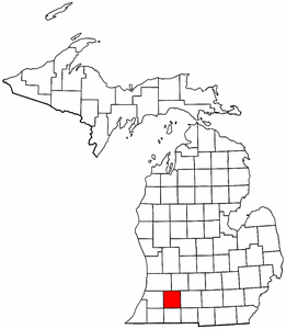
Kalamazoo County, Michigan
|
|
Kalamazoo County is a county located in the state of Michigan. As of 2000, the population is 238,603. Its county seat is Kalamazoo6.
| Contents |
Geography
According to the U.S. Census Bureau, the county has a total area of 1,503 km² (580 mi²). 1,455 km² (562 mi²) of it is land and 47 km² (18 mi²) of it is water. The total area is 3.16% water.
Geographic Features
Major Highways
- Interstate 94
- U.S. Highway 131
- Michigan State Highway 43
- Michigan State Highway 89
- Michigan State Highway 96
Adjacent Counties
- Van Buren County west
- Cass county southwest
- St. Joseph County south
- Branch County southeast
- Calhoun County east
- Barry County northeast and north
- Allegan County north and northwest
Demographics
As of the census2 of 2000, there are 238,603 people, 93,479 households, and 57,956 families residing in the county. The population density is 164/km² (425/mi²). There are 99,250 housing units at an average density of 68/km² (177/mi²). The racial makeup of the county is 84.57% White, 9.73% Black or African American, 0.41% Native American, 1.83% Asian, 0.03% Pacific Islander, 1.27% from other races, and 2.15% from two or more races. 2.64% of the population are Hispanic or Latino of any race.
There are 93,479 households out of which 30.40% have children under the age of 18 living with them, 47.70% are married couples living together, 11.00% have a female householder with no husband present, and 38.00% are non-families. 28.00% of all households are made up of individuals and 8.50% have someone living alone who is 65 years of age or older. The average household size is 2.43 and the average family size is 3.00.
In the county the population is spread out with 24.10% under the age of 18, 15.20% from 18 to 24, 28.20% from 25 to 44, 21.10% from 45 to 64, and 11.40% who are 65 years of age or older. The median age is 33 years. For every 100 females there are 93.60 males. For every 100 females age 18 and over, there are 90.50 males.
The median income for a household in the county is $42,022, and the median income for a family is $53,953. Males have a median income of $39,611 versus $27,965 for females. The per capita income for the county is $21,739. 12.00% of the population and 6.50% of families are below the poverty line. Out of the total population, 12.30% of those under the age of 18 and 6.30% of those 65 and older are living below the poverty line.
Cities, villages, and townships
Cities
Villages
Townships
- Alamo Township
- Brady Township
- Charleston Township
- Climax Township
- Comstock Township
- Cooper Township
- Kalamazoo Charter Township
- Oshtemo Township
- Pavilion Township
- Prairie Ronde Township
- Richland Township
- Ross Township
- Schoolcraft Township
- Texas Township
- Wakeshma Township
Unincorporated
External links
- Kalamazoo County Government (http://www.kalcounty.com/)
- Chronology of Township, Village and City Formation (http://www.rootsweb.com/~mikalama/historychronology.htm)


