Inyo County, California
|
|
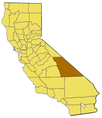
Inyo County is a county located in east-central California, on the east side of the Sierra Nevada south of Yosemite National Park. As of 2000 the county had a population of 17,945. The county seat is Independence.
Mount Whitney, the highest peak in the lower 48 states, is located in the county. Death Valley National Park, the lowest point in the United States, is also located in the county.
| Contents |
History
Inyo County was formed in 1866 from parts of Mono and Tulare Counties.
The county derived its name from the Native American name for the mountains in its area. The meaning of the word inyo is "dwelling place of the great spirit."
Natural History
Inyo County is host to a number of natural superlatives. Among them are:
- Mount Whitney, the highest point in the United States outside of Alaska
- Badwater, Death Valley, the lowest point in the Western Hemisphere
- Methuselah, an ancient Bristlecone Pine, the oldest living thing on Earth
- Owens Valley, the deepest valley on the American continents
- Two mountain ranges exceeding 14,000 feet in elevation: The Sierra Nevada and the White Mountains
- Fourteen of California's fifteen peaks which exceed 14,000 feet (a Fourteener) in elevation
- The largest escarpment in the United States, rising from the floor of Death Valley to the top of Telescope Peak in the Panamint Range
Geography
According to the U.S. Census Bureau, the county has a total area of 26,488 km² (10,227 mi²). 26,426 km² (10,203 mi²) of it is land and 62 km² (24 mi²) of it is water. The total area is 0.23% water.
Demographics
As of the census2 of 2000, there are 17,945 people, 7,703 households, and 4,937 families residing in the county. The population density is 1/km² (2/mi²). There are 9,042 housing units at an average density of 0/km² (1/mi²). The racial makeup of the county is 80.06% White, 0.16% Black or African American, 10.04% Native American, 0.91% Asian, 0.08% Pacific Islander, 4.60% from other races, and 4.15% from two or more races. 12.58% of the population are Hispanic or Latino of any race.
There are 7,703 households out of which 27.90% have children under the age of 18 living with them, 49.80% are married couples living together, 9.90% have a female householder with no husband present, and 35.90% are non-families. 31.40% of all households are made up of individuals and 13.60% have someone living alone who is 65 years of age or older. The average household size is 2.31 and the average family size is 2.88.
In the county the population is spread out with 24.40% under the age of 18, 5.80% from 18 to 24, 23.40% from 25 to 44, 27.30% from 45 to 64, and 19.10% who are 65 years of age or older. The median age is 43 years. For every 100 females there are 95.40 males. For every 100 females age 18 and over, there are 92.90 males.
The median income for a household in the county is $35,006, and the median income for a family is $44,970. Males have a median income of $37,270 versus $25,549 for females. The per capita income for the county is $19,639. 12.60% of the population and 9.30% of families are below the poverty line. Out of the total population, 16.00% of those under the age of 18 and 8.30% of those 65 and older are living below the poverty line.
Cities and towns
- Big Pine
- Bishop
- Cartago
- Darwin
- Dixon Lane-Meadow Creek
- Furnace Creek
- Homewood Canyon-Valley Wells
- Independence
- Keeler
- Lone Pine
- Mesa
- Olancha
- Pearsonville
- Round Valley
- Shoshone
- Tecopa
- West Bishop
- Wilkerson
External links
- County of Inyo website (http://www.countyofinyo.org/)
- Photographic virtual tour of Inyo County. (http://www.Untraveledroad.com/USA/California/Inyo.htm)


