El Paso, Texas
|
|
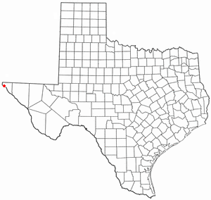
Template:Redirect El Paso is a city located in El Paso County, Texas, United States.
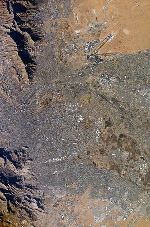
As of the 2000 census, the city had a total population of 679,622. El Paso — second only to San Diego, California, in size among all United States cities on the border with Mexico — lies opposite Ciudad Juárez, Chihuahua. The two cities form a binational metropolitan area of approximately two million people, divided by the Rio Grande.
El Paso is home to The University of Texas at El Paso (founded 1913 as the Texas College of Mines, received university status 1967). Fort Bliss, a major United States Army installation, lies to the east and northeast of the city, extending north up to the White Sands Missile Range. The Franklin Mountains extend into El Paso from the north and nearly divide the city into two sections.
Missing image
FranklinMountains6k.jpg
image:FranklinMountains6k.jpg
The Franklin Mountains
as seen from Kilbourne hole 50 Km west of El Paso, Texas
El Paso is served by El Paso International Airport, I-10, U.S. Highway 54, and Mexican Federal Highway 45.
| Contents |
History
Archeological evidence at the Keystone Wetlands and Hueco Tanks sites indicates thousands of years of human settlement within the El Paso region. The Manso and Suma Indians were identified as present by the earliest Spanish explorers. Nothing is known of these people's origin or ultimate fate.
After the settling of El Paso del Norte, on the south bank of the Rio Grande, the present-day city of El Paso was simply the Ponce de León Ranch, on the north side of the river. American settlers began drifting into El Paso, to stay for good after the founding of the Texas Republic and the Mexican Cession.
A trading post called Franklin was established during this time. El Paso was platted in 1859, but grew slowly when the railroads came in 1881. The population had grown to 10,000 by the 1890 census.
During the late 1880s and 1890s, El Paso acquired a reputation as a lawless and violent "wild west" town. The most notorious local figure was John Wesley Hardin. Hardin was gunned down inside the Acme Saloon on a warm evening of August 19, 1895. Violent-hardened Constable John Selman killed Hardin and became famous virtually overnight as Hardin's killer. Prostitution and gambling flourished until World War I, when the Department of the Army pressured El Paso authorities to crack down on vice. Many of these activities continued to flourish in neighboring Ciudad Juárez, especially during the Prohibition, when bars and saloons on the Mexican side flourished.
The Mexican Revolution (1910-1920) began in 1910, and Ciudad Juárez was the focus of intense fighting. Occasionally, stray shots killed civilians on the El Paso side. El Paso became a center of intrigue as various exiled leaders including Victoriano Huerta and (for a time) Pancho Villa were seen in the city. General John Joseph Pershing was stationed at Fort Bliss, and mounted his ill fated expedition against Pancho Villa after the infamous raid on Columbus, New Mexico on March 9, 1916. The cavalry under Pershing were paid in gold, in competition with Pancho Villa, who offered $50 per machine gun. (When World War I began, Pershing's cavalry had to remain in the Army for the duration of the war, and were no longer paid in gold.)
Perhaps the most enduring legacy of the revolution era was the arrival of thousands of Mexican refugees, whose descendants formed the nucleus of the Chicano community that emerged in later decades.
From World War II until the 1980s, El Paso boomed into a sprawling city. The expansion of Fort Bliss from a frontier post to a major Cold War military center brought in thousands of soldiers, dependents, and retirees. The industrial economy was dominated by copper smelting, oil refining, and the proliferation of low wage industries (particularly garment making), which drew thousands of Mexican immigrants. New housing subdivisions were built, expanding El Paso far to the west, northeast and east of its original core areas.
In 1967, the U.S. agreed to cede a long-disputed part of El Paso to Mexico due to changes in the course of the Rio Grande, which forms the international boundary between the two countries.
Since 1990, the local economy has been adversely affected by competition with low wage labor abroad, and the closure of the main copper smelter. The passage of the North American Free Trade Agreement has been a mixed blessing, with local transport, retail, and service firms expanding, but with the accelerated loss of many industrial jobs. El Paso is very sensitive to changes in the Mexican economy and the regulation of cross border traffic; the Mexican peso devaluation of late 1994 and the temporary closing of the ports of entry and subsequent stringent controls of cross border traffic after the September 11, 2001 Terrorist Attack were felt strongly in El Paso.
Geography and Climate
El Paso is located at 31°47'25" North, 106°25'24" West (31.790208, -106.423242)Template:GR. The city is at 3750 feet (1140 m) above sea level. The mountain peaks in El Paso reach 7200 feet (2200 m) above sea level. According to the United States Census Bureau, the city has a total area of 648.9 km² (250.5 mi²).
The most wealthy part of the city is in the West. Huge mansions rest on the western foothills of the Franklin mountains. The Coronado country club is located in the foothills of west El Paso.
The Franklin Mountains extend into El Paso from the north and nearly divide the city into two sections. The Rio Grande Rift lies beneath the Pass, through which the Rio Grande flows, as evidenced by an extinct volcano, Mt. Cristo Rey just to the west of the city, on the New Mexico side of the Rio Grande. Other volcanic features include Kilbourne hole and Hunt's hole, which are Maar volcanic craters 30 miles (50 km) west of the Franklin Mountains. El Paso is surrounded by the Chihuahuan Desert, the easternmost section of the Basin and Range Region. Temperatures average from a high of 56 °F (13 °C) and a low of 29 °F (−2 °C) in January to a high of 96 °F (35.5 °C) and low of 68 °F (20 °C) in August. The city's record high is 114 °F (45.5 °C), and its record low is −8 °F (−22 °C).
Rainfall averages 8.74 inches (222 mm) per annum. Most precipitation occurs during the monsoon occurring from late June through September. In most years rainfall is scant during the rest of the year.
Demographics
As of the censusTemplate:GR of 2000, there are 563,662 people, 182,063 households, and 141,098 families residing in the city. The population density is 873.7/km² (2,263.0/mi²). There are 193,663 housing units at an average density of 300.2/km² (777.5/mi²). The racial makeup of the city is 73.28% White, 3.12% African American, 0.82% Native American, 1.12% Asian, 0.10% Pacific Islander, 18.15% from other races, and 3.40% from two or more races. 76.62% of the population are Hispanic or Latino of any race.
There are 182,063 households, out of which 42.4% have children under the age of 18 living with them, 54.6% are married couples living together, 18.5% have a female householder with no husband present, and 22.5% are non-families. 19.2% of all households are made up of individuals and 7.2% have someone living alone who is 65 years of age or older. The average household size is 3.07 and the average family size is 3.54.
In the city the population is spread out with 31.0% under the age of 18, 10.0% from 18 to 24, 29.1% from 25 to 44, 19.2% from 45 to 64, and 10.7% who are 65 years of age or older. The median age is 31 years. For every 100 females there are 90.4 males. For every 100 females age 18 and over, there are 85.0 males.
The median income for a household in the city is $32,124, and the median income for a family is $35,432. Males have a median income of $28,989 versus $21,540 for females. The per capita income for the city is $14,388. 22.2% of the population and 19.0% of families are below the poverty line. Out of the total population, 29.8% of those under the age of 18 and 17.7% of those 65 and older are living below the poverty line.
Notable Denizens
Ted Bender
Jimmy Carl Black
Lydia Cornell
Norma Crane
Sam Donaldson
Bobby Fuller
Eddie Guerrero
John Wesley Hardin
Don Haskins
Juan Lazcano
Phil Ochs
Sandra Day O'Connor
Richard Ramirez
Debbie Reynolds
Nolan Richardson
Gene Roddenberry
Sergio Troncoso
The Mars Volta
See also: Mayors of El Paso
Trivia
An interesting fact about El Paso and Juárez is that it was possible to celebrate New Year's twice in the same evening, when Juárez was on Central time and El Paso was on Mountain time. Both cities are now on Mountain time.
da:El Paso de:El Paso ja:エル・パソ
External links
Template:Mapit-US-cityscale
http://www.elpasotimes.com/
http://www.newspapertree.com/
http://www.thestrelz.com/shm/shm.htm
News from El Paso and the surrounding area (http://kvia.com/)
| | 
|
|---|---|
| Regions: Arklatex | Big Bend | Central Texas | Dallas/Fort Worth Metroplex | East Texas | Edwards Plateau | Houston Metropolitan Area | North Texas | Northeast Texas | Piney Woods | Rio Grande Valley | Texas Hill Country | Texas Panhandle | Llano Estacado | Southeast Texas | South Texas | West Texas | |
| Metropolitan Areas: Abilene | Amarillo | Austin-Round Rock | Beaumont-Port Arthur | Brownsville-Harlingen | College Station-Bryan | Corpus Christi | Dallas-Fort Worth-Arlington | El Paso | Houston-Sugar Land-Baytown | Killeen-Temple | Laredo | Longview-Marshall | Lubbock | McAllen-Edinburg-Mission | Midland | Odessa | San Angelo | San Antonio | Sherman-Denison | Texarkana | Tyler | Victoria | Waco | Wichita Falls | |
| See also: List of Texas counties |


