Rio Grande Rift
|
|

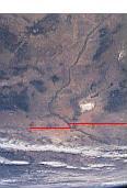
The Rio Grande runs a north-south course, in New Mexico and Colorado, along the Rio Grande rift. Southern boundary line of NM added for clarity
Credit:larger image of NASA Astronaut photograph. Mission-Roll-Image STS100-704-152
The Rio Grande Rift is a rift valley extending north from Mexico, near El Paso, Texas through New Mexico into central Colorado.
The area is presently quiescent, but significant geological activity has occurred in the area over the last 30 million years. The rifting involves a pure-shear rifting mechanism, in which both sides of the rift pull apart evenly and slowly, with the crust stretching like taffy rather than fracturing.Template:RefTemplate:RefTemplate:Ref
After the compressive forces of the Laramide orogeny ended during the Eocene Epoch which had produced the Sangre de Cristo Mountains, erosion of these uplands filled the area of the Raton Basin with abundant sediments. In the late Oligocene Epoch regional tensional forces became dominant and rifting was initiated as the crust began tearing apart. The rifting produced a linear zone of tearing known as a graben. This large graben consists of normal faulting on each flank with the central portion downdropped. Igneous intrusions moved into the zones of weakness produced by this faulting and reached the surface in many areas as extensive volcanism along the margins of the rift. The most active rifting and associated volcanism came to an end in the late Cenozoic. The youngest eruptions are in the Valley of Fires, New Mexico and are 1500-2000 years old.Template:RefTemplate:Ref
The Sangre de Cristo Range lies to the east of the north portion of the rift. The Valles Caldera National Preserve is a huge caldera in the Jemez Mountains, located where the Rio Grande Rift intersects the Jemez Lineament, an extended crustal structure in the southwestern United States. However, the Jemez Mountains themselves are not primarily a feature of the rift; rather, the range on the west side of the graben corresponding to the Sangre de Cristos is the lower and less well-known Nacimiento Mountains. The Colorado Plateau, to the west, includes the San Juan Volcanic Field and the San Juan Mountains. The city of Albuquerque lies within the rift. The Rio Grande follows the course of the rift from southern Colorado to El Paso; it starts a southeast course out of New Mexico at the pass between the Franklin Mountains and the Sierra Juarez, which ends at the Gulf of Mexico.
References
- Template:Note Wilson, David, et al., Lithospheric structure of the Rio Grande rift, Nature 433, 851 - 855 (24 February 2005); doi:10.1038/nature03297
- Template:Note Fleck, John, 2005, Study Sheds Light on 30 Million Years of Rio Grande Valley Stretching, Albuquerque Journal, Electronic Ed., February 24, 2005 http://www.abqjournal.com/paperboy/ia/scitech/308842science02-24-05.htm?rrc Accessed 04-05-05.
- Template:Note Hill, Karl, Feb 25,2005, The Rio Grande Rift: a continent "stretched like taffy", NMSU News Release, http://www.nmsu.edu/~ucomm/Releases/rio_grande_rift.html Accessed 04-05-05.
- Template:Note Aber, James S., Rio Grande Rift, http://academic.emporia.edu/aberjame/struc_geo/rio/rio.htm Accessed 04-05-05.
- Template:Note Veatch, Steven Wade, The Rio Grande Rift, 20 March, 1998, http://home.att.net/~sgeoveatch/rio_grande_rift.htm Accessed 04-05-05.
