Delaware
|
|
| |||||
| State nickname: The First State | |||||

| |||||
| Other U.S. States | |||||
| Capital | Dover | ||||
| Largest city | Wilmington | ||||
| Governor | Ruth Ann Minner | ||||
| Official languages | None | ||||
| Area | 6,452 km² (49th) | ||||
| - Land | 5,068 km² | ||||
| - Water | 1,387 km² (21.5%) | ||||
| Population (2000) | |||||
| - Population | 783,600 (45th) | ||||
| - Density | 154.87 /km² (7th) | ||||
| Admission into Union | |||||
| - Date | December 7, 1787 | ||||
| - Order | 1st | ||||
| Time zone | Eastern: UTC-5/-4 | ||||
| Latitude | 38?27'N to 39?50'N | ||||
| Longitude | 75?2'W to 75?47'W | ||||
| Width | 48 km | ||||
| Length | 161 km | ||||
| Elevation | |||||
| - Highest | 137 m | ||||
| - Mean | 18 m | ||||
| - Lowest | 0 m | ||||
| Abbreviations | |||||
| - USPS | DE | ||||
| - ISO 3166-2 | US-DE | ||||
| Web site | delaware.gov | ||||
Delaware is a state of the United States. It is known as the "First State" because it was the first of the 13 colonies to ratify the United States Constitution. Ratification occurred on December 7, 1787.
| Contents |
History
Europeans first settled in a Dutch trading post at "Zwaanendael" (or "Swaanendael," present-day Lewes (pronounced "Lewis")) in 1631. The area became "New Sweden" with a colony established by Swedes (led by Peter Minuit) around Fort Christina (now Wilmington) in 1638.
The name "Delaware" comes from the title of Thomas West, 3rd Baron De La Warr, erstwhile governor of the colony of Virginia. The deed to the property that is now Delaware was granted to William Penn in 1682, by James, Duke of York (later, James II of England), and was part of the colony of Pennsylvania. In 1704 the "three lower counties" gained a separate legislature, and in 1710 a separate executive council.
However, C棩lius Calvert, 2nd Baron Baltimore of Maryland claimed a competing grant to lands in the southern portion of Pennsylvania and most of Delaware. Thus raged over 100 years of litigation between William Penn and Baltimore, and, later, their heirs, in the High Court of Chancery in London. The legal battles were settled by the heirs agreeing to a survey -- which resulted in the Mason-Dixon line, surveyed by Charles Mason and Jeremiah Dixon between 1763 and 1767. Part of the Line now forms the east-west boundary between Delaware and Maryland, and part of the north-south boundary between Pennsylvania and Delaware (this section, known as The Wedge was in dispute up till 1921), and some 80 of their original limestone markers remain. The remanider of the border between Pennsylvania and Delaware is formed by an arc known as The Twelve-Mile Circle. The north-south boundary between Delaware and Maryland is known as the Transpeninsular Line. Several towns on the borders between Delaware and Maryland are divided by these lines.
Delaware was one of the thirteen colonies which revolted against British rule in the American Revolution. After the Revolution began in 1776, the three counties became "The Delaware State," and in 1792 that entity adopted its first constitution, declaring itself to be the "State of Delaware." Its first governors went by the title of "President of the Delaware State".
The oldest black church in the country was chartered in Delaware by former-slave Peter Spencer in 1813 as the "Union Church of Africans," which is now the A.U.M.P. Church. The Big August Quarterly which began in 1814 is still celebrated and is the oldest such cultural festival in the country.
During the American Civil War, Delaware was a slave state that remained in the Union (Delaware voters voted not to secede on January 3, 1861). Eight months after the end of the Civil War, however, Delaware voted on February 18, 1865 to reject the 13th Amendment to the United States Constitution and so voted unsuccessfully to continue slavery beyond the Civil War. Delaware ratified the amendment on February 12, 1901--40 years after Lincoln's Emancipation Proclamation.
Law and government
Delaware's fourth and current constitution was adopted in 1897 and provides for executive, judicial and legislative bodies. The legislative body consists of a House of Representatives with 41 members and a Senate with 21 members. The executive branch is headed by the Governor of Delaware and the judicial branch provides for a hierarchy of courts with the state Supreme Court being the highest.
The present governor of Delaware is Ruth Ann Minner (Democrat). The lieutenant governor is John C. Carney. Delaware is also one of the few states (California being another) that elect the governor and lieutenant governor separately. Delaware's U.S. Senators are Joseph R. Biden (Democrat) and Thomas Carper (Democrat). Delaware's single US Representative is former Governor, Michael N. Castle (Republican). See: List of Delaware Governors Delaware only has 3 counties: Kent County, New Castle County, and Sussex County. See: List of counties in Delaware
Delaware has one of the few remaining Courts of Chancery in the nation, which has jurisdiction over equity cases.
Geography
Datamil_de_map.jpg
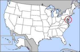
Delaware is bounded to the north by Pennsylvania, to the east by the Delaware River and the Atlantic Ocean and to the west and south by Maryland. Small portions of Delaware are also situated on the far, or eastern, side of the Delaware River Estuary, and these small parcels share land boundaries with New Jersey. The largest city is Wilmington, and the capital is Dover.
The state of Delaware, together with the Eastern Shore counties of Maryland and two counties of Virginia, form the Delmarva Peninsula, a geographical unit stretching far down the Mid-Atlantic coast.
The U.S. Air Force base outside Dover is one of the largest in the U.S. In addition to its other responsibilities, Dover AFB serves as the entry point and morgue for American military persons (and some U.S. government civilians) who die overseas.
There are no network broadcast-television stations in Delaware, although a public-television station from Philadelphia, WHYY, maintains a studio and broadcasting facility in Wilmington. Philadelphia station, Channel 6 WPVI also maintains a bureau in downtown Wilmington. The northern part of the state is served by network stations in Philadelphia, Pennsylvania and the southern part by network stations in Salisbury, Maryland.
Topography
Delaware lies on a level plain, the highest elevation being less than 442 feet above the sea. The northern part is hilly, with a rolling surface, but below New Castle the ground is flat and sandy and in some parts swampy. A ridge about 70 feet in altitude extends along the western boundary of the state and is the watershed for the affluents of the Delaware in the east and of several streams falling into Chesapeake Bay. The principal streams are the Christina and the Brandywine rivers. The Chritiana is navigable for large ships as far as Wilmington. The coast of Delaware Bay is marshy; the Atlantic coast has many sand beaches, inclosing shallow lagoons. The largest of these are Rehoboth Bay, Indian River Bay, and a portion of St. Martin's Bay. The only harbors of consequence are Wilmington, Lewes, and New Castle.
Climate
Since the great majority of Delaware is a part of the Atlantic Coastal Plain, the climate is moderated by the effects of the ocean. The southern third of the state has a mild subtropical climate, with hot, humid summers and mild winters. the middle portion is the transition to the upper portion of the state, which has a warm continental climate and receives occasional winter snowfall.
Demographics
|
As of 2003, there were 817,491 people living in Delaware. Racially, the state is:
The five largest ancestries in Delaware are: African American (19.2%), Irish (16.6%), German (14.3%), English (12.1%), Italian (9.3%). |
ReligionThe religious affiliations of the people of Delware are:
The three largest Protestant denominations in Delaware are: Methodist (27% of the total state population), Baptist (9%), Pentecostal & Presbyterian & Episcopalian (tied 3%) |
Important cities
Wilmington is a separate developed city in northern Delaware. However, because of its proximity, it acts as both a job hub and suburb with Philadelphia, Pennsylvania.
|
| Missing image National-atlas-delaware.png Delaware cities |
Top 10 richest places in Delaware
Ranked by per capita income
- Greenville: $83,223
- Henlopen Acres: $82,091
- South Bethany: $53,624
- Dewey Beach: $51,958
- Fenwick Island: $44,415
- Bethany Beach: $41,306
- Hockessin: $40,516
- North Star: $39,677
- Rehoboth Beach: $38,494
- Ardentown: $35,577
- For more see the complete list of places
Economy
The gross state product of Delaware in 2003 was $49 billion. The per capita personal income was $34,199, ranking 9th in the nation.
Delaware's agricultural output consists of poultry, nursery stock, soybeans, dairy products and corn. Its industrial outputs include chemical products, processed foods, paper products, rubber and plastic products. Delaware's economy generally outperforms the national economy of the United States. Its largest employers are concentrated in science (E.I. DuPont de Nemours & Co., Syngenta, AstraZeneca, Hercules), banking (MBNA America, Wilmington Trust Company, First USA / Bank One, JPMorgan Chase, AIG, Citigroup, Deutsche Bank), manufacturing (General Motors, Chrysler), and farming, specifically chicken farming in Sussex County (Perdue, Mountaire Farms).
Education
Colleges and universities
|
Professional sports teams
Delaware's only two professional sports teams are the Wilmington Blue Rocks minor league baseball team, a Class A affiliate of the Boston Red Sox, and the Delaware Griffins, part of the Women's Professional Football League.
Miscellaneous information
The USS Delaware was named in honor of this state.
Other places named Delaware
The Delaware River is a major river in the eastern United States, rising in New York State, forming the boundary between New Jersey and Pennsylvania, and emptying into Delaware Bay, which separates New Jersey from the state of Delaware.
Delaware Native Americans
Delaware is also the name of a Native American group (called in their own name Lenni Lenape) that was very influential in the dawning days of the United States. However, a band of the Nanticoke tribe of Indians still remains in Sussex County.
See also
- Delaware Colony
- Delaware corporation
- Some neighboring states contain locations named Delaware Township or Delaware County.
- Delaware state symbols
Clip Art and Pictures
- Free Clipart (http://classroomclipart.com)
State Maps
- US State Maps (http://classroomclipart.com/cgi-bin/kids/imageFolio.cgi?direct=Clipart/US_State_Maps)
- Printable Black and White Map of Delaware (http://www.lessonplancentral.com/statemaps/delaware_mapBW.htm)
State Flags
- US State Flags (http://classroomclipart.com/cgi-bin/kids/imageFolio.cgi?direct=Clipart/State_Flags)
Lesson Plans, Resources and Activites
- Delaware Lesson Plans (http://lessonplancentral.com/lessons/Social_Studies/State_Facts/Delaware/index.htm)
- Lesson Plan Central (http://lessonplancentral.com)
External links
- State of Delaware homepage (http://www.state.de.us/)
- Delaware State Information (http://www.eachtown.com/state_info.php/stateid/8)
- Delaware Map Data (http://datamil.udel.edu/)
- The Emancipation Proclamation (http://usinfo.state.gov/usa/infousa/facts/democrac/24.htm) Includes a short introduction.
- U.S. Senate site with the full U.S. Constitution and the Thirteenth Amendment (http://www.access.gpo.gov/congress/senate/constitution/amdt13.html) "Slavery and Involuntary Servitude"
- US Census Bureau (http://quickfacts.census.gov/qfd/states/10000.html)
- Delaware Newspapers (http://www.usnewspapers.org/state/delaware)
| Regions of Delaware | Missing image Delaware_state_flag.png Flag of Delaware |
|---|---|
| Delaware Valley | Cape Region | |
| Counties | |
| Kent | New Castle | Sussex |
| Political divisions of the United States | 
| ||||||
|---|---|---|---|---|---|---|---|
| |||||||

