Guam
|
|
| |||||
| Territorial motto: Where America's Day Begins | |||||
 | |||||
| Official languages | English, Chamorro | ||||
| Unofficial languages | Japanese (used in business transactions), Tagalog (used in conversation) | ||||
| Capital | Hagåtña | ||||
| Chief of state | George W. Bush | ||||
| Governor | Felix Perez Camacho | ||||
| Area - Total - % water | Ranked 202nd 549 km² Negligible | ||||
| Population - Total (2003) - Density | Ranked N/A 163,941 (July 2003 est.) 299/km² | ||||
| Independence | none (territory of the USA) | ||||
| Currency | US dollar (USD) | ||||
| Time zone | UTC+10 (no DST) | ||||
| Territorial anthem | Fanoghe Chamorro | ||||
| Internet TLD | .gu | ||||
| Calling Code | 1-671 | ||||
ApraHarbor.jpeg
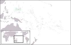
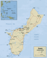
The Territory of Guam (Guåhån in Chamorro) is an island in the Western Pacific Ocean and is an organized unincorporated territory of the United States. Its indigenous people are the Chamorros, who first inhabited the island approximately 3,500 years ago. The capital is Hagåtña, formerly Agana (pronounced Agaña). Guam's economy is mainly supported by tourism (particularly from Japan) and its United States armed forces base. The latter takes up one-third of the entire land mass of the island. The United Nations Committee on Decolonization includes Guam on the United Nations list of Non-Self-Governing Territories.
| Contents |
History of Guam
Main article: History of Guam
Guam's history of colonialism is the longest along the Pacific islands, starting with Ferdinand Magellan's visit in 1521 during his around the world voyage. The island became an important resting stop on the Spanish trade route between the Philippines and Mexico.
The United States took control of the island in 1898 after the Battle of Guam of 1898 in the Spanish-American War. Guam came to serve as a way station for American ships traveling to and from the Philippines.
During World War II, Guam was attacked and invaded by the Japanese armed forces in 1941. The United States came back in the Battle of Guam in 1944 to recapture the island from Japanese military occupation.
In the early 1960s, the United States granted U.S. citizenship to the Chamorro people and gradually the island obtained semi-autonomous status through the Organic Act.
Politics of Guam
Main article: Politics of Guam
While there is a movement for Guam's complete independence from the United States and a competing but limited movement for statehood, most people on Guam favor a modified version of the current territorial status, involving greater autonomy from Washington, D.C. and the mainland.
Transportation and Communications in Guam
- Main articles: Communications in Guam, Transportation in Guam
Guam is served by Antonio B. Won Pat International Airport.
As travel restrictions eased and the Japanese economy grew, Guam became a favorite destination for Japanese tourists. Guam is a relatively short flight from Japan compared to Hawaii, and a series of tourist hotels and golf courses were built to cater to the tourists. Today, about 90 percent of tourists to Guam are Japanese. The main tourist beach, Tumon Bay has beautiful white sand, and Tumon Bay is now a marine preserve, teeming with fish. Recently completed infrastucture projects have brought underground fiber-optics and new roads to the busy Tumon area.
Miscellaneous
Snake_browntree.jpg
The island is also known as a prominent example for the disastrous effects of bioinvasion: A stowaway on U.S. military transport at the end of World War II, the slightly venomous, but rather harmless, brown tree snake (Boiga irregularis) came north to Guam and killed almost the entire native bird population on the previously snake-free island. This snake has no natural predators on the island; nowadays, Guam is one of the areas with the highest snake density in the world (an estimated 2,000 snakes/km²). Even so, residents rarely see these snakes. They curl up and hide during the day, and move about on trees and fences at night. As prodigious tree climbers, the snakes caused frequent blackouts in neigborhoods across the Island. Now all power poles have a slick metal sheath that prevent the snakes from climbing up.
Guam lies along the Marianas Trench, a deep subduction zone at the edge of the Pacific plate. The Challenger Deep, the deepest point on earth, is just southwest of Guam at 35,838 ft (10,923 meters) deep.
See also
From the CIA World Factbook 2000:
External links
- Official Guam Webpage (http://ns.gov.gu/)
- Guampedia (http://www.guampedia.com/)
- US Library of Congress - Portals to the World (http://www.loc.gov/rr/international/hispanic/guam/guam.html)
- Maps - Perry-Castañeda Library Map Collection (http://www.lib.utexas.edu/maps/guam.html)
- Map of Micronesia (http://www.mapsouthpacific.com/micronesia/index.html)
- myMicronesia/Guam section (http://www.mymicronesia.com/guam/)
- Pacific Daily News, Guam's Primary Newspaper (http://www.guampdn.com/apps/pbcs.dll/frontpage)
- ChamorroBible.org - Full text for Chamorro and English Scriptures (the rare 1908 Chamorro Bible), Chamorro language resources, maps, and related material.
- The Brown Tree Snake on Guam (http://www.mesc.usgs.gov/resources/education/bts/bts_home.asp) How the arrival of one invasive species damaged the ecology, commerce, electrical systems, and human health on Guam: A comprehensive information source.
| Political divisions of the United States | 
| ||||||
|---|---|---|---|---|---|---|---|
| |||||||
ch:Guåhån da:Guam de:Guam et:Guam es:Guam eo:Gvamo fr:Guam gl:Guam io:Guam id:Guam it:Guam he:גואם lt:Guamas zh-min-nan:Guahan nl:Guam ja:グアム no:Guam oc:Guam pl:Guam pt:Guam ru:Гуам sk:Guam sl:Guam fi:Guam sv:Guam uk:Гуам zh:關島


