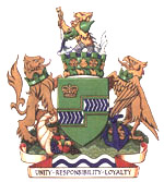
Niagara Regional Municipality, Ontario
|
|
| ||
| Motto: Building Community. Building Lives. | ||
| Area: | 1,852 sq. km. | |
| Population - Total (2001) | 410,570 | |
| MPs | ||
| Dean Allison, Walt Lastewka, John Maloney, Rob Nicholson | ||
| MPPs | ||
| Jim Bradley, Kim Craitor, Tim Hudak, Peter Kormos, Jennifer Mossop | ||
| Regional Chair | Peter Partington | |
| Governing body | Niagara Regional Council | |
| Regional Niagara (http://www.regional.niagara.on.ca) | ||
Niagara Regional Municipality (2001 population 410,574), also known as Niagara Region, Regional Niagara, or the Regional Municipality of Niagara, is an area covering 12 municipalities, including th cities of Niagara Falls, Port Colborne, St. Catharines, Thorold, and Welland; the towns of Fort Erie, Grimsby, Lincoln, Niagara-on-the-Lake, and Pelham; and the townships of Wainfleet and West Lincoln, covering 1850 square kilometres. The regional seat in Thorold, where Niagara Regional Council meets.
The region boasts a number of tourist attractions, including its "Wine Country" and the internationally-renown Niagara Falls, a natural wonder of the world.
| Contents |
Attractions
Airports
- St. Catharines-Niagara District Airport (Niagara-on-the-Lake)
- Welland-Port Colborne Airport (Welland)
Education
- Brock University (St. Catharines)
- Niagara College
History and Trails
- Fort George National Historic Site (Niagara-on-the-Lake)
- Fort Mississauga National Historic Site (Niagara-on-the-Lake)
- Greater Niagara Circle Route
- Navy Island National Historic Site (Niagara Falls)
- Niagara Parkway
- Niagara Wine Route
- Queenston Heights National Historic Site (Niagara-on-the-Lake)
- Waterfront Trial
- Welland Canal Parkway
Other
- Clifton Hill (Niagara Falls)
- Lundy's Lane Tourist District (Niagara Falls)
- Niagara Olde Town (Niagara-on-the-Lake)
- Welland Canal Centre (St. Catharines)
- Wet and Wild (Lincoln)
Protected areas
- Short Hills Provincial Park
- Wainfleet Bog Provincial Wildlife Preserve
- Ball's Falls Conservation Area
- Chippawa Creek Conservation Area
- Long Beach Conservation Area
- Morgan's Point Conservation Area
- Cave Springs Conservation Area
- St. John's Conservation Area
- Rockway Conservation Area
- Louth Conservation Area
- Mountainview Conservation Area
- Beamer Memorial Conservation Area
- Woodend Conservation Area
- Woolverton Conservation Area
- Wainfleet Wetlands
- Humberstone & Willoughby Wetlands
- Mud Lake Wetlands
- E.C. Brown Conservation Area
- United Empire Loyalist Conservation Area
- Port Davidson Weir Conservation Area
- Sugar Bush Conservation Area
- Stevensville Conservation Area
- Virgil Dams Conservation Area
- Happy Rolph's Bird Sancuary
Highways
400-series expressways
Other highways
- Ontario provincial highway 3
- Ontario provincial highway 20
- Ontario provincial highway 58
- Ontario provincial highway 58A
- Ontario provincial highway 140
Surrounding census divisions
External links
- The Regional Municipality of Niagara (http://www.regional.niagara.on.ca/)
| Census Divisions of Ontario | 
| ||
|---|---|---|---|
| Counties of Ontario: Bruce | Dufferin | Elgin | Essex | Frontenac | Grey | Haliburton | Hastings | Huron | Lambton | Lanark | Leeds and Grenville | Lennox and Addington | Middlesex | Northumberland | Perth | Peterborough | Prescott and Russell | Renfrew | Simcoe | Stormont, Dundas and Glengarry | Wellington | |||
| Regional Municipalities of Ontario: Durham | Halton | Muskoka | Niagara | Oxford | Peel | Waterloo | York | |||
| Single Tier Municipalities of Ontario: Brant | Brantford | Chatham-Kent | Greater Sudbury | Haldimand | Hamilton | Kawartha Lakes | Norfolk | Ottawa | Prince Edward | Toronto | |||
| Separated municipalities - Historic counties of Ontario | |||
| Districts of Ontario: Algoma | Cochrane | Kenora | Manitoulin | Nipissing | Parry Sound | Rainy River | Sudbury | Thunder Bay | Timiskaming | |||


