Rio de Janeiro State
|
|
| Statistics | |
|---|---|
| Capital: | Rio de Janeiro |
| Area: | 43,696.054km² |
| Inhabitants: | 12,807,706 (?) |
| Pop. density: | 366.6 inh./km² |
| Timezone: | GMT -3 |
| ISO 3166-2: | BR-RJ |
| Governor: | Rosângela Matheus |
| Map | |
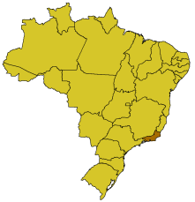
Rio de Janeiro is one of the 26 states of Brazil (plus the Federal District). It has an area of 43,653km² and is situated on the southeastern coast. Its capital is the city of Rio de Janeiro, which was the colony's capital as of 1764 (the first being Salvador da Bahia), and the nation's capital from 1822 to 1960. In the year 2000, the population was 12,807,706.
Governor: Rosângela Matheus (since January 1, 2003).
Lieutenant Governor: Luiz Paulo Conde (former mayor of Rio de Janeiro).
| Contents |
Flag
Br_RJ_2.png
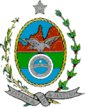
Here the flag can be seen with the eagle, symbol of Brazil's royal family and God's Finger Rock in the back, which is visible from Rio de Janeiro in a clear day.
The outer part of the coat of arms represents its agricultural richness, sugarcane (left) and coffee (right).
Location
This Brazilian state is in the east of the southeastern subdivision of Brazil, which also contains the states of São Paulo, Minas Gerais and Espírito Santo. It has as its limits: The Atlantic Ocean (E), the state of Espírito Santo (N), the state of Minas Gerais (N) and (W), and the state of São Paulo (S).
Cities
Other cities include:
- Angra dos Reis
- Aperibé
- Araruama
- Areal
- Armação dos Búzios
- Arraial do Cabo
- Barra do Piraí
- Barra Mansa
- Belford Roxo
- Bom Jardim
- Bom Jesus do Itabapoana
- Cabo Frio
- Cachoeiras de Macacu
- Cambuci
- Campos dos Goytacazes
- Cantagalo
- Carapebus
- Cardoso Moreira
- Carmo
- Casimiro de Abreu
- Comendador Levy Gasparian
- Conceição de Macabu
- Cordeiro
- Duas Barras
- Duque de Caxias
- Engenheiro Paulo de Frontin
- Guapimirim
- Iguaba Grande
- Itaboraí
- Itaguaí
- Italva
- Itaocara
- Itaperuna
- Itatiaia
- Japeri
- Laje do Muriaé
- Macaé
- Macuco
- Magé
- Mangaratiba
- Maricá
- Mendes
- Miguel Pereira
- Miracema
- Natividade
- Nilópolis
- Niterói
- Nova Friburgo
- Nova Iguaçu
- Paracambi
- Paraíba do Sul
- Parati
- Paty do Alferes
- Petrópolis
- Pinheiral
- Piraí
- Porciúncula
- Porto Real
- Quatis*Queimados
- Quissamã
- Resende
- Rio Bonito
- Rio Claro
- Rio das Flores
- Rio das Ostras
- Santa Maria Madalena
- Santo Antônio de Pádua
- São Fidélis
- São Francisco de Itabapoana
- São Gonçalo
- São João da Barra
- São João de Meriti
- São José de Ubá
- São José do Vale do Rio Preto
- São Pedro da Aldeia
- São Sebastião do Alto
- Sapucaia
- Saquarema
- Seropédica
- Silva Jardim
- Sumidouro
- Tanguá
- Teresópolis
- Trajano de Morais
- Três Rios
- Valença
- Varre-Sai
- Vassouras
- Volta Redonda
External links
- Official homepage (http://www.rj.gov.br) (Portuguese)
| States of Brazil | 
|
|---|---|
| Acre | Alagoas | Amapá | Amazonas | Bahia | Ceará | Espírito Santo | Goiás | Maranhão | Mato Grosso | Mato Grosso do Sul | Minas Gerais | Pará | Paraíba | Paraná | Pernambuco | Piauí | Rio de Janeiro | Rio Grande do Norte | Rio Grande do Sul | Rondônia | Roraima | Santa Catarina | São Paulo | Sergipe | Tocantins | |
| Federal District: Brazilian Federal District | |
Template:Brazil-geo-stubca:Estat de Rio de Janeiro de:Rio de Janeiro (Bundesstaat) es:Rio de Janeiro (Estado) eo:Rio-de-Ĵanejrio gl:Estado de Rio de Janeiro it:Stato di Rio de Janeiro he:ריו דה ז'נירו (מדינה) ka:რიო-დე-ჟანეირო (შტატი) nl:Rio de Janeiro (staat) ja:リオデジャネイロ州 no:Rio de Janeiro (delstat) pt:Rio de Janeiro sv:Rio de Janeiro (delstat)


