Fog
|
|
Morningfog.jpg
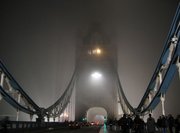
Fog is cloud in contact with the ground. It occurs when moisture from the surface of the Earth evaporates; as this evaporated moisture moves upward, it cools and condenses into the familiar phenomenon of fog. Fog differs from clouds in that fog touches the surface of the Earth, while clouds do not. It can form in a number of ways, depending on how the cooling that caused the condensation occurred:
- Radiation fog is formed by the cooling of land after sunset by thermal (infrared) radiation in calm conditions with clear sky. The cool ground then produces condensation in the nearby air by heat conduction. In perfect calm the fog layer can be less than a metre deep but turbulence can promote a thicker layer. Radiation fog is common in autumn and usually does not last long past sunrise.
- Advection fog occurs when moist air passes over cool ground by advection (wind) and is cooled. This form is most common at sea when tropical air encounters cooler higher-latitude waters. It is also extremely common as a warm front passes over an area with significant snowpack.
- Steam fog is the most localized form and is created by cold air passing over much warmer water. Water vapor quickly enters the atmosphere by evaporation and condensation occurs once the dewpoint has been reached, thus creating a wispy steam. Steam fog is most common in polar regions, and around deeper and larger lakes in late autumn and early winter. It is closely related to lake-effect snow and lake-effect rain, and often causes freezing fog, or sometimes hoar frost.
- Precipitation fog (or frontal fog) forms as precipitation falls into drier air below the cloud, the liquid droplets evaporate into water vapour. The water vapour cools and at the dewpoint it condenses and fog forms.
Low_fog.jpg
- Upslope fog forms when winds blow air up a slope (called orographic lift), adiabatical cooling it as it rises, and causing the moisture in it to condense. This often causes freezing fog on mountaintops, where the cloud ceiling would not otherwise be low enough.
- Valley fog forms in mountain valleys, often during winter. It is the result of a temperature inversion caused by heavier cold air settling into the valley, with warmer air passing over the mountains above. It is essentially radiation fog confined by local topography, and can last for several days in calm conditions. In California's Central Valley, Valley fog is often referred to as Tule fog.
- Ice fog is any kind of fog where the droplets have frozen into extremely tiny crystals of ice in midair. Generally this requires temperatures well below the freezing point, making it common only in and near the Arctic and Antarctic regions. Extremely small amounts of this falling from the sky form a type of precipitation called ice crystals, often reported in Barrow, Alaska.
- Freezing fog is when liquid fog droplets freeze to surfaces, forming white rime ice. This is very common on mountaintops which are exposed to low clouds. It is equivalent to freezing rain, and essentially the same as the ice which forms inside a freezer which is not of the "frostless" or "frost-free" type.
All types of fog form when the relative humidity reaches 100%, and the air temperature tries to drop below the dewpoint, pushing it lower by forcing the water vapor to condense.
Fog reduces visibility. Some vehicles have radar etc., cars have to drive slower and use more lights. Especially dangerous is when fog is very localized, and the driver is caught by surprise. Fog is particularly baneful for airport operators, some of whom have attempted to develop methods (such as using heaters or salt particles) to aid fog disperal. These methods enjoy some success at temperatures below freezing.
---

