1906 San Francisco earthquake
|
|
San_Francisco_City_Hall_1906-04-20.jpg
The San Francisco earthquake of 1906 was a major earthquake at San Francisco, California on the early morning of Wednesday, April 18, 1906. After the earthquake, subsequent fires destroyed almost the entire city of San Francisco. This great earthquake is perhaps the most discussed earthquake in history, rivaled only by the 1755 earthquake that destroyed Lisbon, Portugal.
The official casualty count was 700, but as many as 3,000 people might have died. An estimated 225,000 people were left homeless, out of a population of about 400,000. Most of the fatalities occurred in San Francisco but 189 were reported elsewhere.
The earthquake's notoriety rests in part that it was the first natural disaster of its size to be captured by photography. Further, it occurred at a time when geology and seismology were just blossoming; analysis of the 1906 displacements and strain in the surrounding crust led Reid (1910) to formulate his elastic-rebound theory of the earthquake source, which remains today the principal model of the earthquake cycle.
SanFranHouses06.JPG
The first foreshock was registered at 5:12 a.m. on April 18, 1906. The earthquake itself, which occurred on the San Andreas Fault with an epicenter near San Francisco approximately 20-25 seconds later, lasted 47 seconds, was punctuated by violent shocks, and was felt from Oregon to Los Angeles, and inland as far as central Nevada.
The United States Geological Survey estimates that the earthquake measured 7.9 on the moment magnitude scale, which is very powerful. Estimates of the sizes of historical earthquakes, however, are subject to debate. The U.S.G.S. says the earthquake caused ruptures visible on the surface for a length of 470 kilometers (290 miles). By comparison, it says, the 1989 Loma Prieta earthquake had a rupture length of about 40 kilometers (25 miles). The highest Modified Mercalli Intensities (MMI's) of VII to IX paralleled the length of the rupture, extending as far as 80 kilometers inland from the fault trace. One important characteristic of the shaking intensity noted in Lawson's (1908) report was the clear correlation of intensity with underlying geologic conditions. Areas situated in sediment-filled valleys sustained stronger shaking than nearby bedrock sites, and the strongest shaking occurred in areas where ground reclaimed from San Francisco Bay failed in the earthquake. Modern seismic-zonation practice accounts for the differences in seismic hazard posed by varying geologic conditions.
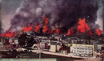
As damaging as the earthquake and its aftershocks were, the fires that burned out of control afterwards destroyed much more property. Fires broke out in many parts of town, some initially fueled by natural gas mains broken by the quake. Other fires were the result of arson. Some property owners set fire to their damaged buildings, because most insurance policies covered fire losses while prohibiting payment if the building had just sustained earthquake damage. Captain Leonard D. Wildman of the U.S. Army Signal Corps reported that he "was stopped by a fireman who told me that people in that neighborhood were firing their houses...They were told that they would not get their insurance on buildings damaged by the earthquake unless they were damaged by fire."
As water mains were also broken, the city fire department had few resources to fight the fires with. Several fires in the downtown area merged to become one giant inferno. One journalist at the time wrote that readers elsewhere should understand that it was not a fire in San Francisco, but rather a fire of San Francisco. The fire ultimately destroyed over 500 city blocks of the downtown core.
General Frederick Funston declared martial law, and finally got the fire under control by dynamiting blocks of buildings around the fire to create fire breaks.
As a basic reference about the earthquake and the damage it caused, geologic observations of the fault rupture and shaking effects, and other consequences of the earthquake, the Lawson (1908) report remains the authoritative work, as well as arguably the most important study of a single earthquake. In the public's mind, this earthquake is perhaps remembered most for the fire it spawned in San Francisco, giving it the somewhat misleading appellation of the "San Francisco earthquake". Shaking damage, however, was equally severe in many other places along the fault rupture.
San_francisco_1906_earthquake.jpg
The overall cost of the earthquake was estimated at the time to be around $400,000,000 ($400 million).
Media
Template:Multi-video start Template:Multi-video item Template:Multi-video end
See also
External links
- The Great 1906 Earthquake and Fire (http://www.sfmuseum.org/1906/06.html) on Museum of the City of San Francisco site
- 1906 San Francisco Quake (http://quake.wr.usgs.gov/info/1906/) on U.S. Geological Survey site
- Several videos of the aftermath (http://www.archive.org/movies/movieslisting-browse.php?collection=prelinger&cat=Earthquakes:%20San%20Francisco,%201906)
- Interactive Earthquake Panoramas (http://dualmoments.com/pansfromfilms/sfq1906pano/index.html) on the Extreme Photo Constructions site.
- Kite panoramas of the devastation (http://www.rtpnet.org/robroy/lawrence/landscape.html)
- Modified Mercalli Intensity Maps for the 1906 San Francisco Earthquake (http://pubs.usgs.gov/of/2005/1135/)
{{Commons|San Francisco earthquake]]he:רעידת האדמה של 1906 nl:Aardbeving van San Francisco no:Jordskjelvet i San Fransisco 1906 pt:Terremoto de São Francisco de 1906

