Earthquake
|
|
| Contents |
Characteristics
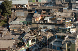
Earthquakes occur every day on Earth, but the majority of them are minor and cause no damage(those less than 5 on ritcher scale).Large earthquakes can cause serious destruction and massive loss of life through a variety of agents of damage, including fault rupture, vibratory ground motion (i.e., shaking), inundation (e.g., tsunami, seiche, dam failure), various kinds of permanent ground failure (e.g. liquefaction, landslide), and fire or a release of hazardous materials. In a particular earthquake, any of these agents of damage can dominate, and historically each has caused major damage and great loss of life, but for most of the earthquakes shaking is the dominant and most widespread cause of damage.
| Missing image SanFranHouses06.JPG Damage from the 1906 San Francisco earthquake. |
| Missing image EarthquakeFreewayCa1989.jpg Section of collapsed freeway after the 1989 Loma Prieta earthquake. |
Most large earthquakes are accompanied by other, smaller ones, that can occur either before or after the principal quake — these are known as foreshocks or aftershocks, respectively. The power of an earthquake is distributed over a significant area, but in the case of large earthquakes, it can spread over the entire planet. Ground motions caused by very distant earthquakes are called teleseisms. It is usually possible to identify a point from which the earthquake's seismic waves appear to originate. That point is called its "focus" and usually proves to be the point at which the fault slip was initiated. The position of the focus is known as the "hypocenter" and the location on the surface directly above it is the "epicenter". The fault may slip well beyond its epicenter, though. Just as a large loudspeaker can produce a greater volume of sound than a smaller one, large faults are capable of higher magnitude earthquakes than smaller faults are.
Earthquakes, especially those that occur beneath oceans or seas, can give rise to tsunamis, either as a direct result of the deformation of the sea bed due to the earthquake, or as a result of submarine landslips or "slides" indirectly triggered by it.
There are four types of seismic waves all that are generated simultaneously. They arrive in the following order: first the body waves P-waves (primary or pressure waves) then S-waves (secondary or shear waves), next the surface waves (Love waves) then Rayleigh waves.
Intensity
A class of earthquakes known as silent earthquakes are thought to be caused by very slow slippage. They are of extremely low intensity but can last for days or weeks releasing as much energy as large earthquakes.
In the 1930s, a California seismologist named Charles F. Richter devised a simple numerical scale (which he called the magnitude) to describe the relative sizes of earthquakes, which has come to be called the Richter scale. Since Richter, seismologists have developed a number of magnitude scales. Most of the scales in use in the Western world (such as the moment magnitude scale) are mutually consistent to a sufficient extent that the term "Richter scale" is routinely used in reporting these numbers to the public. Other scales (and other ways of describing the size of earthquakes) are used in some non-Western countries, and by earthquake specialists. For example, the Japanese shindo scale for measuring the force of earthquakes measures horizontal movement. The press sometimes mistakenly reports such values as "Richter magnitude", and this has given rise to public confusion.
Nisqually_Earthquake_ShakeMAp_Mon_13_2003.jpg
Nisqually_Community_Internet_Intensity_Map_for_the_Nisqually_Earthquake_FEB_2281854_ciim.gif
Earthquake effects are described in terms of intensity, a scale which attempts to quantify the severity of shaking at a given location. A number of intensity scales are in use, and there is a significant degree of consistency amongst them. The best known is the Mercalli (or Modified Mercalli, MM) scale, but the more consistent and analytical European Macroseismic Scale (EMS) is now increasingly widely used. In Japan the Japan Meterological Agency seismic intensity scale (JMA) is used.
Causes
Most earthquakes are powered by the release of the stresses that accumulate over time, typically, at the boundaries of the plates that make up the Earth's lithosphere. The most severe of these earthquakes are located along compressional and translational plate boundaries. Deep focus earthquakes are possibly generated as subducted lithospheric material catastrophically undergoes a phase transition at depths greater than 600 km. Some earthquakes are also caused by the movement of magma in volcanoes, and such quakes can be an early warning of volcanic eruptions. A rare few earthquakes have been associated with the build-up of large masses of water behind dams, such as the Kariba Dam in Zambia, Africa, and with the injection or extraction of fluids into the Earth's crust (e.g. at certain geothermal power plants and at the Rocky Mountain Arsenal). Such earthquakes occur because the strength of the Earth's crust can be modified by fluid pressure. Finally, earthquakes (in a broad sense) can also result from the detonation of explosives. Thus scientists have been able to monitor, using the tools of seismology, nuclear weapons tests performed by governments that were not disclosing information about these tests along normal channels. Earthquakes such as these, that are caused by human activity, are referred to by the term induced seismicity. Another possibility to explain earthquakes is related to gas movement in the earth's interior, mainly methane (see related topics [[1] (http://www.people.cornell.edu/pages/tg21/Earthq.html); [[2] (http://www.people.cornell.edu/pages/tg21/eyewit.html)).
Preparation for earthquakes
Specific fault articles
- Alpine Fault
- Calaveras Fault
- Hayward Fault Zone
- North Anatolian Fault Zone
- New Madrid Fault Zone
- San Andreas Fault
Specific earthquake articles
- Shaanxi earthquake (1556). Deadliest known earthquake in history, estimated to have killed 830,000 in China.
- Cascadia Earthquake (1700).
- Kamchatka earthquakes (1737 and 1952).
- Lisbon earthquake (1755).
- New Madrid Earthquake (1811).
- Fort Tejon Earthquake (1857).
- San Francisco Earthquake (1906).
- Great Kanto earthquake (1923). On the Japanese island of Honshu, killing over 140,000 in Tokyo and environs.
- Kamchatka earthquakes (1952 and 1737).
- Great Chilean Earthquake (1960). Biggest earthquake ever recorded, 9.5 on Moment magnitude scale.
- Good Friday Earthquake (1964) Alaskan earthquake.
- Sylmar earthquake (1971). Caused great and unexpected destruction of freeway bridges and flyways in the San Fernando Valley, leading to the first major seismic retrofits of these types of structures, but not at a sufficient pace to avoid the next California freeway collapse in 1989.
- Tangshan earthquake (1976). The most destructive earthquake of modern times. The official death toll was 255,000, but many experts believe that two or three times that number died.
- Armenian earthquake (1988). Killed over 25,000.
- Loma Prieta earthquake (1989). Severely affecting Santa Cruz, San Francisco and Oakland in California. Revealed necessity of accelerated seismic retrofit of road and bridge structures.
- Marmara earthquake (1990).
- Northridge, California earthquake (1994). Damage showed seismic resistance deficiencies in modern low-rise apartment construction.
- Great Hanshin earthquake (1995). Killed over 6,400 people in and around Kobe, Japan.
- İzmit earthquake (1999) Killed over 17,000 in northwestern Turkey.
- D?arthquake (1999)
- Chi-Chi earthquake (1999).
- Gujarat Earthquake (2001).
- Dudley Earthquake (2002).
- Parkfield, California earthquake (2004). Not large (6.0), but the most anticipated and intensely instrumented earthquake ever recorded and likely to offer insights into predicting future earthquakes elsewhere on similar slip-strike fault structures.
- Chuetsu Earthquake (2004).
- Indian Ocean Earthquake (2004). One of the largest earthquakes ever recorded at 9.0. Epicenter off the coast of the Indonesian island Sumatra. Triggered a tsunami which caused nearly 300,000 deaths spanning several countries.
- Sumatran Earthquake (2005).
- Fukuoka earthquake (2005).
See also List of earthquakes
Two other earthquakes
Bam, Tehran Earthquake (2003) Tehran city earthquake of 9 March 2003 at 22:50:23 (GMT) a moderate earthquake, M=4.1 (IGTU) struck north east of Tehran. Its epicenter has been estimated at 35.74N and 51.46E (IGTU) up to now,the following stations have recorded the strong motion due to this event: Abbasspur University, Jamshidiyeh Park, Ministry of Agriculture (20Th floor), among which the maximum acceleration is 0.055g.
Northern Iran earthquake magnitude 6.3, 2004 28 May 12:38:46 UTC, Preliminary Earthquake Report, U.S. Geological Survey, National Earthquake Information Center, World Data Center for Seismology, Denver, A strong earthquake occurred at 12:38:46 (UTC) on Friday, 28 May 2004. The magnitude 6.3 event has been located in Northern Iran.
Related articles
- Elastic-rebound theory
- Geophysics
- Interplate earthquake
- Intraplate earthquake
- Megathrust earthquake
- List of earthquakes
- Plate tectonics
- List of tectonic plates
- Seismic wave
- Seismology
- Tsunami
- The VAN method to predict earthquakes
External links
- EQNET: Earthquake Information Network (http://www.eqnet.org/)
- The U.S. National Earthquake Information Center (http://neic.usgs.gov/)
- USGS Earthquake FAQs (http://earthquake.usgs.gov/faq/)
- Environmental Geology - GEOL 406/506 (Earthquakes) (http://wapi.isu.edu/envgeo/EG5_earthqks/eg_mod5.htm)
- The European Macroseismic Scale (http://www.quakes.bgs.ac.uk/hazard/ems1.htm)
- Geowall (http://www.geowall.org)- An interesting 3d presentation system for looking at and understanding earthquake data.
- Virtual Earthquake (http://www.sciencecourseware.com/VirtualEarthquake/) Educational site explaining how epicenters are located and magnitude is determined.
- Tsunami Experiment (http://www.bigelow.org/virtual/handson/tsunami.html)
- PBS NewsHour - Predicting Earthquakes (http://www.pbs.org/newshour/science/earthquake/)
- Southern California Earthquake Data Center (http://www.data.scec.org/)
- European-Mediterranean Seismological Centre (EMSC) (http://www.emsc-csem.org/)
- Global Seismic Monitor at GFZ Potsdam (http://www.gfz-potsdam.de/geofon/seismon/globmon.html)
- USGS Earthquake Monitoring History (http://earthquake.usgs.gov/bytopic/eqmonitoring/history/part09.php)
- Global Earthquake Report – chart updated with each new earthquake or aftershock (http://tsunami.geo.ed.ac.uk/local-bin/quakes/mapscript/demo_run.pl)
- Earthquakes in Iceland during the last 48 hours (http://hraun.vedur.is/ja/englishweb/index.html), updated automatically once every 2 minutes.
- Recent earthquakes in California and Nevada (http://www.data.scec.org/recenteqs/Quakes/quakes0.html)
- USGS – Largest earthquakes in the world since 1900 (http://neic.usgs.gov/neis/eqlists/10maps_world.html)
- The Destruction of Earthquakes - and a List of the Worst ever recorded (http://www.armageddononline.org/earthquake.php)


