Nile
|
|
The Nile (Arabic: النيل an-nīl), in Africa, is one of the two longest rivers on Earth.
| Contents |
Terminology
The word "Nile" comes from the word Neilos (Νειλος), a Greek name for the Nile. Another Greek name for the Nile was Aigyptos (Αιγυπτος), which itself is the source of the name "Egypt".
Longest river
The Nile is usually considered the longest river in the world, but whether the Nile is actually longer than South America's Amazon still remains the subject of much debate. This is, for the most part, due to two reasons: first, the lengths of rivers vary over time (especially in plains, where rivers often change course), and, second, the point from which the length of a river is measured is not always agreed upon. The Nile carries far less water than the mighty Amazon, partly because it receives not a single tributary from its halfway mark at the Atbara River in Sudan all the way to the Mediterranean Sea.
If the remote headstream — the Ruvyironza — is taken as the beginning and followed to the Mediterranean, the Nile is approximately 6695 km (4160 miles) long. Measuring instead from Lake Victoria gives a length of approximately 5584 km (3470 miles). It drains approximately 2.8 million to 3.4 million km² (1.1 million to 1.3 million mile²).
Branches
There are two great branches of the Nile: the White Nile, from equatorial East Africa, and the Blue Nile, from Ethiopia. Both branches formed on the western flanks of the East African Rift, which is the southern African part of the Great Rift Valley.
White Nile
Lake Victoria, which lies between Uganda, Kenya and Tanzania is considered to be the source of the Nile, although the lake itself has feeder rivers of considerable size from the other Great Lakes of Africa. In particular, the farthest headstream of the Nile is the Ruvyironza River in Burundi, which is an upper branch of the Kagera River. The Kagera flows for 690 km (429 miles) before reaching Lake Victoria.
Leaving Lake Victoria, the river is known as the Victoria Nile. It flows further for approximately 500 km (300 miles), through Lake Kyoga, until it reaches Lake Albert. After leaving Lake Albert, the river is known as the Albert Nile. It then flows into Sudan, where it becomes known as the Bahr al Jabal. At the confluence of the Bahr al Jabal with the Bahr el Ghazal, itself 720 km (445 miles) long, the river beomes known as the Bahr al Abyad, or the White Nile, from the clay suspended in its waters. From there, the river flows to Khartoum.
Blue Nile
Meanwhile, the Blue Nile (or Bahr al Azraq to Sudanese; Abbai to Ethiopians) springs from Lake Tana in the Ethiopian Highlands. The Blue Nile flows about 1,400 km (850 miles) to Khartoum, where the Blue Nile and White Nile join to form "the Nile." Most of the water carried by the Nile originates from Ethiopia, but this runoff only happens in summer, when the great rains fall on the Ethiopian Plateau; the rest of the year the great rivers draining Ethiopia to the Nile (Sobat, Blue Nile, and Atbara) flow weakly or are dry.
The Nile
After the Blue and White Niles merge, the only remaining major tributary is the Atbara River, which originates in Ethiopia north of Lake Tana, and is approximately 800 km (500 miles) long. It joins the Nile approximately 300 km (200 miles) past Khartoum. The Nile is also unusual in that its last tributary (the Atbara) joins it approximately halfway to the sea. From that point north, the Nile diminishes because of evaporation.
The Nile in Sudan is distincitve for two reasons: 1) it flows over 6 groups of cataracts, from the first at Aswan to the sixth at Sabaloka (just north of Khartoum); and 2) it reverses course for much of its course, flowing back to the SW before returning to flow north again to the sea. This is the "Great Bend of the Nile".

The Nile then reaches the man-made Lake Nasser, impounded behind the Aswan High Dam 270 km (170 miles) into Egypt from the Sudanese border. Since 1998 some of Lake Nasser's waters have spilt westward to form the Toshka Lakes. From Lake Nasser the main channel flows north through Egypt and into the Mediterranean Sea; a side channel, the Bahr Yussef, splits from the main channel downriver from the city of Asyut, and empties into the Fayum. Where the Nile meets the Mediterranean, the Nile Delta, is the eponym of all river deltas worldwide. Enrichment from Nile sediments carried eastward by currents nurture the fishing industries of the Eastern Mediterranean, or used to before the Aswan High Dam was built.
History
The Nile (iteru in Ancient Egyptian) was the lifeline of the ancient Egyptian civilization, with most of the population and all of the cities of Egypt resting along those parts of the Nile valley lying north of Aswan. The Nile has been the lifeline for Egyptian culture since the Stone Age. Climate change - or perhaps overgrazing - about 10,000 years ago desiccated the pastoral lands of Egypt to form the Sahara and the tribes naturally migrated to the river, where they developed a settled agricultural economy and more centralized society.
Despite the attempts of the Greeks and Romans (who were unable to penetrate the Sudd), the source of the Nile was unknown until the 19th century, when John Hanning Speke was the first to identify it as Lake Victoria. Various earlier expeditions since ancient times had failed to determine the river's source, thus yielding classical Hellenistic and Roman representations of the river as a male god with his face and head obscured in drapery.
Speke was part of a 1856-1858 expedition led by Richard Francis Burton to search for the source of the Nile by entering Africa from Dar-Es-Salam (modern Tanzania). Burton was convinced that Lake Tanganyika was the source, but it was Speke who, leaving a sick Burton behind, found the large body of water now known as Lake Victoria and convinced himself that this was the Nile's true source. Speke returned with James Augustus Grant in 1860-1863 for further explorations around Lake Victoria and traced the Nile northwards to Gondokoro, on the southern boundary of the Sudd.
On April 28, 2004, geologist Pasquale Scaturro and his partner, kayaker and documentary filmmaker Gordon Brown became the first people to navigate the entire Nile, from Lake Tana in Ethiopia to the beaches of Alexandria on the Mediterranean. Though their expedition included a number of others, Brown and Scaturro were the only ones to remain on the expedition for the entire journey. They chronicled their adventure with an IMAX camera and two handheld video cams, sharing their story in the IMAX film "Mystery of the Nile," and in a book of the same title.
The Nile still supports much of the population of Egypt, living between otherwise inhospitable regions of the Sahara Desert. The river flooded every summer, depositing fertile soil on the fields. The flow of the river is disturbed at several points by cataracts, which are sections of faster flowing water with many small islands, shallow water, and rocks, forming an obstacle to navigation by boats.
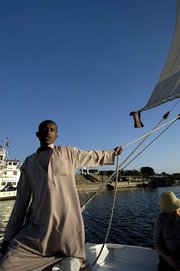
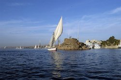
The Nile was, and still is, used to transport goods to different places along its long path; especially the winter winds in this area blow to the south, upriver, so ships could travel up and down the Nile with ease. While most Egyptians still live in the Nile valley, the construction of the Aswan High Dam (finished in 1970) to provide hydroelectricity ended the summer floods and their renewal of the fertile soil.Cities on the Nile include Khartoum, Aswan, Luxor (Thebes), and the Giza–Cairo conurbation. The first cataract, the closest to the mouth of the river, is at Aswan to the north of the Aswan Dams. The Nile north of Aswan is a regular tourist route, with cruise ships and traditional wooden sailing boats known as feluccas. In addition, many "floating hotel" cruise boats ply the route between Luxor and Aswan, stopping in at Edfu and Kom Ombo along the way. It used to be possible to sail on these boats all the way from Cairo to Aswan, but security concerns have shut down the northernmost portion for many years.
Flooding
The annual cycles of the Nile became a central facet in the lives of ancient Egyptians. The annual flood was personified by the god Hapy, who was associated with fertility and regeneration. The Nile was very important for stimulating both religion and science during Pharonic times. The Nile mysteriously and predictably rose each summer to flood and fertilize the land, without rain and in the hottest time of the year. A good flood and Egypt's wealth was assured; a poor flood or too great of a flood and Egypt would suffer.
The cyclic mystery created awe and stimulated worship, and the job of recording the history of Nile flooding, when the Nile was expected to flood, and the locations of farmers' plots after the floodwaters receded stimulated creation of the first scientific instrument (the Nilometer), astronomy, and surveying. The concerns of ancient Egyptians for a good flood were justified. The failure of the Nile floods and the generally low level of the river is thought to have been responsible for the collapse of the Old Kingdom about 4200 years ago. These concerns are captured in the Bible, where Joseph correctly interpreted Pharoah's dreams of 7 years of abundance and 7 years of poverty in Egypt to relate to good and then bad Nile floods.
Ledyard, in his Travels, speaks contemptuously of this celebrated wonder:—"This is the mighty, the sovereign of rivers—the vast Nile that has been metamorphosed into one of the wonders of the world! Let me be careful how I read, and, above all, how I read ancient history. You have heard, and read too, much of its inundations. If the thousands of large and small canals from it, and the thousands of men and machines employed to transfer, by artificial means, the water of the Nile to the meadows on its banks—if this be the inundation that is meant, it is true; any other is false; it is not an inundating river."
More recently, drought conditions during the 1980's led to widespread starvation in Ethiopia and Sudan but Egypt was protected from drought by water impounded in Lake Nasser.
The Eonile
The present Nile is at least the fifth river that has flowed north from the Ethiopian Highands. Satellite imagery identified dry watercourses in the desert to the west of the Nile. An Eonile Canyon filled by surface drift represents an ancestral Nile, called the Eonile that flowed during the later Miocene, transporting clastics and light sediments to the Mediterranean, where several gas fields have been discovered. South of Cairo, the sand-filled canyon reaches 1400 meters.
When the Mediterranean Sea was a hot dry empty salt-floored sink in the late Miocene period, the Nile cut its course down to the new base level until it was several hundred feet below world ocean level at Aswan and 8000 feet below at Cairo. This huge canyon is now full of later sediment.
Formerly Lake Tanganyika drained northwards into the Nile, until the Virunga Volcanoes blocked its course in Rwanda. That would have made the Nile much longer, with its longest headwaters in northern Zambia.
External link
- Nile paleogeography (http://www.aber.ac.uk/~qecwww/tana/geology.htm)
External links
- Good summary, and breakdown of the Nile (http://nileriver.port5.com)
- Information and a map of the Nile's watershed (http://earthtrends.wri.org/maps_spatial/maps_detail_static.cfm?map_select=299&theme=2)
- Geology and History of the Nile (http://www.utdallas.edu/dept/geoscience/remsens/Nile/index.html)
- Nile Delta from Space (http://www.photoglobe.info/spc_nile_delta.html)
- Facts About The Nile River (http://www.ancient-egypt-online.com/river-nile-facts.html)
- Photo Gallery from a cruise between Luxor and Aswan (http://www.ianandwendy.com/OtherTrips/Egypt/NileCruise/slideshow2.htm)
- An excellent essay about the challenges of equitably allocating the waters of the Nile (http://www.history.ucsb.edu/faculty/Inscrutable%20Nile1.pdf)


