
Washington, D.C.
|
|

Washington, D.C., officially the District of Columbia (also known as D.C.; Washington; the Nation's Capital; the District; and, historically, the Federal City) is the capital city and administrative district of the United States of America. Washington, D.C. is part of the Baltimore-Washington Metropolitan Area, which also includes parts of Maryland, Virginia, and West Virginia. It should not be confused with the U.S. state of Washington, located in the Pacific Northwest.
The District of Columbia is a federal district as specified by the United States Constitution with limited—and sometimes contentious—local rule. The District is ruled "in all cases whatsoever" by the U.S. Congress, while nevertheless going unrepresented in that body. The land forming the original District came from the states of Virginia and Maryland, but only the Maryland portion remains part of the District. The population of the District of Columbia, as of 2003 U.S. Census Bureau estimates, is 563,384. If Washington, D.C. were considered as a state, it would rank last in area behind Rhode Island, 50th in population ahead of Wyoming, and 36th in Gross State Product, ahead of 15 states.
The centers of all three branches of the U.S. federal government are in Washington, D.C., as well as the headquarters of most federal agencies. Washington also serves as the headquarters for the World Bank, the International Monetary Fund, and the Organization of American States, among other international (and national) institutions. All of this has made Washington the frequent focal point of massive political demonstrations and protests, particularly on the National Mall. Washington is also the site of numerous national landmarks, museums, and sports teams, and is a popular destination for tourists.
The official bird of Washington DC is the wood thrush. The official motto is Justitia Omnibus (Justice for All).
| |||||
| City motto: Justitia Omnibus (Justice for All) | |||||
| Founded | 16 July1790 | ||||
| County | Independent city | ||||
| Mayor | Anthony Williams (Democrat) | ||||
| Area - City Proper | 61 mi² | ||||
| Population - City (2003) - Metropolitan - Density (city proper) | 563,384 4,796,183 9,316.4/mi² | ||||
| Time zone | Eastern: UTC-5 | ||||
| Latitude Longitude | 39°17' N 76°36' W | ||||
| www.dc.gov | |||||

| Contents |
Name
"Washington, D.C." is the most common way to refer to the District throughout the rest of the United States and the world. Residents of Washington and its surrounding suburbs refer to the city simply as the District or D.C., to contrast its greater metropolitan area.
"Washington" or "Washington, D.C."' is also used as a metonym for the federal government. Politicians and candidates for office sometimes use these terms pejoratively to convey a sense of solidarity with their constituents by distancing themselves from the negative image of an out-of-touch centralized government. (The Washington Post criticized this common political tactic in a 2001 editorial (http://www.washingtonpost.com/ac2/wp-dyn?pagename=article&contentId=A22140-2001Aug30¬Found=true).)
Law and government
District_of_Columbia_flag.png
Local government
The city is run by an elected mayor (currently Anthony A. Williams) and the D.C. Council. District schools are administered by a school board that has both elected and appointed members. The 37 elected Advisory Neighborhood Commissions (ANCs) provide the most direct access for residents to their local government. However, Congress has plenary power over the district. It has the right to review and overrule laws created locally, and has often done so. The Tenth Amendment to the United States Constitution does not apply to the District of Columbia.
DC residents pay all federal taxes, such as income tax, as well as local taxes. The mayor and council adopt a budget of local money with Congress reserving the right to make any changes. Because so much of the valuable property in the district is federally owned and hence exempt from local property taxes, the city is frequently cash-strapped. Public services in the city suffer as a result.
Representation in federal government
Dctaxationsample_small.jpg
According to the U.S. Constitution, Washington, D.C. is under the direct jurisdiction of Congress. Congress has delegated various amounts of this authority to local government. Still, D.C. residents lack some representation that is enjoyed by residents of U.S. states.
Residents of the District vote for the President but do not have voting representation in Congress. Citizens of Washington are represented in the House of Representatives by a non-voting delegate (currently Eleanor Holmes Norton (D-DC At-Large)) who sits on committees and participates in debate but cannot vote. DC does not have representation in the Senate. Citizens of Washington, DC are thus unique in the world, as citizens of the capital city of every other country have the same representation rights as other citizens. Attempts to change this situation, including the proposed District of Columbia Voting Rights Amendment, have been unsuccessful.
The history of DC's relationship with the federal government, as well as the arguments for and against increased representation, are covered in the article District of Columbia voting rights.
- See also: D.C. Statehood, No taxation without representation
History
See main article History of Washington, DC.
A Southern site for the capital was agreed at a dinner between Thomas Jefferson and Alexander Hamilton. The initial plan for the Federal City was a diamond, ten miles wide on each side, giving it 100 square miles (260 square kilometers). The actual site on the Potomac River was chosen by President Washington. Washington may have chosen the site for its natural scenery, in the belief that the Potomac would become a great navigable waterway, or even in the hope of increasing the value of his land holdings in the area.
On August 24, 1814, British forces burnt the capital during the most notable destructive raid of the War of 1812. President James Madison and U.S. forces fled and British forces burned public buildings including the Capitol, the Navy Yard, and the Treasury building. The Presidential Mansion was also gutted.
Washington_dc_1874.jpg
Washington remained a small city of a few thousand permanent residents until the outbreak of the U.S. Civil War in 1861. The significant expansion of the federal government to administer the war—and its legacies, such as veterans' pensions—led to notable growth in the city's population. But on April 14, 1865, just days after the end of the war, president Abraham Lincoln was assassinated by John Wilkes Booth in Ford's Theater.
In the early 1870s, Washington was given a territorial government, but governor Alexander Shepherd's reputation for extravagance resulted in Congress abolishing his office in favor of direct rule. Congressional governance of the District would continue for a century.
The Washington Monument opened in 1888. Plans were laid to further develop the monumental aspects of the city, with work contributed by such noted figures as Frederick Law Olmsted and Daniel Burnham. However, development of the Lincoln Memorial and other structures on the National Mall did not get underway until the early 20th century.

The Twenty-third Amendment to the United States Constitution was ratified on March 29, 1961 allowing residents of Washington, DC to vote for president and have their votes count in the Electoral College.
The District's population peaked in 1950, when the Census for that year recorded a record population of 802,178 people. At the time, that ranked the city as the ninth-largest in the country, ahead of Boston and ahead of St. Louis. The population declined in the following decades, mirroring the suburban outmigration of many of the nation's older urban centers following World War II. In 1957, Washington DC became the first major American city with an African-American majority population.
The first 4.6 miles (7.4 kilometers) of the Washington Metro subway system opened on March 27, 1976.
Walter Washington became the first elected mayor of the District in 1974. Marion Barry became mayor in 1978, but was arrested for drug use in an FBI sting on January 18, 1990, and would serve a six-month jail term. His successor, Sharon Pratt Kelly, became the first black woman to lead a city of that size and importance in the U.S. But Barry defeated her in the 1994 primary and was once again elected mayor for his fourth term, during which the city nearly became insolvent and was forced to give up some home rule to a Congressionally appointed financial control board.

The Washington area was the target of at least one of the four hijacked planes in the September 11, 2001 attacks. One plane struck the Pentagon in Arlington County, killing 125 people in addition to the 64 aboard the plane, while another that was downed in a field in Pennsylvania is believed by many to have been intended to hit either the White House or the U.S. Capitol.
Shortly thereafter, Washington endured an anthrax attack, when what may have been a domestic terrorist sent anthrax-contaminated mail to numerous members of Congress. Thirty-one staff members were infected, and two U.S. Postal Service employees at a contaminated mail sorting facility at Brentwood later died.
During three weeks of October 2002, John Allen Muhammad and Lee Boyd Malvo killed ten people and wounded three others in the region in what became known as the Beltway Sniper attacks. In March 2004, Muhammad was sentenced to death and Malvo to life imprisonment for the attacks by a Virginia court.
In November 2003, the toxin ricin was found in the mailroom of the White House, and in February 2004, in the mailroom of U.S. Senate Majority Leader Bill Frist. As with the earlier anthrax attacks, no arrests have been made.
Partly in response to these events from the past few years, the Washington area has taken many steps to increase security.
When US forces in Pakistan raided a house suspected of being a terrorist hideout, they found information several years old, about attacks on Washington DC, New York City, and Newark, New Jersey. It was directed to intelligence officials, and on August 1, 2004, the Secretary of Homeland Security put the city on Orange (High) Alert.
A few days later security checkpoints were popping up in and around the Capitol Hill and Foggy Bottom Neighbourhoods, and fences were erected on monuments once freely accessible, such as the Capitol (not open to tourists). Tours to the White House can only be arranged by a member of Congress. Screening devices for biological agents, metal detectors, and vehicle barriers became much more commonplace at office buildings as well as government buildings and in transportation facilities.
This ultra-tight security was referred to as "Fortress Washington" – people protested that "Walling off Washington" due to information several years old was not acceptable.
Thanks in part to the renewed expansion of the federal government after the creation of the Department of Homeland Security, as well as the thriving real estate market, Washington has experienced a huge housing boom that has seen thousands of units constructed, along with thousands of people moving to the District. This has led the city government to dispute a 2005 estimate made by the Census Bureau that the District's population will drop to 433,000 by 2030, claiming that Census officials routinely undercount the city's population and that the data they employed did not anticipate current economic and social trends. City officials have also released their own growth reports that estimate that the District's population will rise to 712,000 by 2030.
Geography
See Geography of Washington, D.C.
Crime
Dchomicides.gif
At the peak of the violent crime wave, in the early 1990s, Washington DC was known as the murder capital of the U.S. The number of homicides peaked in 1991, with 482 in that year. Despite the high rate of crime, violence was not evenly distributed across the city, but rather was primarily concentrated in specific neighborhoods, located east of Rock Creek Park. These areas included Columbia Heights, Adams Morgan, Logan Circle, Shaw, Le Droit Park and the East End of Downtown (Chinatown), all located to the north of the National Mall. As recently as 2001, many services such as baby sitters would not go east of 16th Street, into these neighborhoods due to the prevalence of violent crime. High rates of crime have also plagued substantial portions of Northeast Washington, including the Trinidad neighborhood, as well as most of the neighborhoods located east of the Anacostia River, in Southeast Washington.
The tide has since turned as gentrification is sweeping eastward across the District and has transformed the neighborhoods of Adams Morgan, Logan Circle, Columbia Heights, and the East End of Downtown (Chinatown). In the past ten years, the number of homicides has been halved, from 399 in 1994 to 198 in 2004. The gentrification of these neighborhoods was, in part, spurred by the extension of Metrorail's Green Line to the Shaw, U Street, Columbia Heights, and Petworth neighborhoods, during the late 1990s. The revitalization efforts began, first in the Adams Morgan and Logan Circle areas, and more recently in Columbia Heights. In 2005, gentrification is now beginning to reach Shaw, Le Droit Park, Petworth, Bloomingdale, Eckington, as well as Trinidad. The transformation of the Downtown/Chinatown areas into clean, safe areas was aided by the construction of the MCI Center, which opened in 1997, and the new Washington Convention Center that opened in 2004 at Mount Vernon Square. As a result of the revitalization efforts, the home values in these neighborhoods have skyrocketed, while the violent crime rates have plummeted.
Despite this gentrification, the Sursum Corda public housing project, located along North Capitol Street between K and M Streets, bordering the Downtown/Chinatown and Le Droit Park neighborhoods, has remained a magnet for drug dealers and crime. However, since a 14-year girl was murdered here in the beginning of 2004, the D.C. government has begun to tackle this hotspot. A plan is in the works to demolish the public housing and replace it with mixed-income housing. Helping to spur development in this area north of Union Station, is the New York Avenue metrorail station that opened in November 2004, and related economic development.
It is advisable for visitors to Washington to acquaint themselves with the neighborhoods of the city and plan their visits accordingly, the same care that one would pay when visiting any major city is recommended. Tourist advice ("conventional wisdom") generally recommends that visitors do not venture east of the U.S. Capitol. An exception to that is the historic Capitol Hill neighborhood, located directly to the east of the U.S. Capitol Building. There are many attractions in the eastern half of the city, including the historic Eastern Market (the largest continually operated public market in the city) and the National Arboretum on New York Avenue. The visitor will also find countless historic residential neighborhoods in the eastern half of the city. This "common" tourist advice to remain west of the U.S. Capitol is seen by some locals as racially motivated, since most of the District's white residents live west of the U.S. Capitol and most of the property related crime also occurs west of the U.S. Capitol. Like any major city, it is advisable to use common sense and not be out alone at late hours of the night.
An added impact of this wave of gentrification is that a substantial amount of violent crime has spilled across the District's eastern boundaries into Prince George's County, Maryland. In 2004, Prince George's County experienced 148 homicides, up from 128 in 2003. As of mid-May 2005, the suburban county had already had 64 homicides for the year. That level of violence contrasts unfavorably with the other major counties surrounding Washington, including Montgomery County, Maryland which had 17 homicides for 2004, and Fairfax County, Virginia, with 10 homicides in 2004.
Like many other large cities, Washington D.C. has enacted a number of strict gun control laws. Handguns have been completely outlawed (unless registered as of February 5, 1977), carrying guns (concealed or not) is prohibited, and all guns and ammunition must be registered [1] (http://www.nraila.org/GunLaws/StateLaws.aspx?ST=DC). Critics, citing numerous statistics, have questioned the efficacy of these restrictions. Due to its prominence both as the national capital and as the so-called "murder capital" of the US (although it does not currently hold that dubious honor), Washington has become something of a popular example [2] (http://www.lewrockwell.com/lott/lott31.html) in the wider debate on gun control. For a fuller perspective, see gun control.
Demographics
As of the census of 2000, there are 572,059 people, 248,338 households, and 114,235 families residing in the city. The population density is 3,597.3/km² (9,316.4/mi²). There are 274,845 housing units at an average density of 1,728.3/km² (4,476.1/mi²). The racial makeup of the city is 60.01% Black or African American, 32.78% White, 2.66% Asian, 0.30% Native American, 0.06% Pacific Islander, 3.84% from other races, and 2.35% from two or more races. 7.86% of the population are Hispanic or Latino of any race.
There are 248,338 households out of which 19.8% have children under the age of 18 living with them, 22.8% are married couples living together, 18.9% have a female householder with no husband present, and 54.0% are non-families. 43.8% of all households are made up of individuals and 10.0% have someone living alone who is 65 years of age or older. The average household size is 2.16 and the average family size is 3.07.
In the city the population is spread out with 20.1% under the age of 18, 12.7% from 18 to 24, 33.1% from 25 to 44, 21.9% from 45 to 64, and 12.2% who are 65 years of age or older. The median age is 35 years. For every 100 females there are 89.0 males. For every 100 females age 18 and over, there are 86.1 males.
The median income for a household in the city is $40,127, and the median income for a family is $46,283. Males have a median income of $40,513 versus $36,361 for females. The per capita income for the city is $28,659. 20.2% of the population and 16.7% of families are below the poverty line. Out of the total population, 31.1% of those under the age of 18 and 16.4% of those 65 and older are living below the poverty line.
Religion
In a 2000 survey by the American Religion Data Archive (http://www.thearda.com/), religious congregations in Washington DC were asked for their membership in the city (methodology (http://www.thearda.com/RCMS/2000/CCMMethods.html)). About 26% of the population was not claimed by any congregation, and their religious affiliation, if any, is unknown. Of the population belonging to a congregation, the population was as follows:
- All Christian 78%, including:
- Roman Catholic: 38%
- Baptist (American Baptists and Southern Baptists): 21%
- Episcopal: 4%
- Muslim: (surveyed) 14%
- Jewish: (surveyed) 6%
Economy
National-atlas-district-of-columbia.gif
Washington had a Gross State Product in 2003 of $69.7 billion. Washington, D.C. is first and foremost a company town, the company being, of course, the federal government. Most (but by no means all) people who work in or around the District have some sort of connection to the federal government. In addition to government employees, many people work for the federal contractors headquartered in the area, and many also work for the numerous nonprofit organizations of all sizes and political orientations. Then there are the law firms and lobbying firms, catering and administrative services companies, and several other industries that are sustained by the enormous economic presence of the federal government.
This arrangement has the effect of making the Washington economy virtually recession proof relative to the rest of the country, because the federal government will still operate no matter the state of the general economy.
Several major companies are based in Washington, including the Carlyle Group, Marriott, and XM Satellite Radio.
Just outside the District, mostly in the Northern Virginia suburbs of Washington, there are headquarters to many large corporations. America Online and Orbital Sciences Corporation are based in Dulles, Virginia; MCI is based in Ashburn, Virginia; Nextel and Unisys are based in Reston, Virginia; US Airways is based in Arlington, Virginia; Colgan Air is based in Manassas, Virginia; Lockheed Martin is based in Bethesda, Maryland; General Dynamics is based in Falls Church, Virginia; Alhurra is based in Springfield, Virginia; Independence Air is based at Dulles International Airport; and the Gannett Company and its newspaper USA TODAY are based in McLean, Virginia.
The American genomics industry is largely centered around the Maryland suburbs of Washington. Prominent players are Celera Genomics, The Institute for Genomic Research (also known as "TIGR"), and Human Genome Sciences (all of which are in the city of Rockville, Maryland).
Cultural features
Landmarks and museums
Washington is the home of numerous national landmarks and is a popular tourist destination. Landmarks include:

Professional sports
Washington is home to several professional sports teams: the MLS D.C. United, the NHL Washington Capitals, the WNBA Washington Mystics, the NBA Washington Wizards, and the MLB Washington Nationals. Washington also hosts the annual Legg Mason Tennis Classic tennis tournament.
The NFL Washington Redskins formerly played at R.F.K. Stadium in the District, but, although still named for the city, are now based at FedEx Field in Landover, Maryland.
Other professional and semi-professional teams based in DC include the USAFL Baltimore Washington Eagles, the NWFA D.C. Divas, the Minor League Football DC Explosion, and the Washington Cricket League. It was also home to the WUSA Washington Freedom, and, during the 2000–2002 NLL seasons, the Washington Power was based in the city.
On September 29, 2004, Major League Baseball announced plans to relocate the Montreal Expos to Washington for the 2005 season; on November 22, a new name was announced for the team — the Washington Nationals. A very public back-and-forth between the city council and MLB threated to scuttle the agreement until December 21, when a plan for a new stadium in Southeast DC was finalized. The Nationals will play at R.F.K. Stadium for the 2005, 2006, and 2007 seasons, with the new stadium slated to be ready for 2008. The market is also home to many fans of the Baltimore Orioles whose owner opposed the move of the Expos to DC.
There were two Major League Baseball teams named the Washington Senators in the early and mid-20th century, which left to become respectively the Minnesota Twins and the Texas Rangers. In the 19th century, the town was home to teams called the Washington Nationals, Washington Statesmen, and Washington Senators on and off from the 1870s to the turn of the century.
Washington was also home to several Negro League teams, including the Homestead Grays, Washington Black Senators, Washington Elite Giants, Washington Pilots, and Washington Potomacs.
The MCI Center in Chinatown, home to the Capitals, Mystics, Wizards, and the Georgetown Hoyas, is also a major venue for concerts, WWE professional wrestling, and other events.
See also: U.S. cities with teams from four major sports.
Performing arts
The Kennedy Center for the Performing Arts hosts the National Symphony Orchestra, the Washington Opera, the Washington Ballet, and other musical and stage performances. Notable local music clubs include Madam's Organ Blues Bar in Adams Morgan, and the Black Cat, the 9:30 Club, and the historic Bohemian Caverns jazz club, all in the U Street NW area.
The only native DC music genre is go-go, a post-funk, percussion-driven flavor of R&B that blends live sets with relentless dance rhythms (that "go and go and go.") The most accomplished practitioner of go-go was DC bandleader Chuck Brown, who brought go-go to the brink of national recognition with his 1979 LP Bustin' Loose.
Washington was also an important center in the genesis of punk rock in the United States. Punk bands of note from Washington include Fugazi, Bad Brains, and Minor Threat. Native Washingtonians continue to support punk bands, long after the punk movement's peak in popularity. The region also has a storied indie rock history and was home to TeenBeat and Simple Machines, among other indie record labels.
DC has also historically been a center for bluegrass music.
TV shows featuring Washington
- Main article: List of television shows set in Washington, D.C.
Many television series featuring the District have had essential ties to the government (The West Wing) or security organizations (The District, Get Smart). Other programs had the nation's capital as a secondary focus, telling stories on their own that were not always tied to the infrastructure of the government either in the district or for the country. Murphy Brown focused on the lives of the reporters of a Washington-based television newsmagazine, FYI. The soap opera Capitol allowed for stories about political intrigue alongside the traditional class struggle sagas. The sitcom 227 mentioned the role of government in the District rarely, instead showing life of the African-American majority as seen through the eyes of residents in a Washington apartment building.
Local media
The Washington Post is the oldest and most read daily newspaper in Washington. The Post is also one of the most reputable daily newspapers in the U.S. and is highly influential in its political reporting, particularly after the role of its reporters in cracking the Watergate scandal. The daily Washington Times and the free weekly Washington City Paper also have substantial readership in the District. On February 1, 2005 the free daily tabloid Washington Examiner debuted. It had formerly been a chain of suburban newspapers known as the Journal Newspapers. The weekly Washington Blade focuses on gay issues. Many neighborhoods in the city have their own small-circulation newspaper, usually a free weekly. They are sometimes published by each neighborhood's respective neighborhood association.
Neighborhood newspapers include:
- Dupont Current for Dupont Circle
- Georgetown Current for Georgetown
- In-Towner for Dupont Circle, Logan Circle, Adams Morgan and nearby neighborhoods
- Northwest Current for Upper Northwest
- Voice of the Hill for the Capitol Hill neighborhood
Washington is served by the following local broadcast television stations:
- WBDC—Channel 50, a WB affiliate
- WDCA—Channel 20, a UPN affiliate
- WRC—Channel 4, an NBC affiliate
- WETA—Channel 26, a PBS affiliate
- WJLA—Channel 7, an ABC affiliate
- WTTG—Channel 5, a FOX affiliate
- WUSA—Channel 9, a CBS affiliate
Public Access on Cable Television is provided by the Public Access Corporation of the District of Columbia on 2 DCTV (http://www.onlinedctv.org/)channels simulcast to both local cable TV Systems. One channel is devoted to religious programming and the other channel provides a diversity of offerings.
Some prominent radio stations in the District include:
- WTEM, 980 AM, sports talk station SportsTalk 980.
- WAMU, 88.5 FM, an NPR-affiliate run by American University. Plays the usual NPR programs, community programming, and BBC news. Once known for its daily bluegrass programming, bluegrass and oldtime country are now aired only on Sunday and on its online affiliate, bluegrasscountry.org (http://www.bluegrasscountry.org/).
- WETA, 90.9 FM, another NPR-affiliate. It previously ran a mixed program, but has recently abandoned most of its classical music programming in favor of round-the-clock news/analysis, broadcasting shows originating mainly from NPR, PRI and the BBC.
- WHFS, 99.1 FM, long-time alternative rock station turned Latin.
- WKYS, 93.9 FM, a Radio One station competing with WPGC for the young African-American market. Home to the regionally syndicated Russ Parr Morning Show.
- WPGC, 95.5 FM, a highly rated rythmic CHR/hip-hop station.
- WHUR, 96.3 FM, a commercial radio station run by Howard University, an "urban adult contemporary" station in radio industry parlance. Also highly rated.
- WASH, 97.1 FM, a soft adult contemporary station; better known as "WASH-FM."
- WMZQ, 98.7 FM, the city's country music station.
- WIHT, 99.5 FM, a popular top-40 radio station run by Clear Channel Communications.Missing image
Washington_Monument_cherry_blossoms.jpgWashington Monument - WWDC, 101.1 FM, also known as "DC 101," this is the District's "alternative rock" station. "Shock jock" Howard Stern worked at WWDC briefly in the early 1980s, when he made national headlines for prank-calling Air Florida the day after the fatal crash of the airline's Flight 90 into Washington's 14th Street Bridge.
- WJZW, 105.9 FM, the city's smooth jazz station.
- WJFK, 106.7 FM, an all-talk station owned by the Infinity Broadcasting network. It broadcasts personalities ranging from Howard Stern to Bill O'Reilly.
- WMAL, 630 AM, long-running conservative talk station.
- WTOP, 1500 AM, an all-news station. Claims to be the District's top-rated radio station.
XM Satellite Radio is based in Washington as well.
- List of D.C. radio stations (http://www.tvradioworld.com/region1/dc/Radio.asp?m=was)
Educational institutions
Colleges and universities
High schools
Other schools
Main article: Washington, DC schools
- Sheridan School
- Reformed Theological Seminary
- Washington Theological Union
- USDA Graduate School
Transportation
Roadways
The Capital Beltway surrounds the Washington area. East of the Interstate_95 exits in Virginia and Maryland, the Beltway has a double route number: I-95 and I-495. West of those exits, the Beltway is designated simply as I-495. I-270 connects the Beltway with I-70. The Henry G. Shirley Memorial Highway (I-395) breaks off of I-95 at the Beltway to connect northern Virginia with downtown Washington. I-66 begins at the east edge of Georgetown, connects to the Beltway, and continues through northern Virginia to I-81. I-295 comes up from the south starting at the eastern edge of the Woodrow Wilson Bridge on the Beltway and crosses the Anacostia River into downtown, linking up with I-395. Anacostia Freeway (DC-295), splits from I-295 on the south side of the Anacostia, and links with the unnumbered Baltimore-Washington Parkway via a short section of Maryland State Highway 201.
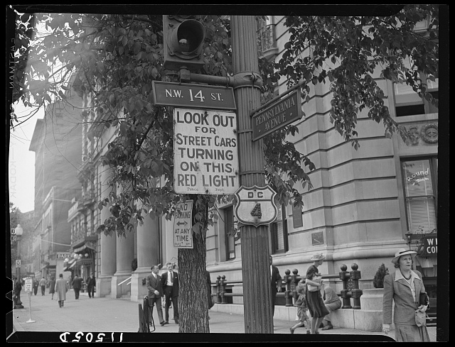
Among the major roads in Washington are MacArthur Boulevard, 14th Street NW, 16th Street NW, Connecticut Avenue, K Street NW, the Rock Creek and Potomac Parkway, Wisconsin Avenue, M Street NW, Pennsylvania Avenue, Constitution Avenue, Independence Avenue, Massachusetts Avenue, U Street NW, North Capitol Street, South Capitol Street, East Capitol Street, Georgia Avenue, Minnesota Avenue, Nannie Helen Boroughs Avenue, Martin Luther King Jr. Avenue, New York Avenue, Rhode Island Avenue, the Anacostia Freeway, and the Suitland Parkway. The Whitehurst Freeway, an elevated freeway over K Street in Georgetown, allows U.S. Highway 29 traffic to bypass Georgetown between the Key Bridge and K Street downtown.
U.S. Highways 1, 29 and 50 pass through Washington, mostly on surface streets. The route numbers are not used by residents and the sparse signage reflects that.
Washington formerly had other District routes in addition to DC Route 295, signed using a modified U.S. Highway shield (a 1942 photo (http://memory.loc.gov/pnp/fsa/8b14000/8b14400/8b14423r.jpg)), but these are long-gone.
Bus and rail
The Washington area is serviced by the Washington Metro public transportation system, which operates public buses (Metrobus) and the region's subway system (Metrorail). Many of the jurisdictions around the region also run public buses that interconnect with the Metrobus/Metrorail system. Union Station is served by MARC and Virginia Railway Express commuter trains, and Amtrak intercity rail. Intercity bus service is available from the Greyhound Bus Terminal in Northeast and from dragon buses leaving from Chinatown.
Airports
No commercial airports lie within the District of Columbia itself, though three are situated nearby:
- Ronald Reagan Washington National Airport (DCA), 4.3 miles (6.9 km) south in Arlington County, Virginia;
- Washington Dulles International Airport (IAD), 26.3 miles (42.3 km) west between Dulles and Chantilly, Virginia;
- Baltimore/Washington International Airport (BWI), 31.7 miles (51.0 km) northeast in Linthicum, Maryland near Baltimore.
The first two are managed by a special body, the Metropolitan Washington Airports Authority, while the third is under the administration of the State of Maryland.
Reagan National — known to most long-time area residents simply as "National Airport" — is favored for its close proximity and Metro access, but flights are heavily restricted on account of noise and security concerns. With a handful of exceptions, flights in and out of DCA are restricted to airports less than 1250 miles (2000 km) away. On the most common approach, pilots must negotiate a tight corridor over the Potomac between restricted airspace over the White House and Mall to the north and the Pentagon to the south, executing a ninety-degree turn just before touchdown.
Dulles is the busiest airport by passengers served, and the second busiest international gateway on the Eastern Seaboard. It is a hub of United Airlines and Independence Air, and on account of the latter the largest low-cost carrier hub in the U.S., although LCC Southwest Airlines notably maintains one of its largest East Coast operations at BWI.
General aviation is additionally available at Montgomery County Airpark (Gaithersburg, Maryland), College Park Airport (College Park, Maryland), Potomac Airfield (Friendly, Maryland), and Manassas Regional Airport (Manassas, Virginia).