


Eritrea Facts for Kids – Geography, History & Culture of East Africa
Explore Eritrea facts for kids. Learn about this East African country’s location on the Red Sea, its diverse geography, ancient and modern history, and rich cultural traditions.
🌍 Introduction: A Land Carved by Mountains and Sea
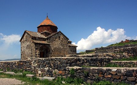
Eritrea hugs the southern shores of the Red Sea, wedged between Sudan, Ethiopia, and Djibouti in the Horn of Africa. Though its coastline stretches over 2,200 kilometers, much of the country rises into rugged highlands and volcanic plateaus. Eritrea’s people represent nine major ethnic groups—each with its own language, music, and customs—united by a hard-won independence in 1993. From the Italian-built architecture of Asmara to the ancient ruins on the Dahlak Archipelago, Eritrea blends African, Arab, and European influences into a distinctive Creole culture. Despite political challenges, Eritreans draw strength from community, tradition, and the dramatic landscapes they call home.
🗺️ Geography & Environment
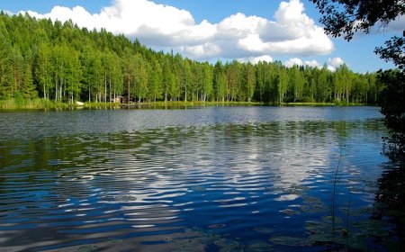
Eritrea covers about 117,600 square kilometers, with three major geographic zones. Along the coast lies the Red Sea coastal plain, dotted with salt flats and coral islands, where the Dahlak Archipelago teems with marine life. Inland, the central highlands ascend from 1,800 to over 3,000 meters, forming the spine of the country. This region, centered on Asmara (2,300 m), enjoys a mild climate and fertile soil. South of the highlands, the land slopes into the western lowlands and the Danakil Depression, one of the hottest, driest places on Earth. Here, colorful mineral springs and lava fields recall Eritrea’s volcanic origins. Rainfall is scarce in the lowlands (under 200 mm annually) but more plentiful in the highlands (up to 600 mm), supporting terraced farms of barley, lentils, and coffee.
🏛️ Government, Language & Population
Eritrea is a unitary one-party state led by the People’s Front for Democracy and Justice since independence. Although a constitution was ratified in 1997, elections have not been held, and national service remains compulsory. The de facto capital and largest city is Asmara, nicknamed “Little Rome” for its preserved Art Deco buildings. Asmara’s streets bustle with cafés, markets, and coffee ceremonies beneath eucalyptus-lined boulevards.
Eritrea’s population is roughly 6 million, divided among nine ethnic communities. The two largest are the Tigrinya (≈55 %) in the highlands and the Tigre (≈30 %) in the lowlands; other groups include the Saho, Afar, Kunama, and Rashaida. Eritrea has no single national language. Tigrinya, Arabic, and English serve in administration and education, while each ethnic group preserves its own tongue. Religion reflects the country’s diversity: about 50 % follow Eritrean Orthodox Christianity, while 48 % practice Sunni Islam, with small Catholic, Protestant, and indigenous-belief communities.
🎭 Culture & Daily Life
Eritrean life revolves around community, ceremony, and cuisine. In towns and villages, the coffee ceremony—roasting beans on a charcoal brazier, brewing in a decorated pot, and serving three rounds of strong coffee—marks hospitality and friendship. Families share injera (a spongy flatbread) topped with stews of lentils, chickpeas, or spiced meat. Special occasions call for tsebhi (meat stews) and kitcha fit-fit (shredded flatbread with butter and spice).
Music and dance vary by region: the highland tigrinya songs accompany dancers who stamp and sway in colorful shawls, while coastal Dahlak rhythms blend Arab and African melodies. Drums, the krar (a lyre-like harp), and the washint (flute) sustain vocal storytelling and songs of love, war, and harvest. Youth often gather in Asmara’s plazas to chat, watch street art, or play traditional games.
While many Eritreans still farm small plots or herd goats, others work in government, education, or abroad—sending remittances that bolster family incomes. Women play active roles in agriculture and trade, though gender equality remains a work in progress. Despite emigration and service demands, strong ties to ancestral villages keep many families rooted in the land.
📜 History Highlights
Eritrea’s history traces back to the Kingdom of Aksum (1st–8th centuries CE), which ruled from the highlands and minted the first local coins. The arrival of Islam in the 7th century brought Arab traders to the coast, while Abyssinian wars and Ottoman incursions shaped the lowlands. In 1885, Italy seized the ports and built the colony of Eritrea, connecting it to mass-migration plantations and railroads to the interior.
After World War II, Britain administered Eritrea, and in 1952 the UN federated it with Ethiopia under Emperor Haile Selassie. Ethiopian annexation in 1962 sparked the 30-year struggle for independence, led by the Eritrean Liberation Front and, later, the People’s Front for Democracy and Justice. In 1991, Eritrean fighters liberated Asmara; a UN-supervised referendum in 1993 confirmed independence by a 99.8 % vote. Since then, border wars with Ethiopia (1998–2000) and internal consolidation have defined the young nation’s path.
💰 Economy & Resources
Eritrea’s economy remains largely agricultural, with over 80 % of the population engaged in subsistence farming and herding. Main crops include sorghum, barley, lentils, sesame, and coffee—grown on terraced hillsides around Asmara. The government has promoted irrigation and small-scale irrigation schemes to counter drought. Eritrea also sits on notable minerals—including gold, copper, zinc, and potash—and the Bisha mine (gold, silver, copper, zinc) opened in 2011, attracting foreign investment.
The port of Massawa and the newer Dahlak Massawa free zone handle imports and exports, while the Asmara-Massawa Cableway—once the world’s longest ropeway—remains a tourist attraction. Remittances from Eritrean diaspora in the Gulf and Europe contribute significantly to household incomes. Economic growth is tempered by sanctions, bureaucracy, and limited foreign access, but recent reforms aim to expand telecommunications and renewable energy projects (wind, solar, geothermal).
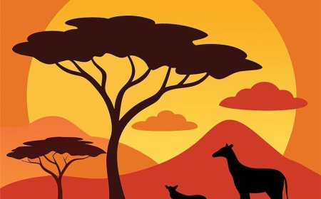
🌿 Wildlife & Natural Beauty
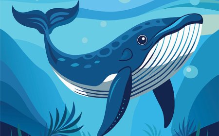
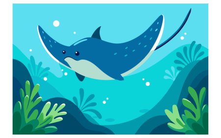
Eritrea’s varied habitats support unique wildlife. The Gash-Barka region hosts Beira antelope, gazelles, and desert hares. The Semien–Debub highlands shelter vervet monkeys, gelada baboons, and alpine flora. Along the coast and islands, green and hawksbill turtles nest on sandy beaches, while coral reefs teem with tropical fish. The Dahlak Archipelago Marine National Park protects over 120 reef fish species and marine mammals like dolphins and occasional whale sharks.
Birdwatchers find pink flamingos on Lake Kulul and migrant waterfowl in wetlands around Delanta. Conservation efforts face challenges—habitat loss, overgrazing, and water scarcity—but community-based parks like Semenawi Bahri National Park and eco-tourism lodges in Akrur seek to balance protection with local livelihoods.
📚 Vocabulary List
Word Definition
Archipelago A group of islands in a sea or ocean
Eritrean Liberation Front The main guerrilla group that fought for Eritrea’s independence
Injera A spongy flatbread made from teff flour, staple in the Horn of Africa
Remittance Money sent by migrants back to relatives in their home country
Federation A political system in which regions maintain some autonomy under a central authority
Terracing Building stepped levels on hillsides to grow crops and prevent erosion
Semien The northern highland region of Eritrea
Sanctions Restrictions imposed by other countries to influence a nation’s behavior
Massawa A historic port city on the Red Sea coast of Eritrea
Gelada A highland monkey species found in Eritrea’s mountains
🧒 Kid-Friendly Summary
Eritrea is a small country on the Red Sea in the Horn of Africa. It has cold highlands, hot deserts, and hundreds of islands. People speak Tigrinya, Arabic, and English, and most follow Christian or Muslim faiths. In small farms, families grow sorghum, lentils, and coffee on terraced hills. In the cities of Asmara and Massawa, you’ll see Art Deco buildings and busy ports. Eritreans roast coffee beans for ceremonies, share injera, and dance to drums and string music. After fighting for independence, they’re working to protect animals like gazelles and turtles, and to build a peaceful future.
🎯 Interactive Quiz: What Do You Know About Eritrea?
What body of water lies to Eritrea’s northeast?
a) Mediterranean Sea b) Red Sea c) Indian Ocean d) Atlantic Ocean
Which desert depression is one of the hottest places on Earth?
a) Sahara b) Danakil Depression c) Kalahari d) Gobi
What year did Eritrea gain independence?
a) 1952 b) 1962 c) 1993 d) 2001
What is injera?
a) A coffee ceremony b) A type of stew c) A flatbread d) A drum
Which language is NOT commonly used in Eritrea?
a) Tigrinya b) Arabic c) English d) Portuguese
What is the name of Eritrea’s capital?
a) Massawa b) Asmara c) Keren d) Barentu
What large mine opened in 2011?
a) Bisha b) Kibira c) Zakouma d) Gulak
What endemic monkey can be found in Eritrea’s highlands?
a) Gelada b) Chimpanzee c) Baboon d) Gibbon