


Djibouti Facts for Kids – Geography, History & Culture of East Africagic Nation
Discover fascinating facts about Djibouti for kids. Learn where it’s located on the Red Sea, its volcanic landscapes, diverse culture and languages, and vital role in East African history.
🌍 Introduction: A Small Nation with Global Importance
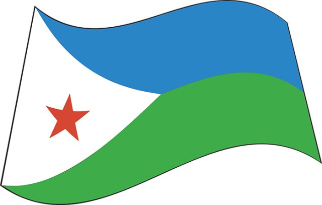
Djibouti is a tiny country—just about 23,000 square kilometers—nestled between Eritrea, Ethiopia, and Somalia, with the Red Sea and Gulf of Aden at its northeastern tip. Despite its size, Djibouti plays an outsized role in global trade and security, guarding one of the world’s busiest shipping lanes at the Bab el-Mandeb Strait. Its hot desert plains give way to volcanic salt lakes and rugged mountains, and its people—mainly Afar and Somali ethnic groups—have long blended nomadic traditions with modern commerce. Since independence from France in 1977, Djibouti has developed its port city capital as a regional hub for shipping, foreign military bases, and multicultural exchange.
🗺️ Geography & Environment
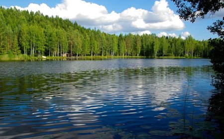
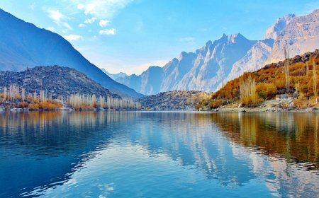
Djibouti’s landscape shifts dramatically over short distances. Along the coast, the capital city of Djibouti sprawls around a natural harbor on the Gulf of Tadjoura, where container ships and fishing dhows share the blue waters. Inland, broad lava fields and basalt hills rise to the Goda Mountains, where cooler air and rare juniper forests survive higher up. To the west lies Lake Assal, 155 meters below sea level—the lowest point in Africa—its white salt flats gleaming under the equatorial sun. The country’s climate is arid, with daytime temperatures often above 40 °C and fewer than 200 mm of rainfall per year. These conditions challenge farmers but suit nomadic herders and salt miners, while offshore coral reefs support a surprising diversity of fish and invertebrates.
🏛️ Government, Language & Population
Djibouti is a unitary presidential republic. After voting to end French colonial rule in 1977, it adopted a constitution guaranteeing a multiparty system, though one party has dominated politics for decades. The President serves as both head of state and government, with a National Assembly legislating at the capital in Djibouti city. The population of around 1 million is concentrated along the coast and in oasis towns, while the interior remains sparsely inhabited. The two largest ethnic groups, Afar and Issa Somali, speak their namesake languages, alongside French and Arabic, the country’s official languages. Islam shapes daily life: mosques call the faithful to prayer, and Islamic festivals unite communities.
🎭 Culture & Daily Life
Djiboutians balance centuries-old traditions with the demands of modern ports and foreign bases. In coastal towns, women sell laxoox (flat, spongy bread) and sambuusa (fried pastries) in morning markets, while men shepherd goats or tend small salt pans at Lake Assal. Coffee and tea—often brewed with cardamom—anchor social gatherings. Traditional music features the oud and tama (hourglass drum), accompanying poems in Gabi, the local poetic form. Weddings and festivals blend Afar folk dances with Somali ones, and brightly patterned shawls adorn both men and women. Education is free but attendance varies; literacy programs in French and local languages aim to raise reading and writing rates above the current 67% level.
📜 History Highlights
For millennia, camel caravans and dhows linked Djibouti’s salt and frankincense to Ethiopia’s highlands and Arabia’s ports. In the late 19th century, France secured coastal footholds, establishing French Somaliland in 1896. The French fortified the port at Djibouti city and built a railroad to Addis Ababa, boosting trade and military reach. During World War II, Italian forces briefly occupied parts of the territory, but France regained control in 1943. A 1958 referendum opted to remain French, only to vote for full independence in 1977, naming the new nation after its capital. Since then, Djibouti has hosted foreign militaries—including French, U.S., Japanese, and Chinese bases—drawing both investment and strategic significance to its shores.
💰 Economy & Resources
Djibouti’s economy revolves around its port services, serving as Ethiopia’s gateway to the sea, and re‐exports, warehousing, and logistics. The Djibouti–Addis Ababa Railway speeds cargo inland. Salt production at Lake Assal, fish from coastal waters, and a budding tourism sector—thanks to diving and desert landscapes—supplement port revenues. Remittances from Djiboutians working abroad in the Gulf and Europe also fuel local businesses. The government promotes special economic zones near the port and seeks to expand renewables, tapping geothermal and solar power to reduce costly fuel imports.
🌿 Wildlife & Natural Beauty
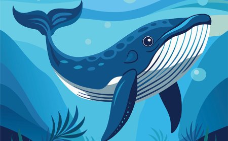
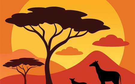
Though arid, Djibouti hosts unique ecosystems. Lake Assal attracts flamingos to its hypersaline waters. Day Forest National Park in the Goda Mountains conserves juniper forests, now home to the endemic Djibouti francolin, a rare bird species. Offshore, coral reefs near Tadjoura shelter clownfish, parrotfish, and sea turtles, while migratory whales pass in winter. The Moussa Ali volcano on the border with Ethiopia offers dramatic cliffs and panoramic views of the Gulf of Tadjoura. Conservation efforts balance salt mining, port expansion, and habitat protection, engaging local communities in wildlife monitoring and forest restoration.
📚 Vocabulary List
Word Definition
Archipelago A group of islands
Gulf of Tadjoura The inlet of the Red Sea on Djibouti’s northern coast
Lake Assal Africa’s lowest point, a salt lake in western Djibouti
Unitary state A country governed as a single entity with a central government
Laxoox A spongy flatbread common in the Horn of Africa
Sambuusa A fried pastry filled with meat or vegetables
Gabi A style of Somali poetry performed with percussion
Idris Deria A type of traditional drum also called “tama”
Special economic zone A designated area with business incentives to attract investment
Geothermal Heat energy derived from the Earth’s interior
🧒 Kid-Friendly Summary
Djibouti is a tiny country at the mouth of the Red Sea, where camels once crossed the sands and ships still sail to faraway lands. People speak French, Arabic, and their own Afar or Somali languages, and most are Muslim. They eat flatbread called laxoox and spicy pastries called sambuusa, and they gather by the water or under juniper trees in the mountains. You can visit Lake Assal, shining like a giant mirror of salt, or dive on colorful reefs. Djibouti’s port helps neighbors send goods around the world, and the country houses soldiers from many nations. Even with desert heat, life in Djibouti blends old traditions and modern jobs by the sea.
🎯 Interactive Quiz: What Do You Know About Djibouti?
What strait does Djibouti guard?
a) Strait of Gibraltar b) Bab el-Mandeb c) Strait of Hormuz d) Bosporus
✅ Answer: b) Bab el-Mandeb
What is the lowest point in Africa, found in Djibouti?
a) Rift Valley b) Lake Assal c) Lake Victoria d) Danakil Depression
✅ Answer: b) Lake Assal
Which two ethnic groups form most of Djibouti’s population?
a) Oromo and Amhara b) Afar and Somali c) Bantu and Nilotic d) Zulu and Xhosa
✅ Answer: b) Afar and Somali
What language is NOT an official language of Djibouti?
a) French b) Arabic c) English d) None of these
✅ Answer: c) English
What is “sambuusa”?
a) A drum b) A flatbread c) A fried pastry d) A ceremonial dance
✅ Answer: c) A fried pastry
What economic activity is Djibouti’s port most known for?
a) Oil drilling b) Agriculture exports c) Shipping and logistics d) Tourism only
✅ Answer: c) Shipping and logistics
Which national park conserves juniper forests in Djibouti?
a) Virunga b) Day Forest c) Zakouma d) Kibira
✅ Answer: b) Day Forest
Djibouti’s climate is best described as:
a) Tropical rainforest b) Mediterranean c) Arid desert d) Temperate
✅ Answer: c) Arid desert
🏫 National Education Standards Alignment
Geography (NGS Standards):
1: Use maps, globes, and geospatial data
4: Physical and human characteristics of places
10: Human impacts on Earth’s systems
13: Regional interconnections
History (U.S. Standards):
Historical Thinking 1–3
Era 8: Contemporary global history; post-colonial nations
Social Studies (C3 Framework):
D2.Geo.4-8, D2.His.1-8, D2.Civ.2-8
Literacy (Common Core):
RI.6.1, RI.6.2, RI.6.4, RH.6-8.7