|
|
| Statistics | |
|---|---|
| State: | Bavaria |
| Capital: | Würzburg |
| Adm. Region: | Unterfranken |
| Area: | 967.56 km² |
| Inhabitants: | 158,919 (2000) |
| pop. density: | 164 inh./km² |
| Car identification: | WÜ |
| Homepage: | landkreis-wuerzburg.de (http://www.landkreis-wuerzburg.de) |
| Map | |
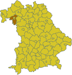
Würzburg is a Kreis (district) in the northwestern part of Bavaria, Germany. Neighboring districts are (from the north, clockwise) Main-Spessart, Schweinfurt, Kitzingen, Neustadt (Aisch)-Bad Windsheim, and the district Main-Tauber in Baden-Württemberg. The city Würzburg is no part of the district, although it is completely enclosed by it.
| Contents |
History
In 1852, districts were created in the region, including the precursor two districts of Würzburg and Ochsenfurt. In 1972 the previous district Würzburg was merged with the former district Ochsenfurt, and several municipalities from the districts Marktheidenfeld, Karlstadt, Kitzingen and Gerolzhofen were added to form the district with today's borders.
Partnerships
The district has partnerships with the Regional Council Mate Yehuda (Israel), and the Czech Olomouc Region.
Coat of arms
| Missing image De_wuerzburg_coat.png Coat of arms | In the upper part of the coat of arms are the Points of Franconia, the symbol of the former State of Würzburg. The fleur-de-lis in the bottom-right is the symbol of the St.Burkhard monastery in Würzburg, while the lion in the bottom-left derive from the coat of arms of the former Ochsenfurt district. |
Towns and municipalities
| Towns | Verwaltungsgemeinschaften |
|---|---|
|
¹ administrated inside a |
|
External link
- Official website (http://www.landkreis-wuerzburg.de)


