Teton Dam
|
|
Teton_Dam_failure.jpg
The Teton Dam was a dam on the Teton River in southeastern Idaho in the United States that suffered a spectacular failure on June 5, 1976. The collapse resulted in the loss of 11 lives and a monetary cost of close to US$1 billion.
| Contents [hide] |
Description and Geology
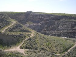
The dam was located in the Teton Canyon approximately 44 miles (71 km) northeast of the city of Idaho Falls. It was a 305 ft. (93 m) high earthfill dam intended for irrigation, electricity, flood prevention, and recreation. The dam was built by the United States Bureau of Reclamation, which later received most of the blame for the collapse. The site of the dam is accessible to the public.
The dam site is located in the eastern Snake River Plain, which is a broad tectonic depression on top of rhyolitic ash-flow tuff, which is late-Cenozoic volcanic rock dating to about 1.9 million years. The tuff sits on top of sedimentary rock. The area is very permeable, but no seepage was noted on the dam itself before the date of the collapse. Several springs had opened up downstream a few days before, however.
The collapse and aftermath
At the time of the collapse, the reservoir had just filled for the first time with spring runoff. Water began seeping from the dam the Thursday before the collapse, not unexpected for an earthen dam.
On the morning of Saturday June 5 a new leak appeared. Bulldozers were sent to plug the leak, unsuccessfully. Local media appeared, and an alarm was raised to downstream residents. Two bulldozers were caught in the eroding embankment, their operators pulled to safety with ropes. At around 11:57 a.m., the dam collapsed. By evening the reservoir had completely emptied.
Cities immediately downstream, such as Rexburg, suffered horribly. The city of Idaho Falls, further downstream, had time to prepare. At the old and unstable American Falls Dam downstream, engineers released water before the flood arrived. That dam held, and the flood was over. Cleaning up took the rest of the summer.
A wide-ranging controversy erupted from the dam's collapse. According to the Bureau of Reclamation site (see references below), "Today, Bureau of Reclamation engineers assess all Reclamation dams under strict criteria established by the Safety of Dams program. Each structure is periodically reviewed for resistance to seismic stability, internal faults and physical deterioration."
See also
External links and references
- US Bureau of Reclamation site with several photos (http://www.usbr.gov/pn/about/Teton.html)
- Informative geology site at the U of California, Santa Barbara (http://www.geol.ucsb.edu/faculty/sylvester/Teton%20Dam/narrative.html)
- More geology, US Bureau of Reclamation (http://www.usbr.gov/pn/about/tetonmit.html)
- A site with several photographs (http://www.ida.net/users/elaine/idgenweb/flood.htm)
- University of Utah site with many gripping photographs (http://www.lib.utah.edu/spc/photo/p211/p211.html)
- "The Bureau That Changed the West" One That Got Away: Teton Dam (http://www.idahoptv.org/outdoors/shows/bofr/teton/brown.html) (site critical of USBR)de:Teton-Staudamm

