Skyway
|
|
A skyway is a path that is traversed without touching the ground.
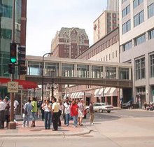
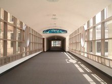
In an urban setting, a skyway, skywalk or footbridge is an enclosed (or covered) bridge between two buildings. This protects pedestrians from the weather. These skyways are usually owned by businesses, and are therefore not public spaces (compare with sidewalk). Skyways usually connect on the second or third floor, though they are sometimes much higher, as in Petronas Towers (though this skyway is often referred to as a sky bridge). The space in the buildings connected by skyways is often devoted to retail business, so areas around the skyway may operate as a shopping mall. Non-commercial areas with closely associated buldings, such as university campuses, can often have skyways and/or tunnels connecting buildings. At 16 km, the Plus 15 walkway in downtown Calgary, Alberta is the largest elevated system in the world. The system connects over 100 office towers.
Some cities have the equivalent of a skyway underground, and many locales have mixed subway/skyway systems; see underground city.
Some covered bridges (skyways) were ruined in the September 11th attacks, at the World Trade Center. Photo of one of the ruined bridges. (http://www.parrhesia.com/wtc100301/tn/wtc017.jpg.html) (Note: This particular bridge/ skyway survives and has been restored since 9/11.) Also see here (http://www.parrhesia.com/wtc100301/tn/wtc029.jpg.html).
List of cities with notable skyway/skywalk systems
| City | Length | Blocks Connected | link |
|---|---|---|---|
| Atlanta, Georgia | |||
| Calgary, Alberta (+ 15 Walkway) | 16 km | ~64 blocks | map (http://www.calgary.ca/docgallery/BU/engineering_services/emaps/plus_15_network_map.pdf) |
| Cedar Rapids, Iowa | 15 blocks | ||
| Cincinnati, Ohio (Skywalk) | 1.3 miles | 15 blocks | map (http://www.cincyusa.com/maps/skywalk.asp?sec=map&cat=) |
| Des Moines, Iowa | 3 miles | 27 blocks | map (http://www.downtowndsm.info/pdfs/walkmap.pdf) |
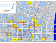
| Duluth, Minnesota | miles | ~17 blocks | map (http://www.visitduluth.com/maps/parking/) |
| Edmonton, Alberta (Pedway) | km | ~13 blocks | map (http://www.edmontondowntown.com/live/media/map2004edited.pdf) |
| Hong Kong (footbridges) | |||
| Minneapolis, Minnesota (Skyway) | >5 miles | ~62 blocks | map |
| Pittsburgh, Pennsylvania | 16 blocks | map (http://pghbridges.com/pittsburghW/pghped.htm) | |
| Rochester, NY | 20 buildings over 13 blocks | map (http://www.rochesterdowntown.com/downloads/rochester_skyway_map.pdf) | |
| Saint Paul, Minnesota (Skyway) | 30 blocks | map (http://www.saint-paul.com/maps/skyway.html) | |
| Sioux City, Iowa | 13 blocks | map (http://www.downtownsiouxcity.com/skywalk.html) | |
| Spokane, Washington | 16 blocks | ||
| Winnipeg, Manitoba | 18 blocks | map (http://www.downtownwinnipegbiz.com/index/downtown_map_full) |
Other uses of the term skyway
In air travel, a skyway is a "highway in the sky"—the path that airliners take through the atmosphere. Skyway Airlines serves Missouri.
In local transportation, a skyway can be a ski lift or other suspended-carriage system, like an aerial tramway. In Jacksonville, Florida, the Skyway Express is a people mover.
Disneyland, Tokyo Disneyland, and Magic Kingdom also had Skyways of their own, for transporting guests around the parks in a similar fashion; Disney closed these Skyway attractions in 1994, 1998 and 1999, respectively.
The term may also simply refer to a high road bridge; examples are the James N. Allan Skyway, which bridges the opening of Hamilton Harbour between Burlington and Hamilton, Ontario, the Pulaski Skyway, which travels high above two navigable rivers in northeast New Jersey, Chicago Skyway, a toll road in Chicago, Illinois and the SLEX Skyway, an extended part of South Luzon Expressway which is uncompleted but in use.he:מדרכה עילית zh:人行过街天桥 Template:Commons

