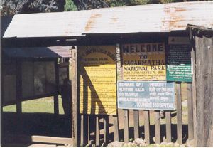
Sagarmatha National Park
|
|
Sagarmatha National Park, is located in eastern Nepal, containing parts of the Himalayas and the southern half of Mount Everest. The park was created July 19, 1976 and in 1979 was inscribed as a Natural World Heritage Site. Sagarmatha means "goddess of the sky" and is the Nepalese name for Mount Everest.
The park encompasses an area of 1,148 km² and ranges in elevation from its lowest point of 2,845 m (9,335 ft) at Jorsalle to 8,850 m (29,035 ft) at the summit of Everest. Barren land above 5,000 m (16,400 ft) comprises 69% of the park while 28% is grazing land and the remaining 3% is forested. The park contains the upper watershed of the Dudh Kosi river basin system.
The park's visitor centre is located at the top of a hill in Namche Bazaar, also where a company of the Nepal Royal Army is stationed for protecting the park. The park's southern entrance is a few hundred metres north of Mondzo (2,835 m / 9,300 ft), a one day hike from Lukla.
The entry fee for foreign nationals is 1,000 Nepalese Rupees ($13 USD in 2002).
Reference
- http://www.wcmc.org.uk/protected_areas/data/wh/sagarmat.html
- Park Regulations (http://www.south-asia.com/dnpwc/Sagarmatha%20national%20Park/park-regu.htm)

