Mount Fuji
|
|
| Mount Fuji | |
|---|---|
| Missing image Fuji_mt.jpg | |
| Elevation: | 3,776 metres (12,388 feet) |
| Coordinates: | Template:Coor dm |
| Location: | Japan |
| Type: | Stratovolcano (active) |
| First ascent: | 663 by an anonymous monk |
| Easiest route: | basic snow/ice climb |
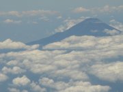
Mount Fuji (富士山 Fuji-san, IPA: ) is the highest mountain on the island of Honshu and indeed in all of Japan. It straddles Shizuoka and Yamanashi prefectures in central Japan just west of Tokyo, from which it can be seen on a clear day. It is located near the Pacific coast of central Honshu.
Fuji-san is sometimes referred to as Fuji Yama in some Western texts, because the third character of its name, 山 meaning mountain, can also be pronounced "yama". (See Kanji readings.) However, this name is obsolete in Japan. In fact, the Japanese phrase "Fujiyama, geisha" means the Japan that is misunderstood by the West. The suffix -san, meaning a mountain, has nothing to do with the Japanese title -san used for a person.
| Contents [hide] |
Geography
IMG_0899.JPG
Mt. Fuji is surrounded by the five lakes of Mt. Fuji: Lake Kawaguchiko, Lake Yamanakako, Lake Saiko, Lake Motosuko and Lake Shojiko. It is part of the Fuji-Hakone-Izu National Park.
Geology
Scientists believe that Mt. Fuji was formed in four distinct phases of volcanic activity. The first phase, called Sen-komitake, is composed of an andesite core recently discovered deep within the mountain. Sen-komitake was followed by the "Komitake Fuji," a basalt layer believed to be formed several hundred thousand years ago. Approximately 100,000 years ago, "Old Fuji" was formed over the top of Komitake Fuji. The modern, "New Fuji" is believed to have formed over the top of Old Fuji by around 10,000 years ago. [1] (http://www.japantimes.co.jp/cgi-bin/getarticle.pl5?nn20040404f1.htm)
MountfujiNASA.jpg
The volcano is currently classified as active with low risk of eruption. The last recorded eruption occurred in 1707 during the Edo period. At this time, a new crater, along with a second peak, named Hōei-zan after the era name, formed halfway down its side.
Mt. Fuji is where the Eurasian Plate (or the Amurian Plate), the Okhotsk Plate, and the Philippine Plate meet. They form the western part of Japan, the eastern part of Japan, and the Izu Peninsula respectively.
History

It is thought that the first ascent was in 663 by an anonymous monk. A sacred mountain since ancient times, Mt. Fuji's summit was forbidden to women until the Meiji Era. Today it is a popular tourist destination and common destination for mountain-climbing (see below).
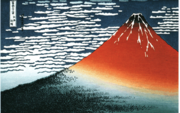
Mt. Fuji is an attractive volcanic cone and a frequent subject of Japanese art. The most renowned work is Ukiyo-e painter Hokusai's masterpiece 36 views of Mt. Fuji. It is also mentioned in Japanese literature throughout the ages and the subject of many poems.
Etymology
The current kanji for Mt. Fuji, 富 and 士, mean wealth or abundant and warrior respectively, but it is likely these characters were applied to the already existent pronunciation.
The origin of the name Fuji is unclear, but it has been associated throughout history with various Chinese characters according to folk etymologies. One of the earlier folk etymologies claims that Fuji came from 不二 (not + two), meaning without equal or nonpareil. Another folk etymology claims that it came from 不尽 (not + exhaust), meaning neverending.
Perhaps the most popular folk etymology is the one that claims that the mountain's name means abounding with warriors, written with the Chinese characters 富士 (abundant or wealthy + warrior). See The Tale of the Bamboo Cutter.
Yet another folk etymology links the name to the Ainu huci, which has been proven wrong by linguists but still survives in non-academic sources.
Other Japanese names for Mt. Fuji, which have become obsolete or poetic, include Fuji-no-Yama (ふじの山, the Mountain of Fuji), Fuji-no-Takane (ふじの高嶺, the High Peak of Fuji), Fuyō-hō (芙蓉峰, the Lotus Peak), and Fu-gaku (富岳 or 富嶽, the first character of 富士, Fuji, and 岳, mountain).
Climbing Mount Fuji
MtFujiTorii.jpg
The most popular period for people to hike up Mt. Fuji is from July 1 to August 27. The ascent can take anywhere between 5 to 7 hours while the descent can take from 3 to 5 hours. The hike is divided into ten stations and there are paved roads up to the fifth station, which is about 1400 meters above sea level. Thousands climb Mt. Fuji during this two-month period. Most climb during the night to watch the sun rise in the morning. The sheer number of climbers each year has created something of a trash problem on the road to the summit, but this has not decreased the mountain's popularity.
For more on climbing Mt. Fuji, see this Japan Times article, Getting to the top in Japan (http://www.japantimes.co.jp/cgi-bin/getarticle.pl5?fv20040702a1.htm), and our sister site Wikitravel below.
Trivia
- Singer Kyu Sakamoto once had bearers carry a grand piano to the summit for a concert.
Related topics
External links
- Live Webcams of Mt. Fuji (http://www.city.fujiyoshida.yamanashi.jp/forms/info/info1.aspx?info_id=300)ar:جبل فوجي
da:Fuji de:Fujisan es:Monte Fuji fr:Mont Fuji la:Mons Fusius nl:Fuji ja:富士山 ko:후지 산 pl:Fuji-san pt:Monte Fuji zh:富士山

