Cloud
|
|
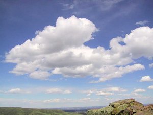
A cloud is a visible mass of condensed water droplets or ice crystals suspended in the atmosphere above Earth's (or another planetary body's) surface.
The condensing water vapor forms small droplets of water (typically 0.01 mm [1] (http://www.geog.ucsb.edu/~joel/g110_w03/chapt06/cloud_drops/agburt_06_01.jpg)) or ice crystals that, when surrounded with billions of other droplets or crystals, are visible as clouds. Clouds reflect all visible wavelengths of light equally and are thus white, but they can appear grey or even black if they are so thick or dense that sunlight cannot pass through.
Clouds on other planets often consist of material other than water, depending on local atmospheric conditions (what gases are present, and the temperature).
| Contents |
Cloud formation and properties
Clouds form in areas where moist air cools, generally by rising. This can happen
- along warm and cold fronts,
- where air flows up the side of a mountain and cools as it rises higher into the atmosphere (orographic uplift),
- when warm air blows over a colder surface such as a cool body of water.
Clouds are heavy. The water in a typical cloud can have a mass of up to several million tonnes. However, the volume of a cloud is correspondingly high, and the net density of water vapor is actually low enough that air currents below and within the cloud are capable of keeping small droplets suspended. As well, conditions inside a cloud are not static: water droplets are constantly forming and re-evaporating. This give these droplets plenty of time to re-evaporate as they fall into in the warmer air beneath the cloud.
Most water droplets are formed when water vapor condenses around a condensation nucleus, a tiny particle of smoke, dust, ash, or salt. In supersaturated conditions, water droplets may act as condensation nuclei.
Water droplets large enough to fall to the ground are produced in two ways. The most important is through the Bergeron Process, theorized by Tor Bergeron, in which supercooled water droplets and ice crystals in a cloud interact to produce the rapid growth of ice crystals, which precipitate from the cloud and melt as they fall. This process typically takes place in clouds with tops cooler than -15?C. The second most important process is the collision and wake capture process, occurring in clouds with warmer tops, in which the collision of rising and falling water droplets produces larger and larger droplets, which are eventually heavy enough to overcome air currents in the cloud and the updraft beneath it and fall as rain. As a droplet falls through the smaller droplets which surround it, it produces a "wake" which draws some of the smaller droplets into collisions, thus perpetuating the process. This method of raindrop production is the primary mechanism in low stratiform clouds and small cumulus clouds in tropical regions. It typically produces smaller raindrops and drizzle.
The actual form of cloud created depends on the strength of the uplift and on air stability. In unstable conditions convection dominates, creating vertically developed clouds. Stable air produces horizontally homogeneous clouds. Frontal uplift creates various cloud forms depending on the composition of the front (ana-type or kata-type warm or cold front). Orographic uplift also creates variable cloud forms depending on air stability, although cap cloud and wave clouds are specific to orographic clouds.
Cloud Classification
Clouds are divided into two general categories: layered and convective. These are named stratus clouds (or stratiform, the Latin stratus means layer) and cumulus clouds (or cumiloform, cumulus means piled up). These two cloud types are divided into four more groups that distinguish the cloud's altitude. Clouds are classified by the cloud base height, not the cloud top. This system was proposed by Luke Howard in 1802 in a presentation to the Askesian Society.
High clouds (Family A)
These form above 16,500 feet (5,000 m), in the cold region of the troposphere. They are denoted by the prefix cirro- or cirrus. At this altitude water almost always freezes so clouds are composed of ice crystals. The clouds tend to be wispy, and are often transparent.
Clouds in Family A include:
- Cirrus
- Cirrus uncinus
- Cirrus Kelvin-Helmholtz
- Cirrostratus
- Cirrocumulus
- Cumulonimbus with pileus
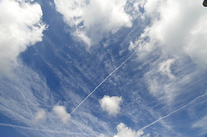
- Contrail
A contrail is a long thin cloud which develops as the result of the passage of a jet airplane at high altitudes.
Middle clouds (Family B)
These develop between 6,500 and 16,500 feet (between 2,000 and 5,000 m) and are denoted by the prefix alto-. They are made of water droplets, and are frequently supercooled.
Clouds in Family B include:
- Altostratus
- Altostratus undulatus
- Altocumulus
- Altocumulus undulatus
- Altocumulus mackerel sky
- Altocumulus castellanus
- Altocumulus lenticularis
Low clouds (Family C)
These are found up to 6,500 feet (2,000 m) and include the stratus (dense and grey). When stratus clouds contact the ground they are called fog.
Clouds in Family C include:
Vertical clouds (Family D)
These clouds can have strong up currents, rise far above their bases and can form at many heights.
Clouds in Family D include:
- Cumulonimbus (associated with heavy precipitation and thunderstorms)
- Cumulus congestus
- Pyrocumulus
- Cumulonimbus incus
- Cumulonimbus calvus
- Cumulonimbus with mammatus
Other clouds
A few clouds can be found above the troposphere; these include nacreous and noctilucent clouds, which occur in the stratosphere and mesosphere respectively.
Colors of clouds
Cloud color tells much about what is going on inside a cloud.
Clouds form when water vapor rises, cools, and condenses out of the air as microdroplets. These tiny particles of water are relatively dense, and sunlight cannot penetrate far into the cloud before it is reflected out, giving a cloud its characteristic white color. As a cloud matures, the droplets may combine to produce larger droplets, which may themselves combine to form droplets large enough to fall as rain. In this process of accumulation, the space between droplets becomes larger and larger, permitting light to penetrate much farther into the cloud. If the cloud is sufficiently large, and the droplets within are spaced far enough apart, it may be that very little light which enters the cloud is able to be reflected back out before it is absorbed. (Think of how much farther one can see in a heavy rain as opposed to how far one can see in a heavy fog.) This process of reflection/absorption is what leads to the range of cloud color from white through grey through black. For the same reason, the undersides of large clouds and heavy overcasts appear various degrees of grey; little light is being reflected or transmitted back to the observer.
Other colours occur naturally in clouds. Bluish-grey is the result of light scattering within the cloud. In the visible spectrum, blue and green are at the short end of light's visible wavelengths, while red and yellow are at the long end. The short rays are more easily scattered by water droplets, and the long rays are more likely to be absorbed. The bluish color is evidence that such scattering is being produced by rain-sized droplets in the cloud.
A more ominous colour is the one seen frequently by severe weather observers. A greenish tinge to a cloud is produced when sunlight is scattered by ice. A cumulonimbus cloud which shows green is a pretty sure sign that someone is about to experience heavy rain, hail, strong winds, and possibly tornados.
Yellowish clouds are rare, but may occur in the late spring through early fall months during forest fire season. The yellow color is due to the presence of smoke.
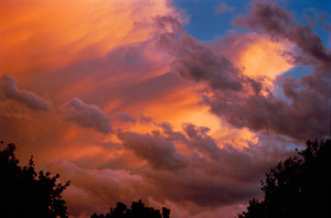
Red, orange, and pink clouds occur almost entirely at sunrise/sunset, and are the result of the scattering of sunlight by the atmosphere itself. The clouds themselves are not that color, they are merely reflecting the long (and unscattered) rays of sunlight which are predominant at those hours. The effect is much the same as if one were to shine a red spotlight on a white sheet. In combination with large, mature thunderheads, this can produce blood-red clouds. The evening before the Edmonton, Alberta tornado in 1987, Edmontonians observed such clouds - deep black on their dark side, and intense red on their sunward side. In this case, the adage "red sky at night, sailor's delight" was clearly incorrect.
Global dimming
The recently recognized phenomena of global dimming is thought to be caused by changes to the reflectivity of clouds due to the increased presence of aerosols and other particulates in the atmosphere.


