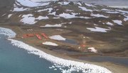
King George Island
|
|
King George Island is the largest of the South Shetland Islands, situated at Template:Coor dm, 120 kilometers off the coast of Antarctica in the Southern Ocean.
King_George_Island_Map.png
The island was discovered by the British explorer William Smith in 1819. It is approximately 95 kilometers long and 25 kilometers wide with a land area of 1150 square kilometers. Over 90% of the island's surface is permanently glaciated. In 1821, 11 men of the sealing vessel Lord Melville survived the Antarctic winter on the island, the first men to do so.
The coastal areas of the island are home to a comparatively diverse selection of vegetation and animal life, including Elephant, Weddell and Leopard seals, and Chinstrap and Gentoo penguins.
Human habitation of King George Island is limited to research stations belonging to Argentina, Brazil, Chile, China, South Korea, Poland, Russia, and Uruguay. Most of these stations are permanently manned, carrying out research into areas as diverse as Biology, Ecology, Geology, and Paleontology.
A small amount of specialised tourist activity also takes place during summer.
The Fildes Peninsula is 4.5 mi long, forming the SW extremity of the island. Named from association with nearby Fildes Strait by the UK-APC in 1960.
See also
External links
- The SCAR King George Island GIS Projectprovides (http://www.kgis.scar.org/) an interactive map of the island.
- Biodiversity at Ardley Island (http://www.planetavivo.org/english/ResearchPrograms/Antarctica/SlideShows/ArdleyIsland/ArdleyIsland1.html)Small place near King George Island, special protected area.de:King George Island

