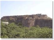
Khammam
|
|
Khammam is a city and district in India's Andhra Pradesh state.
| Contents |
History
The present name of Khammam is said to have been derived from the name of this temple Nrusimhadri later, Stamba Sikhari and then it was termed as Stambhadri. The vertical rock in Urdu language is known as Kamba. The name of the town Khammam seems to have been derived from the name of this hill of Kamba.
Khammam district has very much historical importance in Andhra Pradesh. In Significance of its name, there is an old temple called Narasimha Swamy Temple on small hill top in Khammam Town believed to have been in existence since Tretayuga.
Geography
Khammam is located between 16-45 and 18-35 North latitudes and 79-47 and 80-47 East longitudes. It is bounded by Chhattisgarh state to the north, Orissa state to the northeast, East and West Godavari districts to the east, Krishna District to the south, Nalgonda District to the southwest, and Warangal District to the west. It has an area of 16,029 km².
Demography
| Population | 22.15 lakhs |
| Males | 11.30 lakhs |
| Females | 10.85 lakhs |
| Male, Female ratio | 961 |
| Rural Population | 17.68 lakhs |
| Urban Population | 4.47 lakhs |
| Literates | 7.59 lakhs |
| Working Force | 10.21 lakhs |
| Non-Working force | 11.94 lakhs |
| cultivators | 2.59 lakhs |
| Agriculture Labour | 4.60 lakhs |
| Density | 137 per Sq.Km |
| Scheduled Caste | 3.60 lakhs |
| Scheduled Tribes | 5.59 lakhs |
| Towns | 9 |
Mandals
Phisically Khammam is divided into 42 revenue divisions.

