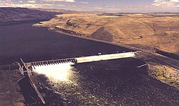
John Day Dam
|
|
John Day Dam is a hydroelectric dam spanning the Columbia River. The dam features a navigation lock plus fish ladders on both sides. The reservoir behind the dam is named Lake Umatilla, and runs 76.4 miles (123 kilometers) up the river channel, to the foot of the McNary Dam.
| Contents |
Location
John Day Dam is located 25 miles east of the city of The Dalles, Oregon, and just below the mouth of the John Day River. It joins Umatilla County, Oregon with Klickitat County, Washington, 216 miles (348 kilometers) upriver from the mouth of the Columbia near Astoria, Oregon.
History
Construction of the dam began in 1958 and was completed in 1971 (making it the most recent new dam on the lower Columbia), at a total cost of $511 million.
Operation
John Day Dam is operated by the United States Army Corps of Engineers. The closest town on the Washington side is Maryhill.
Electricity Generation
The dam's generation capacity is 2,160,000 kW.
See also
External link
- US ACE John Day Dam Web site (https://www.nwp.usace.army.mil/op/d/standard/jd/jd.htm)

