Image:Wpdms nasa topo missoula floods.jpg
|
|

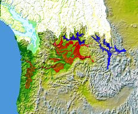
Glacial Lake Columbia (west) and Glacial Lake Missoula (east) are shown in blue, south of the Cordilleran Ice Sheet. The areas inundated during the Missoula Floods and Columbia Floods are shown in red.
© 2004 Matthew Trump.
Missing image Heckert_GNU_white.png | Permission is granted to copy, distribute and/or modify this document under the terms of the GNU Free Documentation License, Version 1.2 or any later version published by the Free Software Foundation; with no Invariant Sections, no Front-Cover Texts, and no Back-Cover Texts. Subject to disclaimers. |
File links
There are no pages that link to this file.
