
Image:Falkland island darwin detail.png
|
|
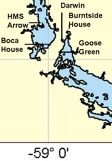
This map shows some of the settlements around the narrow isthmus joining the north and south parts of East Falkland together with the position of HMS Arrow during the Battle of Goose Green.
See also this larger context map.
Image Source: cropped from User:Ahoerstemeier's Image:Falkland_island_detail.png, annotated by User:Wikibob.
References: map showing movements during assault on Goose Green (http://www.raf.mod.uk/falklands/goose.html).
Missing image Heckert_GNU_white.png | Permission is granted to copy, distribute and/or modify this document under the terms of the GNU Free Documentation License, Version 1.2 or any later version published by the Free Software Foundation; with no Invariant Sections, no Front-Cover Texts, and no Back-Cover Texts. Subject to disclaimers. |
File links
There are no pages that link to this file.