Icefields Parkway
|
|
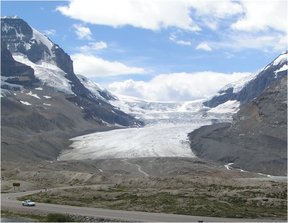
The Icefields Parkway (French Promenade des Glaciers), also known as Alberta Highway 93, parallels the Continental Divide, traversing the rugged landscape of the Canadian Rockies. It is within Banff National Park and Jasper National Park, linking Lake Louise and Jasper.
The parkway, 230 kilometres (143 mi) in length, was completed in 1940; it is named for the features such as the Columbia Icefield which are visible while traveling the parkway.
The parkway is very busy in the summer months of July and August with peak traffic flow of 100,000 vehicles per month. The parkway is primarily a two lane highway with occasional passing lanes. The highway is well engineered to minimize grades and hairpin turns but drivers must also be on the lookout for wildlife, touring cyclists, and vehicles stopped on the shoulder.
Going northwest from Lake Louise, the Icefields Parkway passes the following points of interest:
Athabasca_Falls_1.jpg
- Crowfoot glacier
- Bow Summit (2088m) and Peyto Lake
- Mistaya Canyon
- Saskatchewan Crossing
- Parker Ridge
- Columbia Icefield
- Icefield Centre
- Athabasca Falls
- Sunwapta Pass and Sunwapta Falls
A national parks permit is required to travel on the Icefields Parkway; stations near Lake Louise and Jasper enforce the law. Commercial trucks are prohibited from using the parkway. The maximum speed limit is 90 km/h (56 mph) although the limit is reduced at Saskatchewan Crossing and the Columbia Icefield area. In winter, chains or all-season radial tires are required by law and road closures are not uncommon.
Limited services are available at Saskatchewan Crossing and the Icefield Centre and then only from April to October. Gasoline is only available at Saskatchewan Crossing.de:Icefields_Parkway

