Geography of Tibet
|
|
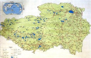
Tibet, located in central Asia, is a region in Asia which is currently, for the most part, part of China. China only recognizes roughly one third of actual historical Tibet as the real Tibet, which they call the Tibetan Autonomous Region, or TAR for short.
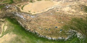
Tibet is often called "the roof of the world," comprising table-lands averaging over 4950 m above the sea with peaks at 6000 to 7500 m and includes Mount Everest. The TAR is bounded on the north by and east by Xinjiang, Qinghai, and Sichuan, on the west by the Kashmir Region of India and on the south by Nepal, Bangladesh and Bhutan. The entire Tibet Autonomous Region sits atop the southern part of a geological structure known as the Tibetan Plateau which extends beyond the TAR into neighboring provinces and countries and includes the Himalayas and many of the highest mountain peaks in the world. In addition, most of the rest of the Tibetan Plateau is part of "historic Tibet", and is populated by primarily Tibetans as well. (as mentioned above)
Physically, the TAR may be divided into two parts, the "lake region" in the west and north-west, and the "river region", which spreads out on three sides of the former on the east, south, and west. Both regions receive limited amounts of rainfall as they lie in the rain shadow of the Himalayas, however the region names are useful in contrasting their hydrological structures, and also in contrasting their different cultural uses which is nomadic in the lake region and agricultural in the river region (see map of the land use patterns of historic Tibet (http://www.tew.org/geography/t2000.agricultural.html))
Sand_dunes_and_snowy_mountains_near_Samye_Monastery.jpg
The lake region extends from the Pangong t'so (t'so = lake) in Ladakh, near the source of the Indus River, to the sources of the Salween, the Mekong and the Yangtze. This region is called the Chang Tang (Byang sang) or 'Northern Plateau' by the people of Tibet. It is some 700 miles broad, and covers an area about equal to that of France. Due to its great distance from the ocean it is extremely arid and possesses no river outlet. The mountain ranges are spread out, rounded, disconnected, separated by flat valleys relatively of little depth. The country is dotted over with large and small lakes, generally salt or alkaline, and intersected by streams, and the soil is boggy and covered with tussocks of grass, thus resembling the Siberian tundra. Salt and fresh-water lakes are intermingled. The lakes are generally without outlet, or have only a small effluent. The deposits consist of soda, potash, borax and common salt. The lake region is noted for a vast number of hot springs, which are widely distributed between the Himalayas and 34° N., but are most numerous to the west of Tengri Nor (north-west of Lhasa). So intense is the cold in Tibet that these springs are sometimes represented by columns of ice, the nearly boiling water having frozen in the act of ejection.
The river region comprises the upper courses of the Brahmaputra, the Salween, the Yangtze, the Mekong, and the Yellow River. Amidst the mountains there are many narrow valleys. Whereas the lake region is an arid and wind-swept desert, the river region is characterized by fertile mountain valleys. The valleys of Lhasa, Shigatse, Gyantse and the Brahmaputra are covered with good soil and groves of trees, are well irrigated, and richly cultivated.
The valley of the Brahmaputra is the great arterial valley of southern Tibet. On the south it is bounded by the Himalayas, on the north by a broad mountain system. The system at no point narrows to a single range; generally there are three or four across its breadth. As a whole the system forms the watershed between rivers flowing to the Indian Ocean – the Indus, Brahmaputra and Salween and its tributaries – and the streams flowing into the undrained salt lakes to the north.
Reference
- This article originally incorporated text from the public domain 1911 Encyclopaedia Britannica.
External link
- online collection of maps of Tibet maintained by The Australian National University (http://www.ciolek.com/WWWVLPages/TibPages/tib-maps.html)


