Camas, Washington
|
|
Camas,_WA_welcome_sign.triddle.jpg
WAMap-doton-Camas.png
Camas is a city located in Clark County, Washington with a population of about 12,500. Officially incorporated on June 18, 1906, the city is named after the camas lily, a native flower. At the west end of downtown camas is a large Georgia-Pacific paper-mill which sometimes emits a strong foul odor that can be smelled in most of Camas and parts of Vancouver and Portland. The town carries a stigma of being blue collar.
The east side of town borders Washougal, Washington and the west side of town borders Vancouver, Washington. Camas is part of the Portland, Oregon greater metropolitan area, with Portland across the Columbia River. Even though the river is not very wide anyone who wants to cross has to take one of two bridges that go through Vancouver.
| Contents |
Bodies of Water
US-WA-lacamas_lake-south_east_bank-tar.jpg
Public Parks
- Crown Park
- Fallen Leaf Park
- Forest Home Park
- Goot Park
- Grass Valley Park
- Heritage Park
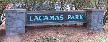
- Lacamas Park
- Lous Bloch Park
- Oak Park
- Prune Hill Sports Park
- Skate Park
Lacamas Park
Lacamas Park encompasses Round Lake and runs against SR 500 on its west side. Across SR 500 is Lacamas Lake. The park is open year round from 7 am to dusk and includes barbecues, a play ground, trails around the park and lake, and access to the Camas Potholes.
The park features a network of trails which lead to the Camas Potholes and the camas lily fields. A 1.2 mile trail that loops around Round Lake starts and finishes near the parking lot. Young children may play in a small playground on the west side of the park. Tables are provided for picnicing as are waste receptacles designed to receive hot coals from grilling. Bathrooms are made available on a seasonal basis only.
Heritage Park
US-WA-Camas-heritage_park-main_sign-tar.jpg
Heritage Park has facilities for launching boats into Lacamas Lake, a playground for young children, lots of open field, and small trails through the trees. The parking lot is very large and includes numerous long parking stalls to accommodate vehicles with trailers.
Gallery
Demographics
As of the censusTemplate:GR of 2000, there are 12,534 people, 4,480 households, and 3,422 families residing in the city. The population density is 443.6/km² (1,149.3/mi²). There are 4,736 housing units at an average density of 167.6/km² (434.3/mi²). The racial makeup of the city is 92.01% White, 0.69% African American, 0.69% Native American, 3.41% Asian, 0.14% Pacific Islander, 0.80% from other races, and 2.26% from two or more races. 2.86% of the population are Hispanic or Latino of any race.
There are 4,480 households out of which 42.6% have children under the age of 18 living with them, 63.9% are married couples living together, 8.5% have a female householder with no husband present, and 23.6% are non-families. 18.6% of all households are made up of individuals and 6.5% have someone living alone who is 65 years of age or older. The average household size is 2.78 and the average family size is 3.19.
In the city the population is spread out with 31.2% under the age of 18, 6.2% from 18 to 24, 32.5% from 25 to 44, 21.4% from 45 to 64, and 8.7% who are 65 years of age or older. The median age is 34 years. For every 100 females there are 96.2 males. For every 100 females age 18 and over, there are 94.6 males.
The median income for a household in the city is $60,187, and the median income for a family is $64,885. Males have a median income of $51,470 versus $31,985 for females. The per capita income for the city is $27,267. 5.4% of the population and 4.4% of families are below the poverty line. Out of the total population, 6.4% of those under the age of 18 and 4.7% of those 65 and older are living below the poverty line.

