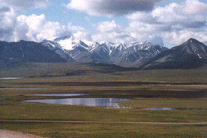
Brooks Range
|
|
The Brooks Range is a mountain range that stretches from west to east across northern Alaska and into Canada's Yukon Territory, a total distance of about 1100 km (700 mi). The mountains are not especially high, topping out at over 2,700 m (9,000 ft), and well north of the tree-line, so they are mostly covered by tundra. Mount Isto is the highest peak in the range, at 2762m (9060 ft.)
The range is mostly uninhabited, but the Dalton Highway and the Alaska Pipeline run through the Atigun Pass (1,415 m, 4,643 ft) on their way to the North Slope and the oil fields at Prudhoe Bay. Anaktuvuk Pass, Alaska is the only settlement in the Brooks Range.
As one of the remotest and least-disturbed wildernesses of North America, the mountains are teeming with wildlife, including Dall sheep, grizzly bears, and caribou.
The range was named by the USGS in 1925 after Alfred Hulse Brooks, who was the chief USGS geologist for Alaska from 1903 to 1924.
Various historical records also referred to the range as the Arctic Mountains, Hooper Mountains, Meade Mountains and Meade River Mountains — and the Canadian portion is still often referred to as the British Mountains. The British Mountains are part of Ivvavik National Park.de:Brookskette

