Berchtesgaden
|
|
Berchtesgaden is a German municipality in the Bavarian Alps with a population of around 9,000. It is located in the district of Berchtesgadener Land in Bavaria, close to the border with Austria, 30 km south of Salzburg and 180 km south-east of Munich. It is situated north of the Berchtesgaden National Park.
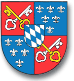
| Coat of Arms | Map |
|---|---|

| Missing image Lage_von_Berchtesgaden.png Lage Berchtesgadens in Deutschland |
| Data | |
| State: | Bavaria |
| Region: | Oberbayern |
| District: | Berchtesgadener Land |
| Area: | 34,78 km² |
| Population: | 7.672 (30.06.2002) |
| Population per km²: | 221 people/km² |
| Altitude: | 520m to 1100m above sea-level |
| Postal code: | 83471 |
| Telephone prefix number: | +49 8652 |
| Geographic location: | Template:Coor dm |
| number plate: | BGL
|
| Address of townhall: | Rathausplatz 1 83471 Berchtesgaden |
| Website: | www.berchtesgaden.de |
| Politics | |
| Mayor: | Rudolf Schaupp (FWG) |
Berchtesgaden is in close proximity to the second highest mountain in Germany, the fabled Mount Watzmann (2713 m), and a deep glacial lake by the name of Königssee (5.2 km²). Also there is the Kehlstein mountain (1835 m), at the top of which is the Kehlsteinhaus (sometimes called "The Eagle's Nest"), with remarkable views.
The area was historically noted for its salt mines, close by is the Obersalzberg (literally upper salt mountain).
The surrounding area was appropriated by the Nazis for their senior leaders to enjoy in the 1930s, and one of Hitler's residences, the Berghof (demolished in 1953, ruins removed in 1996) was located here.
A number of other relics of the Nazi era can still be found in the area. There is the Kehlsteinhaus, which was built as a birthday present for Hitler's 50th birthday and owes its continued existence only to lucky circumstances, which saved it from the brink of demolition. There is the former Gestapo HQ at Hotel Zum Türken, the remnants of homes of former Nazi leaders such as Hermann Göring, Albert Speer, and Martin Bormann. Notable and a for the population of Berchtesgaden massive railway station, then Hotel Platterhof, which was rebuilt by and renamed the General Walker Hotel[1] (http://www.thirdreichruins.com/platterhof.htm) in 1952 and a number of bunkers and fortifications.
After the war, all of these buildings were seized by US Army and served during the Cold War as part of the U.S. Armed Forces Recreation Center (AFRC) (http://www.defense.gov/news/Feb1998/n02191998_9802191.html). In 1995 the AFRC Berchtesgaden was turned over to German authorities and several buildings (most notably the General Walker Hotel and remnants of the Berghof) were demolished shortly thereafter.
External links
- Municipal website (http://www.berchtesgaden.de) (German)
- Touristical website for the region (http://www.berchtesgaden.com) (German, English)
- PhotoGlobe - Berchtesgadner Land (http://www.photoglobe.info/hl_duerrnberg/) offers high quality photos of the area around Berchtesgaden together with GPS coordinates.
- AFRC Timeline (http://www.afrcski.com/timeline/)de:Berchtesgaden
eo:Berchtesgaden fr:Berchtesgaden nl:Berchtesgaden pt:Berchtesgaden sv:Berchtesgaden
