Belo Horizonte
|
|
| Belo Horizonte | |
|---|---|
| State | Minas Gerais |
| Area: | 332 km² |
| Population: | 2 305 812 (Estimate: 07/2003) |
| Height: | 858 m above sea level |
| Postcode (CEP): | 30000-000 |
| Geographic location: | Template:Coor dm |
| Address of the local government: | Prefeitura Municipal de Belo Horizonte Av. Afonso Pena 1212 Centro |
| Website: | www.pbh.gov.br |
| Contact: | scomarh@pbh.gov.br (mailto:scomarh@pbh.gov.br) |
| Map | |

| |

| |
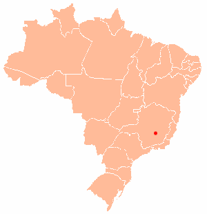
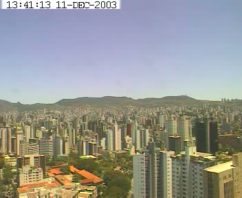
Belo Horizonte (a Portuguese name meaning beautiful horizon) is among the most important cities in Brazil. It is the capital of Minas Gerais state, located in the southeast of the country. With a population of slightly more than 2 million, Belo Horizonte – or "BH" as it is more familiarly known – is a place of intense economical and cultural activity.
| Contents |
History of Belo Horizonte
The metropolis was once a small village, founded by a prospector from São Paulo, João Leite da Silva Ortiz, who found a location with agreeable weather, decided to stay, and built a farm called "Curral del Rey" (archaic Portuguese for "Corral of the King"). The farm's wealth and success encouraged more people into the region, and Curral del Rey became a village surrounded by farms. Several of these were built by the Faria family. When Brazil became a republic in 1889, Curral Del Rey had grown large enough to be chosen as the site for the new capital of Minas Gerais, replacing the previous state capital of Ouro Preto. The city changed its name to Belo Horizonte sometime before 1894. It was officially declared the capital by the State's legistature on December 12, 1897, the city's official birthdate.
Some time afterwards, an attempt was made to change the city's name Cidade de Minas, but the change was not popular and was soon reverted.
One interesting feature of Belo Horizonte is the downtown street plan, featuring a regular array of perpendicular and diagonal streets designed by town planner Aarão Reis. However, the city's growth — which was especially intense in the last twenty years of the 20th century – far surpassed its planning, and the city now faces a number of infrastructure problems. About 20% of the population has no access to the sewage network, like many brazilian cities, and floods are a problem in the slums, destroying houses and killing people in the rainy season (November to March).
Places to go
Located in the nearby suburb of Pampulha is a collection of important buildings, including one of the biggest soccer stadiums in Brazil, called Mineirão, and the pretty Capela de São Francisco de Assis (Igreja da Pampulha), designed by the famous Brazilian architect of the modern school, Oscar Niemeyer. Also there is the famous near-downtown area called Savassi, where most gastronomic and cultural activities take place.
See also
Tancredo Neves International Airport
Gallery of Pictures
External links
- City Hall Web Page (http://www.pbh.gov.br/)
- Picture of the city (http://www.joaodefreitas.hpg.ig.com.br/fotos/prclib.jpg)
- Picture of Pampulha (http://www.joaodefreitas.hpg.ig.com.br/fotos/pampigsjos.jpg)
- Picture of fountain at Praça da Liberdade (http://www.pbh.gov.br/belotur/indfoto/015.jpg)da:Belo Horizonte
de:Belo Horizonte es:Belo Horizonte eo:Belo Horizonte fr:Belo Horizonte it:Belo Horizonte nl:Belo Horizonte ja:ベロオリゾンチ no:Belo Horizonte pl:Belo Horizonte pt:Belo Horizonte fi:Belo Horizonte

