|
|
| Belém | |
|---|---|
| State | Pará |
| Area: | 1070 km² |
| Population: | 1 342 202 (Estimate: 07/2003) |
| Height: | 10 m above sea level |
| Postcode (CEP): | 66000-000 |
| Geographic location: | Template:Coor dm |
| Address of the local government: | Prefeitura de Belém Palácio Antonio Lemos Praça Dom Pedro II s/n |
| Website: | www.prefeituradebelem.com.br |
| Contact: | semad@cinbesa.com.br (mailto:semad@cinbesa.com.br) |
| Map | |

| |
This article is about the city in Brazil. For other uses, see Belém (disambiguation).
Belém is a city in the nothern part of Brazil. It is the capital and also the biggest city of the state of Pará. Its metropolitan area has approximately 2.01 million inhabitants. It is the entrance gate and, together with Manaus, the most important city in the brazilian amazonic region. It is also known as Cidade das mangueiras (city of the mango trees) due to the amount of those trees found in the city.
History
The region of Belém was originally inhabited by Tupinambá indians.
The city was founded on January 12, 1616 by capitain Francisco Caldeira Castelo Branco, who was sent by the Portuguese crown to defend the region against French, Dutch and British colonisation attempts. For this purpose, he built a fortress called Forte do Presépio (currently called Forte do Castelo).
Initially, the city was named Feliz Lusitânia. Later it was renamed to Santa Maria do Grão Pará as well as Santa Maria de Belém do Grão Pará, finally receiving its current name Belém.
Distanced from the rest of the county and strongly linked to Portugal, Belém accepted Brazil's independency not before august 1823, almost one year after its declaration.
Between 1835 and 1840 Belém witnessed the Revolta dos Cabanos also known as Cabanagem, a revolt considered as to have the most authentic popular participation in the country's history.
Due to the growing importance of rubber (Hevea brasiliensis) from the end of the 19th until the beginning of the 20th century, Belém became a very important marketplace. During this period many important buildings were constructed, such as Palácio Lauro Sodré, Colégio Gentil Bitencourt, Teatro da Paz, Palácio Antônio Lemos and the Ver-o-Peso market.
Geography
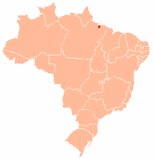
1° 27' south, 48° 29' west. As of 2004, the population is 1.421 million, which makes it the 10th biggest city of Brazil. The mouth of the Amazon lies just to the north of the city.
Template:Brazil-geo-stub da:Belem de:Belém es:Belém fr:Belém it:Belém nl:Belém no:Belém pl:Belém pt:Belém
