Tehran
|
|
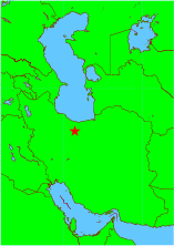
Tehran (also transcribed Teheran) (تهران in Persian), population 9,000,000 (metropolitan: 14,000,000), and a land area of 254 square miles, is the capital of Iran and the center of Tehran Province. Tehran is located at 35°40' North, 51°25' East (35.667, 51.41667). [1] (http://earth-info.nga.mil/gns/html/cntry_files.html)
More than half of the country's industry is based there. Industries include the manufacturing of cars, electronics and electrical equipment, weaponry, textiles, sugar, cement, and chemical products. It is also a leading center for the sale of carpets and furniture. There is an oil refinery nearby.
Tehran is a lively city at the foot of the Alborz mountain range with an immense network of highways unparalleled in western Asia. It is also the hub of the country's railway network. The city has numerous large museums, art centers, palace complexes and cultural centers. Besides Persians there are Azeri, Armenian, Jewish and Afghani communities in Tehran. Persian-speakers constitute 98.3 percent of Tehran's residents.[2] (http://www.hamshahri.org/ostans/iraninfo/tehran/farbomi/leftfar.htm). The city is dotted with mosques, churches and synagogues.
| Contents |
History
Excavations place the existence of settlements in Tehran as far back as 6000BC. Tehran was well known as a village in the 9th century, but was less well-known than the city of Rages which was flourishing nearby in the pre-Mongol era. In the 13th century, following the destruction of Rages by Mongols, many of its inhabitants fled to Tehran. In some sources of the Mongol era the city is mentioned as "Rages's Tehran" (طهرانِ ری). The city is later mentioned in Hamdollah Mostowfi's Nezhat ol-Gholoob (written in 1340) as a famous village.
Tehran became a residence of the Safavid rulers in the 17th century. Tahmasp I built a bazaar and a wall around the city, but it somewhat fell out of favour after Abbas I turned sick when he was passing the city to go to a war with the Uzbeks.
In the early 18th century, Karim Khan Zand ordered a palace, a harem, and a government office to be built in Tehran, possibly to declare the city his capital, but later moved his government to Shiraz. Tehran finally became the capital of Persia in 1795, when the Qajar king Agha Mohammad Khan was crowned in the city. It remains the capital to this day.
During World War II, British and Soviet troops entered the city. Tehran was the site of the Teheran Conference in 1943, attended by US President Franklin D. Roosevelt, British Prime Minister Winston Churchill, and Soviet Premier Joseph Stalin.
On September 8 1978, demonstrations against the Shah led to riots. The army reportedly opened fire on the demonstrating mob. Martial law was installed in the wake of the ensuing revolution, from 1978-80.
During the 1980-88 Iran-Iraq War, Tehran was the scene of repeated Scud missile attacks and air strikes against random residential and industrial targets within the city, resulting in thousands of civilian casualties.
About Tehran
Tehran-arjantin.jpg
The Azadi Tower is the first thing visitors come across when coming from the Mehr-abad International Airport. The tower has become an icon of sorts for Tehran and Iran.
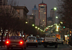
Like many of the world's large cities, Tehran suffers from serious traffic congestion and pollution problems. Tehran has become so congested in the past 10 years, that the government has considered moving the nation's capital to another city to alleviate these problems and help de-centralize the economy and population. This is especially true in light of predictions of an imminent major earthquake in Tehran. Yet millions choose to live and work in Tehran despite these problems. The appealing side of Tehran, it seems, outweighs these concerns.
Teatreshahr11.jpg
The huge Tehran International Fair organises many expositions. Its book expositions are especially popular. Tehran is also the seat of Iran's Parliament (the Majles).
Tehran is also a city of parks and possesses more than 800 well-kept parks. The Tehran Stock Exchange which is a full member of the FIBV and a founding member of the Federation of Euro-Asian Stock Exchanges, is one of the world's best performing stock exchanges, in recent years.[3] (http://news.bbc.co.uk/1/hi/business/3129995.stm)
Among the unusual attractions in Tehran (especially for tourists) are its many electronic stores and the buildings encompassing them where unlicensed copies of music and software CDs, in addition to VCD and DVD movies, are sold at very low prices. Tehran has eight TV channels broadcast by IRIB, and is in receiving range of satellite stations that broadcast over 100 free channels from Europe and Asia. Although technically banned by Iran's government, the four foot dishes are a commodity in millions of homes in Iran.
Tehran is home to the world's fourth tallest free standing structure, the Milad Tower.
Neighborhoods and Districts of Tehran
The city of Tehran is divided into 20 municipal zones, each with its own administrative centers. Tehran contains the following districts and major neighborhoods within these 20 zones:
Shemiran, Elahiyeh, Abbas Abad, Amir Abad, Yusef Abad, Darakeh, Dar Abad, Darband, Sadeghiyeh, Gholhak, Tehran Pars, Afsariyeh, Jordan, Gisha, Narmak, Ekhtiyariyeh, Niyavaran, Jamaran, Dehkadeh Olampik, Sa'adat Abad, Evin, Moniriyeh, Ray, Gomrok, Park Shahr, Hasan Abad, Baharestan, Punak, Bagh Feiz, Jomhuri, Navvab, Yaft Abad, Javadiyeh, Vanak, Shahrak Gharb, Nazi Abad, Shahr Ara, Jannat Abad, etc.
For full list, see List of the localities around Tehran.
Transportation
Tehran is served by Mehrabad International Airport, the old airport located in the western part of the city, and Imam Khomeini International Airport, outside the city and to the south, which was scheduled to be operational in 2004 but currently resides in the hands of Islamic Revolutionary Guards Corps (IRGC).
Tehran also has a central train station with connecting services round the clock to various cities in the country. There are four bus terminals that also provide connections at low fares. These are the South, East, West, and Bei-haghi Park-Drive Terminals.
While the center of the city contains the government ministries and headquarters, the commercial centers are more located toward Taleghani Ave. and Beheshti Ave. further north. Although administratively separate, Rey, Shemiran, and Karaj are often considered part of the larger Tehran metropolitan area.
Tehran is also in the final stages of constructing a monorail innercity transport line.
See also: List of Tehran metro stations
Colleges and universities
Tehran-blvd.jpg
Tehran's major colleges and universities are:
- Allameh Tabatabaii University (http://www.atu.ac.ir/)
- Amirkabir University of Technology (Tehran Polytechnic) (website (http://www.aku.ac.ir/))
- Alzahra University (website (http://www.alzahra.ac.ir/))
- Baghiatollah University (http://www.bmsu.ac.ir/)
- Imam Hossein University (http://www.ihu.ac.ir/)
- Imam Sadegh University (http://www.isu.ac.ir/)
- Institute for Studies in Theoretical Physics and Mathematics (http://www.ipm.ac.ir)
- Iran University of Medical Sciences (http://www.iums.ac.ir/)
- Iran University of Science and Technology (IUST) (http://www.iust.ac.ir/)
- Islamic Azad University of Karaj (http://www.kiau.ac.ir/)
- Islamic Azad University of Roodehen
- Islamic Azad University of Tehran-Medical Sciences (http://www.iautmu.ac.ir/)
- Islamic Azad University of Tehran-North (http://www.iaunt.ac.ir/)
- Islamic Azad University of Tehran-South (http://www.azad.ac.ir/)
- Islamic Azad University of Tehran-Central (http://www.iauctb.ac.ir/)
- Islamic Azad University of Tehran-Region one (http://www.iauro.ac.ir/)
- K.N.Toosi University of Technology (http://www.kntu.ac.ir/)
- Shahed University (http://www.shahed.ac.ir/)
- Shahid Beheshti University (website (http://www.sbu.ac.ir/))
- Shahid Beheshti University of Medical Sciences (http://www.sbmu.ac.ir/)
- Sharif University of Technology (webiste (http://www.sharif.ac.ir/))
- Tarbiat Modarres University (http://www.modares.ac.ir/)
- Tehran University of Medical Sciences (http://www.tums.ac.ir/)
- Tehran University of Tarbiat Moallem (http://www.tmu.ac.ir/)
- University of The Arts (http://www.art.ac.ir/)
- University of Social Welfare and Rehabilitation Sciences (http://www.uswr.ac.ir/)
- University of Tehran (website) (http://www.ut.ac.ir/)
- University of Emam Reza (http://www.emamreza.ac.ir/)
- Hadith College of Tehran (http://www.hadith.ac.ir/)
- Imam Ali University for Army Officers
- Comprehensive University of Technology (http://www.itrws.com/)
- Tehran University of Applied Science and Technology (http://www.uast.ac.ir/)
- Tehran College of Environment (http://www.coe.ac.ir/)
- Bagher Aloloum University (http://www.bou.ac.ir/)
- International University of Iran (http://www.iranu.com/)
- Iran College of Tele-communications (http://www.ictfaculty.ir/)
- Medical University for the Islamic Republic of Iran's Army
- NAJA University of Police
- School of Economic Affairs (SEA) (http://www.sea.ac.ir)
- School of International Relations (SIR) (http://www.sir.ac.ir)
- Shahed University of Medical Sciences
- Shahid Sattari University of Aeronautical Engineering
- University of Islamic Sects
- The Research Institute of The Petroleum Industry (http://www.ripi.ir/en/)
Tehran also contains Iran's largest military academy, and several religious schools and seminaries.
Sports
Azadi.jpg
In football (soccer), Tehran is host to six football clubs in Iran's Premier Football League, namely, Esteghlal, Saba Battery, SAIPA, Peykan FC, Pas and Pirouzi/Persepolis. These clubs have on numerous occasions won Asian titles, and many of their players are well known internationally.
Tehran is also the site of Iran's national football stadium Azadi Stadium with 100000 seating capacity. Many of the top matches of Iran's Premier League are held here.
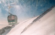
Within 10 minutes of driving distance from Tehran lies an excellent ski resort. Tochal is the world's fifth highest ski resort at over 3730m at its highest 7th station. The resort was completed in 1976 shortly before the overthrow of the Shah.Here, one must first ride the eight km (five mile) long gondola lift which covers a huge vertical. The 7th station has three major slopes. The resort's longest slope is the south side U shaped slope which goes from the 7th station to 5th station. The other two slopes are located on the north side of the 7th station. Here, there are two parallel chair ski lifts that go up to 3900m near Tochal's peak (at 4000m), rising higher than the gondola 7th station station. This altitude is higher than any of the European resorts including Mont Blanc.
From the Tochal peak, one has a spectacular view of the Alborz range, including the 5671 metre (18606 ft) high Mt. Damavand, an extinct volcano.
At the bottom of the lifts in a valley behind the Tochal peak is Tochal hotel, located at 3500m altitude. From there a T lift takes skiers up the 3800 metres of Shahneshin peak, where the third slope of Tochal is.
Tochal 7th station has skiing eight months of the year. But there are also many glaciers and year-round snow fields near Tehran where skiing began in 1938, thanks to the efforts of two German railway engineers. Today, 12 ski resorts operate in Iran, but the most famous are Tochal, Dizin, and Shemshak, all within an hour or so of Tehran.
See also: List of the localities around Tehran, Kilan
Attractions
Keshavarz.jpg
Tehran's many parks provide pleasant getaways from the city's commotion.
Tehran's popular attractions are:
Palaces
- Golestan Palace (http://www.golestanpalace.org/)
- Niyavaran Palace (http://niavaranpalace.org/)
- Sa'd Abad Palace (http://www.saadabadpalace.org/)
- Saltanat Abad Palace
- Firouzeh Palace, (which belongs to Tehran's Zoroastrian community)
- Soleymaniyeh Palace
- Baharestan Palace, (where Iran's first parliament was located at)
- Morvarid Palace, Karaj, designed by the Frank Lloyd Wright Foundation. [4] (http://www.iranian.com/Kasraie/2004/June/Design/)
Galleries, theaters, and museums
- Sa'd Abad Gallery of Fine Arts (http://www.saadabadgallery.ir/)
- Glassware Museum of Tehran (http://www.glasswaremuseum.org/)
- Iran National Rug Gallery (http://carpetmuseum.ir/)
- Reza Abbasi Museum (http://www.rezaabbasimuseum.ir/)
- Tehran Museum of Contemporary Art (http://www.ir-tmca.com/)
- Tehran Theater of the Performing Arts (Te'atr e Shahr)
- Talar Vahdat Theater
- Iran National Museum, (website) (http://www.nationalmuseumofiran.ir)
- Darabad Museum of Natural History
Parks and Recreation
Elahiyeh.jpg
- Tochal Ski resort (http://www.tochalcomplex.com)
- Darband hiking trail
- Chitgar Park
- Mellat Park
- Laleh Park
- Jamshidieh Park
- Niavaran Park
- Sa'ei Park
- Shatranj Park
- Darabad hiking trail
- Darakeh hiking trail
- Jahan-e Kudak Park
- Azadi Sports complex
- Enghelab Sports Complex and Golf course
- Several caves, springs, and waterfalls outisde Tehran.
- Latyan Lake
- Lavizan Forest Park
- Vard-Avard Forest Park
- Khajeer National Park
- Kaveer National Park
- Tar Lake
- Amir Kabir Lake
- Lar Protected Natural Habitat
- Varjeen Protected Natural Habitat
Mosques, shrines, mausoleums, and tombs
Borj-toghrul.jpg
- Soltani Mosque, built by Fath Ali Shah
- Atiq Mosque, built in 1663.
- Mo'ezz o-dowleh mosque, built by Fath Ali Shah
- Haj Seyd Azizollah mosque, built by Fath Ali Shah
- Al-javad mosque, Iran's first modernist design mosque.
- The Old Sepahsalar mosque, another prominent Qajar era mosque.
- The new Sepahsalar mosque (Madreseh e Motahari)
- Filsuf o-dowleh Mosque, Qajar era
- Moshir ol-Saltaneh Mosque, Qajar era
- Mo'ayyer ol-Mamalik Mosque, Qajar era
- Shahr Banu Mausopleum
- Javan-mard Qassab Mausoleum, a pre-Islamic semi-mythical hero
- Dozens of Imam-zadeh shrines, hundreds of years old, including that of Imam Zadeh Saleh.
- Dozens of Saqa Khanehs: traditional places of prayer
- Several Tekyehs: traditional places for mourning Muharram ceremonies for Husayn ibn Ali.
- Ibn Babviyeh cemetery, where many Iranian giants such as Takhti and Ali Akbar Dehkhoda are buried.
- Zahir o-dowleh cemetary, where many Iranian giants of art and culture such as Iraj Mirza, Mohammad Taghi Bahar, Forough Farrokhzad, Abolhasan Saba, Ruhollah Khaleghi, and Darvish-khan are buried.
- Kordan Tomb, Seljuqi era, Karaj.
- Maydanak Tomb, 13th century, Karaj
- The Polish cemetary north of Tehran, where numerous WW2 western allied soldiers are buried.
Churches
- Surep Georg Church, 1790
- Thaddeus Bartoqimus Church, 1808
- Tatavus Church, from the Qajar era
- Enjili Church, 1867
- Assyrian Church
Castles and Forts
Bagh-melli.jpg
- Arzhang Fort, Taleqan, 1149CE
- Iraj Fort, Varamin
- Gol e Khandan Fort, Rudehen, Sassanid era
- Rashkan Fort, Ray, Parthian era
- Tabbarok Fort, Abbasid era
- Sorkheh-Hesar Fort, Seljuqi era.
- Kei-Ghobad Fort, Taleqan, Ismaili era
- Gabri Fort, Parthian era, Ray.
- Several other forts and castle ruins, such as Ghal'eh Dokhtar Tang Goseel, near Karaj. Like all the other forts of this area, these have been ruined by earthquakes. Seljuqi era.
- Harun Prison. Sassanid era. South of Tehran.
- Bagh e Melli foreign ministry compound.
Traditional Houses
Dozens of houses of antiquity with splendid traditional architectural design remain standing in Tehran today. Most are from the Qajar era. Some of these are:
- Etehadiyeh House, Qajar era
- Amir Bahador House, Qajar era
- Emam Jomeh House, 1863CE
- Amin ol-Soltan House, Qajar era
- Shaghaghi (Kushak) House, Qajar era
- Emarat e Bagh e Ferdows, Qajar era
- Emarat Farmaniyeh, Qajar era
- Shahid Modarres House, Uladjan district.
- Vothuq House, 1837CE
- Moshir o-Dowleh Pir Nia House
However, there exist plenty of houses of historical heritage also open to the public, such as: House of Nima Yooshij, House of Mohammed Mossadegh, House of Ayatollah Taleghani, House of Ghavam o-Dowleh, House of Imam Khomeini, and House of Mahmoud Hessaby.
Archeological sites
An abundance of ancient archeological historicl sites exists in and around Tehran. Some of the more prominent ones are:
- Cheshme Ali Teppe, 5th millenium BCE. Excavated by Jaques Demorgan.
- Shoghali Teppe, 6th millenium BCE.
- Qeytariyeh ancient Cemetery, 2nd Millenium BCE.
- Teppe Meel, excavated by Jaques De Morgan, believed to be the temple of the legendary ancient leader Bahram Gur.
- Vavan Teppe, Sassanid era
- Ghareh Teppe, 6th millenium CE, excavated by the British Burton Brown.
- Ozbaki Teppe, Hashtgerd.
Others
Tehran_cemetary_WW2.jpg
- Iran National Library (http://www.nli.ir/)
- Borj-e Milad
- Darolfonoon institute of higher education
- Morvarid Canon, Afsharid dynasty era
- Shebeli Tower, Damavand, Samanid era
- Tughrul Tower, Seljuqi era
- Ala-o-dowleh Tower, Varamin, 1276CE
- Tehran Bazaar, 1523CE.
- Several Ab anbars (traditional water reservoirs) of antique age.
- Several Qanats of antiquity.
- Several Yakh-chals (traditional refrigerators) of antiquity.
- Several bridges of antiquity. Example: Pol e Rumi, located in Northern Tehran, from the Ottoman era, today a property of the Embassy of Turkey.
- Several Caravanserais of antiquity.
- Several fire temples of antiquity
- Alborz High School
The older neighborhoods of Tehran
Tehran's old city fabric changed dramatically during the first Pahlavi era. Some of the older remaining districts of Tehran are: Uladjan, Sanglaj, Bazaar, Chaleh Meydan, Dowlat. Chaleh Meydan is the oldest neighborhood of the aforementioned.
More information
- Tehran Avenue (English) (http://www.tehranavenue.com/)
- Farsinet's information on the history of Tehran (http://www.farsinet.com/tehran/history.html)
- Tehran Metro (http://www.tehranmetro.com)
- WikiTravel - Travel guide to Tehran (English) (http://www.wikitravel.org/en/article/Tehran)
- About Tehran (http://www.iles.umn.edu/faculty/bashiri/Courses/Tehran.html)
- Tehran Cultural Heritage Organization (http://www.tehranmiras.ir/)
- Tehran Traffic Control (http://www.tehrantraffic.com/) (with live webcams)
- Pas Football Club Official website (http://www.ipna.ir/) (in Persian)
- Peykan Football Club Official website (http://www.ikco.com/oldikco/company/football.htm)
- Persian Football League (http://www.persianleague.com/)
- Tehran photos, attractions, hotels (http://www.irpedia.com/cities/city.php?ID=674)
- Real Audio clip of the documentary: "Ancient Tehran: 8,000 years" (http://www.iranian.com/Clips/2005/May/tehran.html)da:Teheran
de:Teheran es:Teherán eo:Tehrano et:Teheran fa:تهران fi:Teheran fr:Téhéran he:טהרן id:Teheran ja:テヘラン ko:테헤란 nl:Teheran no:Teheran pl:Teheran pt:Teerão ro:Teheran ru:Тегеран sv:Teheran zh:德黑兰


