Geothermal areas of Yellowstone
|
|
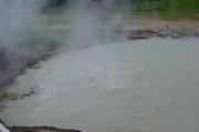
The geothermal areas of Yellowstone include several geyser basins in Yellowstone National Park as well as other geothermal features such as hot springs (including mud pots) and fumaroles. Many of these features build up sinter, geyserite or travertine deposits around and within them. Due to high elevation, the average boiling temperature at Yellowstone's geyser basins is 199 °F (93 °C). Water erupting from Yellowstone's geysers is superheated above the boiling point to an average of 204 °F (95.5 °C) as it immediately leaves the vent; the water cools significantly while airborne and is no longer scalding hot by the time it strikes the ground, nearby boardwalks, or even spectators.
| Contents |
Safety
Geyser Basins
Norris Geyser Basin
Norris_geyser_basin.jpg
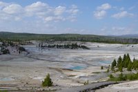
Norris Geyser Basin is the hottest geyser basin in the park and is located near the northwest edge of Yellowstone Caldera near Norris Junction and on the intersection of three major faults. The Norris-Mammoth Corridor is a fault that runs from Norris north through Mammoth to the Gardiner, Montana, area. The Hebgen Lake fault runs from northwest of West Yellowstone, Montana, to Norris. This fault experienced an earthquake in 1959 that measured 7.4 on the Richter scale (sources vary on exact magnitude between 7.1 and 7.8). These two faults intersect with a ring fracture that resulted from the Yellowstone Caldera of 600,000 years ago. These faults are the primary reason that Norris Geyser Basin is so hot and dynamic.
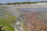
Unlike most of other geyser basins in the park, the waters from Norris are acidic rather than alkaline. The difference in pH allows for a different class of bacterial thermophiles to live at Norris, creating different color patterns in and around the Norris Basin waters.
The largest geyser in the world is Steamboat Geyser and it is located in Norris Basin. Unlike the slightly smaller but much more famous Old Faithful Geyser located in Upper Geyser Basin, Steamboat has an erratic and lengthy timetable between major eruptions. During major eruptions, which may be separated by intervals of more than a year, Steamboat erupts over 300 feet into the air. However, Steamboat does not lie dormant between eruptions, but has minor eruptions of approximately 40 feet every few minutes.
The Ragged Hills that lie between Back Basin and One Hundred Springs Plain are thermally altered glacial moraines. As glaciers receded, the underlying thermal features began to express themselves once again, melting remnants of the ice and causing masses of debris to be dumped. These debris piles were then altered by steam and hot water flowing through them. Madison lies within the eroded stream channels cut through lava flows formed after the caldera eruption. The Gibbon Falls lies on the caldera boundary as does Virginia Cascades.
Upper Geyser Basin
South of Norris along the rim of the caldera is the Upper Geyser Basin, which has the highest concentration of geothermal features in the park. This complement of features includes the most famous geyser in the park, Old Faithful Geyser, as well as four other predictable large geysers. One of these large geysers in the area is Castle Geyser which is about 1400 feet northwest of Old Faithful. Castle Geyser has an interval of approximately 13 hours between major eruptions, but is unpredictable after minor eruptions. The other three predictable geysers are Grand Geyser, Daisy Geyser, and Riverside Geyser.
The hills surrounding Old Faithful and the Upper Geyser Basin are reminders of Quaternary rhyolitic lava flows. These flows, occurring long after the catastrophic eruption of 600,000 years ago, flowed across the landscape like stiff mounds of bread dough due to their high silica content.
Blue_Star_Spring_near_Old_Faithful_Geyser_in_Yellowstone-750px.JPG
Evidence of glacial activity is common, and it is one of the keys that allows geysers to exist. Glacier till deposits underlie the geyser basins providing storage areas for the water used in eruptions. Many landforms, such as Porcupine Hills north of Fountain Flats, are comprised of glacial gravel and are reminders that as recently as 13,000 years ago, this area was buried under ice.
Signs of the forces of erosion can be seen everywhere, from runoff channels carved across the sinter in the geyser basins to the drainage created by the Firehole River. Mountain building is evident on the drive south of Old Faithful, toward Craig Pass. Here the Rocky Mountains reach a height of 8,262 feet (2518 m), dividing the country into two distinct watersheds.
Lower Geyser Basin
Silex_Spring_at_Fountain_Paint_Pot_in_Yellowstone-750px.JPG
Further south is the Lower Geyser Basin, which has a much less concentrated set of geothermal features, including Fountain Paint Pots. Fountain Paint Pots are mud pots, that is, a hot spring that contains boiling mud instead of water. The mud is produced by a higher acidity in the water which enables the spring to dissolve surrounding minerals to create an opaque, usually grey, mud. The Midway Geyser Basin is actually an extension of the Lower Basin.
West Thumb Geyser Basin
The West Thumb Geyser Basin, including Potts Basin to the north, is unique in that it is the largest geyser basin on the shores of Yellowstone Lake. The heat source of the thermal features in this location is thought to be relatively close to the surface, only 10,000 feet (3000 m) down. The West Thumb of Yellowstone Lake was formed by a large volcanic explosion that occurred approximately 150,000 years ago (125,000-200,000). The resulting caldera later filled with water forming an extension of Yellowstone Lake. The West Thumb is about the same size as another famous volcanic caldera, Crater Lake in Oregon, but much smaller than the great Yellowstone Caldera which formed 600,000 years ago. It is interesting to note that West Thumb is a caldera within a caldera.
Ring fractures formed as the magma chamber bulged up under the surface of the earth and subsequently cracked, releasing the enclosed magma. This created the source of heat for the West Thumb Geyser Basin today.
The thermal features at West Thumb are found not only on the lake shore, but extend under the surface of the lake as well. Several underwater geysers were discovered in the early 1990s and can be seen as slick spots or slight bulges in the summer. During the winter, the underwater thermal features are visible as melt holes in the icy surface of the lake. The ice averages about three feet thick during the winter.
Backcountry Geyser Basins
The Gibbon, Heart Lake, Lone Star, and Shoshone Geyser Basins are located away from the heavily traveled portions of the park. Some require several miles of off-trail hiking to reach. These areas also generally lack the boardwalks and other safety features of the developed areas. As falling into geothermal features can be fatal, it is usually advisable to visit these areas with an experienced guide.
Mammoth Hot Springs
In the northwest corner of the park there is a large hot spring complex near Fort Yellowstone called Mammoth Hot Springs. Mammoth is a large hill of travertine that has been created over thousands of years as hot water from the spring cooled and deposited calcium carbonate (over 2 tons of calcium carbonate flows into Mammoth each day in a solution). Although these springs lie outside the caldera boundary, their energy is attributed to the same magmatic system that fuels other Yellowstone geothermal areas.
The hot water that feeds Mammoth comes from Norris Geyser Basin after traveling underground via a fault line that runs through limestone and roughly with the Norris to Mammoth road (the limestone is the source of the calcium carbonate). Shallow circulation along this corridor allows Norris' super-heated water to cool somewhat before surfacing at Mammoth, generally at about 170° F (~77° C). Algae living in the warm pools have tinted that travertine shades of brown, orange, red and green.
Thermal activity here is extensive both over time and distance. Terrace Mountain at Mammoth Hot Springs is the largest known carbonate-depositing spring in the world. The most famous feature at the springs is the Minerva Terrace, a series of travertine terraces. The terraces have been deposited by the spring over many years, but due to recent minor earthquake activity, the spring vent has shifted, rendering the terraces dry.
The Mammoth Terraces extend all the way from the hillside, across the Parade Ground, and down to Boiling River. The Mammoth Hotel, as well as all of Fort Yellowstone, is built upon an old terrace formation known as Hotel Terrace. There was some concern when construction began in 1891 on the Fort site that the hollow ground would not support the weight of the buildings. Several large sink holes (fenced off) can be seen out on the Parade Ground. This area has been thermally active for several thousand years.
The Mammoth area exhibits much evidence of glacial activity from the Pinedale Glaciation. The summit of Terrace Mountain is covered with glacial till, thereby dating the travertine formation there to earlier than the end of the Pinedale Glaciation. Several thermal kames, including Capitol Hill and Dude Hill, are major features of the Mammoth Village area. Ice-marginal stream beds are in evidence in the small, narrow valleys where Floating Island Lake and Phantom Lake are found. In Gardner Canyon, one can see the old, sorted gravel bed of the Gardner River covered by unsorted glacial till.
Mud Volcano and Sulphur Caldron
The thermal features at Mud Volcano and Sulphur Caldron are primarily mud pots and fumaroles because the area is situated on a parched water system with little water available. Fumaroles or "steam vents" occur when the ground water boils away faster than it can be recharged. Also, the vapors are rich in sulfuric acid that leaches the rock, breaking it down into clay. Because no water washes away the acid or leached rock, it remains as sticky clay to form a mud pot. Hydrogen sulfide gas is present deep in the earth at Mud Volcano. As this gas combines with water and the sulfur is metabolized by cyanobacteria, a solution of sulfuric acid is formed that dissolves the surface soils to create pools and cones of clay and mud. Along with hydrogen sulfide, steam, carbon dioxide, and other gases explode through the layers of mud.
A series of shallow earthquakes associated with the volcanic activity in Yellowstone struck this area in 1978. Soil temperatures increased to nearly 200° F (93° C). The slope between Sizzling Basin and Mud Geyser, once covered with green grass and trees, became a barren landscape of fallen trees known as "the cooking hillside."
See also
References
- Bryan, T. Scott (1995). The geysers of Yellowstone. Niwot, Colorado: University Press of Colorado. ISBN 087081365X
- Harris, Ann G.; Tuttle, Esther; and Tuttle, Sherwood D. (1995). Geology of national parks: fifth edition. Iowa: Kendall/Hunt Publishing. ISBN 0-7872-5353-7
- National Park Service - Geological Overview of Specific Yellowstone National Park Areas (http://www.nps.gov/yell/nature/geology/geology%20highlights.htm)
External links
- Geothermal Feature Images for Publication (http://www.nps.gov/yell/press/images/thermalf/index.htm)
- Yellowstone's Geysers (http://www.geyserstudy.org/geyser_main.htm)de:Mammoth Hot Springs


