
Medjimurje County
|
|

Medjimurje (Međimurska županija, Muraköz in Hungarian) is a triangle-shaped county in the northernmost part of Croatia. In the western part of the county, there are slopes of Alpine foothills, while toward the east it touches the flat Pannonian plains. It shares borders with Slovenia and Hungary, with Austria just over the corner.The eastern limits of the county are near the town of Legrad. The closest cities are Varaždin, Koprivnica, Nagykanizsa, Murska Sobota, Bjelovar, Maribor, and Graz, in all three states.
The region is flattered by the name Hortus Croatiae ("the park of Croatia"). The turtle-dove (equal "grlica" in Croatian language or Croatian in short) and the flower violet (equal "ljubičica" ) are unofficial local symbols. It is often fondly called Međimurje malo ("Little Međimurje"). Once, the term MedjiMorje was used locally since the small landmass was surrounded by two big rivers which were associated with the sea (more=sea in Croatian).
| Contents |
Physical characteristics
The county covers the plains between the rivers of Mura and Drava, (Mur and Drau in German), both of which occasionally flood and frequently change their paths. The Mura divides Croatia from Slovenia (Prekmurje) and also from another administrative entity, Varadinska upanija, just to the south. The county's elevation ranges between 120 m and Mohokos's 344 m above sea level. In the Upper Medjimurje, in the west, the Mura changes its course, moving it in terms of geology slowly toward the north. There were occasional earthquakes here. One of significant strength hit the region in 1880, while another in 1738 devastated Čakovec and particularly nearby Šenkovec. The climate is continental, with hot, often stormy summers, calm autumns, and severe winters.
Of the whole area, (729.5 km²), 360 km² are used in agriculture. Unfortunately, due to the high population density, agricultural land is divided into 21,000 units averaging 17,500 m² each. 27.5 km² are covered with orchards; 11 km² of the hilly area with small picturesque towns like Štrigova in the western part are vineyards. Pasturelands and forests are roughly 105 km². The biggest forest is Murčak, located between Domainec and Donji Hraćan (hrast = oak tree in Croatian).
People, municipalities, language
The principal city is Čakovec, (Csáktornya in Hungarian language), the city of 17 500 the center of local activities and that keeps special ties with its sister city, Schramberg, in Germany. The other two cities are Mursko Sredisce and Prelog. Towns include Sveti Martin na Muri, Sveta Marija, Draškovec, Donji Kraljevec, Donja Dubrava, Goričan, Hodoan, Belica (a.k.a. the "Potato City"), Šenkovec, Macinec, Kotoriba, and Podturen.
The area has 119 500 residents in 126 municipalities. It is populated mainly by ethnic Croatians of Roman Catholic extraction, with up to 4 % Hungarians, Germans, Albanians, Slovenes and Roma. It is the smallest (729.5 km²) county but the most densely populated with 164.2 persons/km². In everyday life here, in use is Kajkavian dialect. As in the rest of Croatia official language here is tokavian dialect. Note that Kaj and to equate to what? in subsequently so named dialects.
The demographics of the region changed swiftly in the period between 1950 and 1975, with a significant reduction in the size of the basic population unit--the family. From the national perspective, the population is moving gradually and permanently toward the Istra region, while the seasonal workforce moves toward Zagreb and south. The natural population increase is minimal. Each of the bigger municipalities has an elementary school center, while Čakovec offers more: the Gymnasium, technical and construction high schools, and the academy (Teachers Training College), to fulfill the local and country's needs for education cadre.
Once, only notable place one could have experience local cuisine and culture was that one of so called Medjimurska Hiza in Mackovec. The area was for many centuries part of Hungary, heavily influenced by its history and culture, evident in its language, music, and cuisine. Local diet is based on cereal s and meat. Fanik, (Fasching in German language), is the period when for centuries, people used to make festivities to scare the demons of the darkness and winter away and when Krofni, (big doughnuts) were made. Today, one can ask for them at any time. Orehnjača cake, (orah=nut in Croatian), is delicious as is hard corn bread or ganci, (polenta), when served with Vrhnje, (liquid sour cream) or Kiselo mlijeko (buttermilk). Here we have orange checkered, cone-shaped and dry cheese Turo, heavenly trukli, (boiled pastry with cottage cheese), mlinci, white and black sausage, (Ćurke), with porridge, other dried and otherwise preserved meat and vegetable dishes.
There are spa s used for recreation in Vučkovec and around Sveti Martin na Muri. Also, there are mountaineering, fishing, bowling, radio, aero, and other clubs, including more than 200 of them for various sports activities. Hunting is attracting numerous hunters in low game and bird s, mostly from Italy.
Administrative division
Međimurje county is divided:
- City of Čakovec (county seat)
- Town of Mursko Srediće
- Town of Prelog
- Municipality of Belica
- Municipality of Dekanovec
- Municipality of Domainec
- Municipality of Donja Dubrava
- Municipality of Donji Kraljevec
- Municipality of Donji Vidovec
- Municipality of Goričan
- Municipality of Gornji Mihaljevec
- Municipality of Kotoriba
- Municipality of Miklavec
- Municipality of Mala Subotica
- Municipality of Nedeliće
- Municipality of Orehovica
- Municipality of Podturen
- Municipality of Pribislavec
- Municipality of Selnica
- Municipality of Strahoninec
- Municipality of Sveta Marija
- Municipality of Sveti Juraj na Bregu
- Municipality of Sveti Martin na Muri
- Municipality of enkovec
- Municipality of trigova
- Municipality of Vratiinec
County government
Current leadership:
- Župan (prefect): Josip Posavec (HNS)
- Deputy župan: Mladen Križaić (HDZ)
The county assembly is composed of 41 representatives, presided by Vladimir Ivković (HDZ) and composed as follows:
- Croatian People's Party (HNS) 15
- SDP-HSS-HSU: 13
- Croatian Democratic Union (HDZ) 7
- Croatian Social Liberal Party (HSLS) 6
Based on election results in 2005.
Communication and transport
Medjimurje is a strong trade and communication hub connecting central Europe with Varaždin, Zagreb, and Karlovac as well as the port of Rijeka, (rijeka=river in Croatian), on the shores of the Adriatic sea, mainly in Kvarner bay. Kotoriba is proud of the first railway station building in Croatia and one of the first railway tracks connecting it to Čakovec in the westbound direction. The first railroad track was built here in 1860, helping to connect Budapest with the southern ports Rijeka and Trieste. The second railroad tied Čakovec with Mursko Sredisce and Lendava (Lendva) in Slovenia in 1889.
The road infrastructure is good and includes the new expressway connecting Hungary via Goričan to Zagreb and the seashore. Everyday communication in business, trade and education within as well between the counties and countries makes the area dynamic and open. A small airport for freight is located at Pribislavec.
Business and economy
Roughly 22 000 people are employed, with 60 % of them in bigger companies. An average monthly net wage was 2442 kn in 2002. Until recently, the region was heavily agricultural so that even today nearly 6 500 people--or 5.2 %--are part of the official agriculture business with an additional 7.5 % an unofficial part, totaling 12.7 %, which is above the national average. Since the late 1960s and early 1970s, nearly 17 000 of its inhabitants have been employed abroad, in Austria, Germany, Switzerland and beyond. This area is one of the nation's richest and most prosperous.
The economy of the region is based today on a variety of industries, such as textiles Medjimurska trikotaa,(originally Graner Co.) Čateks, Modeks, footwear (Jelen, Meiso and Calzedonia), food (Agromedjimurje, Vajda, Čakovecki Mlinovi, Mesnice Carović, Mesnice Mihalić), and metal fabrication plants (Ferro-Preis, TMT, and Tehnix). Other industries include the printing and publishing activities of (Zrinski), building materials, building and construction (Tegra and Beton), and chemical (Meplast and Muraplast). Maltar and Co. (later Medjimurjeplet) of Kotoriba, with its basket-waving business (baskets, chairs), has been a significant part of the local economy since the beginning of the 20th century. Industry has developed mostly in the central and eastern parts, corresponding with the population distribution. Transit, communication and trade (METSS former Trgocentar (croatian: Međimurska trgovina suvremenog stila - Međimurje's popular style store) continue to be important.
Resources
There are deposits of coal in Mursko Središće, Peklenica and Lopatinec (lopata = shovel in Croatian), the exploration of which was part of economic life between 1946 and 1972. The total output then was close to 4,600,000 t but was unprofitable compared to the price of gasoline at that time. The estimated reserves are 200,000,000 t, but new technology and approaches would be needed to extract it profitably.
Gas and crude oil deposits were found first in Croatia here, in Selnica and Peklenica, in 1856. The latter got its name from the word "pekel", meaning "hell" in the local dialect, since the people quickly noticed the peculiar properties of the dark, greasy liquid in small ponds appearing spontaneously on the ground. At the time, reserves were calculated to be around 170,000 t. There was exploitation from 1886 to 1889 and even in the 20th century when world demand was in its infancy, and no other sources were even needed. Today, just a modern pipeline stretches from Omišalj on the Adriatic coast and Sisak toward the refinery in Lendava just north from here. Notable gas deposits are in Čakovec's suburb of Mihovljan.
Two hydroelectric dams (HPP Čakovec and Dubrava) on the Drava river, built in 1982 and 1989, provide 161.6 MW of electric power and are used for flood control and irrigation. Geothermal resources exist but cannot be considered as a profitable energy source; instead, they are used for leisure and recreation. Gold particles can be found in both rivers' sands. In 1955, the geological survey calculated the gold concentration in the Drava river to be between 2.5 and 24.4 mg/m³, occasionally reaching 111–150 mg/m³.
History
The first organized human habitations here can be traced back to the stone age, the 5th millennium BC. Numerous findings tell us also about life later, in the bronze age. The origins of inhabitants in both historic spans of time are still uncertain. As for the neolithic locality called Ferenčica near Prelog, urban legend tells us only that it was inhabited by bad, violent and virtueless people. Nearby, there are 3rd century archaeological sites called Ciglišće and Varaščine .
As for the iron age period, the tribes are identifiad as those of the Celts, Serets and Pannons, later subdued by the ever-expanding Roman military machine. In the 1st century, the Romans according to the geographer Strabo knew the place as Insula intra Dravam et Muram ("island between Drava and Mura rivers").
The central city as a locality was called Aquama ("the wet city"), because the area was marshland. Many different tribes, such as Huns, Visigoths, and Ostrogoths, passed through the region later. Since 1093, when the Archdiocese of Zagreb was established, this area has always been part of mightier Zagreb despite the interests of different powers and consequently numerous clashes to try to cut that bond. During the century, tradesmen and merchants (mostly ethnic Germans) started to arrive and to facilitate the creation of the urban localities that we know today. Prelog was founded in 1264, shortly after the invasion by Mongols in 1242.
Čakovec got its name thanks to the count Dimitry Csaky (Dimitrij Čak), who at the beginning of the 13th century erected the timber fortification that eventually was named "Csaky's tower", mentioned for the first time in 1328. With the decree of king Robert in 1333, the fortified settlement on the location of today's Čakovec was announced to be the capitol. It was given as a gift in 1350 to then viceroy (ban), Stjepan I Lacković, a member of the Lackovic family ruling Transylvania. Faster development occurred after 1547 under Nikola Šubić and the rest of the Zrinski family ruling the area between 1546 and 1671. In 1579, the population of craftsmen and merchants outside the walls was granted the right to trade, which was the beginning of the formal and legal city structure. The area was of importance as a trade center with Hungary positioned just on the main roads, facilitating the exchange of goods, crafts, and ideas.
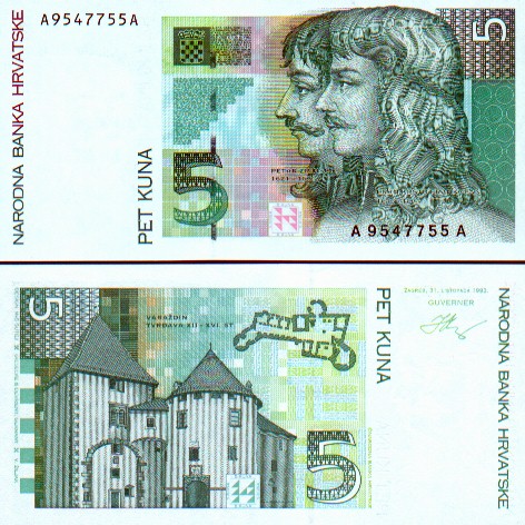
Through history, the region has been in the hands of different rulers and powers, and was a military buffer zone between the Ottoman Empire and Vienna. The most important era was the period during the 16th and 17th centuries when Čakovec was the headquarter of Croatian rulers, military leaders and intellectuals, among whom the Zrinski family is the most famous. Nikola Zrinski (1620 - 1664) distinguished himself in the wars against the Turks. At the coronation of Ferdinand IV, he carried the sword of state and was made captain-general of Croatia. He was killed while hunting, under dubious circumstances. Petar Zrinski, in conflict with the Austrian Empire, was accused of treason and executed on April 30 1671 in Wiener Neustadt while his wife Katarina Zrinski-Frankopan died inprisoned by the same dynasty on November 16 1673 in Graz.
In 1738, the once-proud castle was hit by an earthquake, which caused tremendous damage. The Czech owners of the city at that time, the Althan family, made some repairs, but times changed. Almost overnight, in 1741, fire caused additional damage. The castle started to decay, slowly sinking into oblivion, while the town's civil activities and their importance started to grow. In 1786, 1048 people resided in the town. In 1849 Josip Jelačić, a national and political military leader, pushed the Hungarian forces from that region, and soon the city was freed by political decree. Within years, in 1860 and later in 1889, the railroad was introduced, while in 1893 electric power started illuminating most of the city streets with 131 lanterns.
Upon signing the treaty with the Third Reich, (March 25 1941), Kingdom of Yugoslavia became the member of the Axis powers. On April 6 1941 it was attacked by the same alliance soon to be conquered and divided. Between 1941 and 1945, Medjimurje was under Hungarian occupation.
Miscellaneous
- Since the 4th century BC, there have been reports of floating mills powered by river streams. Ancient know-how was later adopted by arriving Slavs, and after them by Magyars. Many of these mills were operating along the Mura some decades ago. The last one, in Mursko Sredisce, was in use in the 1970s.
- Nedelišće has one of the first Croatian printing presses installed and operating there since 1570 ordered by Zrinski family, while once mightier Prelog was the center for the distribution of rock salt for this part of the kingdom.
- Ignacije Szentmartony, a Jesuit from Kotoriba, was the royal mathematician and astronomer in Lisbon (Lisboa or Lisabon) and also an explorer of Brazil on behalf of the Portuguese government in 1754.
- Baroque frescoes of Ivan Ranger dating between 1776 and 1786 in the chapel of Sveta Jelena (St.Helen) in Šenkovec and in the church of Sveti Jeronim (St.Jerome) in Štrigova are recommended attractions. The pride of Prelog is beautiful church of Sveti Jakob (St. Jacob), built in 1761.
- The German national anthem, written by the Croatian-speaking composer Joseph Haydn, is derived from the song known in Medjimurje under the name "Stal se jesem". The Austrian second national song was composed by Franz von Suppe, who was born in Split and the lyrics of the Austrian official anthem were written by Paula von Preradovic, grand-daughter of poet Petar Preradovic.
- During the Henry Morton Stanley expedition in Africa in 1882, his chief explorer and confidant Dragutin Lerman discovered in the Congo waterfalls on the Kouilou River, (also Kwil), and named them Zrinski chutes, the name they still carry today.
- When building the railroad nearby, some sections of the tracks were stolen. In hope of recovering them, the workers posted the message - Vrati ine, (do return the rail lines). That is how the place of Vratiinec got its name.
- The first crude oil pipeline was built in this part of Europe between Mursko Srediće and the nearby town of Selnica in 1901. Interestingly, at that time the annual production was less than 7 000 t.
- The county, due to the cultural influences from outside, has a rich, ethnological history and a rich folklore. More than 15 000 local songs have been collected here by ethnomusicologist Vinko ganec. He was influenced in his works by Franjo Ksaver, (Franjo Ksaver-Kuhač), and encouraged by Hungarian composer Béla Bartók.
- In the Zrinski's castle, there is a local Museum of Međimurje with 17,000 items of historical or ethnological value. There are also the Kralj, (kralj = king in Croatian) - Bezeredy artistic gallery.
- The village Kriovec might be the only place in the world where people used to--and occasionally still do--extract boulders of coal by pulling them from the bottom of the running Mura river while on the banks of Drava river near Donji Vidovec, one can still witness the process of gold prospecting and extracting as it used to be practiced during the gold rush era.
- The School of Animated Film, AF (kola Animiranog Filma), is active, doing well and taking its part in domestic and many international festivals.
Local notable people
- Florijan Andraec - poet
- Lidija Bajuk - musician, entertainer
- Lujo Bezeredy - sculptor
- Joža Horvat - adventurer, writer
- Goranko Fiulić - politician
- Tihomir Hunjak - mathematician
- Robert Jarni - footbal player
- Ladislav Kralj-Međimurec - painter
- Ivan Novak - historian, politician
- Nikola Pavić - poet
- Ruža Pospiš-Baldani - opera singer
- Franjo Punčec - tennis player
- Ivan Ranger - painter
- Ana tefok - singer
- Ignacije Szentmartony - explorer
- Josip Štolcer-Slavenski - composer
- Nikola Zrinski - soldier, poet, philosopher
- Petar Zrinski - soldier
- Vinko ganec - folklorist, ethnomusicologist
External links
- Međimurje-Maps-Weather-Links (http://www.calle.com/world/HR/9/) * Međimurje-Maps-Contacts-Links (http://www.tzm.hr/main.php?g=5) * Our Local Railroads (http://www.railfaneurope.net/ric/Medjimurje.htm)
- Međimurje News - in Croatian (http://www.medjimurje.com/) * Radio Međimurje (http://www.radio-cakovec.hr/) * Telephone (http://imenik.ht.hr/?lang=1) * Post (Zrinski Stamps) (http://www.posta.hr/marke_det_e.asp?serija=199&brmarke=199)
- Museum of Međimurje (http://www.mdc.hr/cakovec/eng/index.html) * Međimurje Folk Songs/Lyrics (http://fly.cc.fer.hr/~kkolac/popevke.htm) * Međimurje Dance & Costumes (http://www.pecs.hu/~tanac/tanac/tanac10e.htm)
- Animated Film Studio (http://www.safcakovec.com/) *Lado National Folklore Ensemble (http://www.lado.hr/lado.htm) * The City Friend Schramberg (http://www.landkreis-rottweil.de/)
- Petar Zrinski (http://www.magma.ca/%7Erendic/zrinski.htm) *Zrinski Banknotes (http://www.banknotes.com/HR28.JPG) * In Vino Veritas (http://www.hotel.hr/vino-lovrec/) * Teachers Training College (http://www.vus-ck.hr/) * Anthem (http://www.national-anthems.net/web/find.webpage?from=real&what=croatia&id=HR)
- Medimurje Wireless (http://www.mwireless.hr) * Kotoriba in Medimurje (http://www.kotoriba.hr) * Radio medimurje Kotoriba (http://kotoriba.hr/radiomedjimurje.htm)
